Barmer / Barmere / Benemara / Benemare
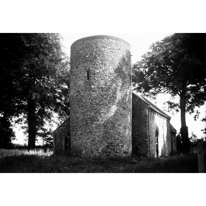
Image copyright © George Plunkett, 2014
Standing permission by Jonathan Plunkett
Results: 4 records
view of church exterior
Scene Description: Photo caption: "The round tower is probably Norman, the remainder of the church Early English"
Copyright Statement: Image copyright © George Plunkett, 2014
Image Source: B&W photograph taken 21 August 1978 by George Plunkett [www.georgeplunkett.co.uk/Norfolk/B/Barmer All Saints church tower [5978] 1978-08-21.jpg] [accessed 10 June 2014]
Copyright Instructions: Standing permission by Jonathan Plunkett
view of church exterior - south view
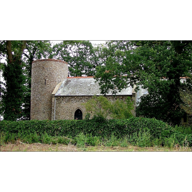
Copyright Statement: Image copyright © Simon Knott, 2006
Image Source: digital photograph September 2006 taken by Simon Knott [www.norfolkchurches.co.uk/barmer/barmer.htm] [accessed 4 June 2013]
Copyright Instructions: Standing permission
view of church interior - nave - looking west
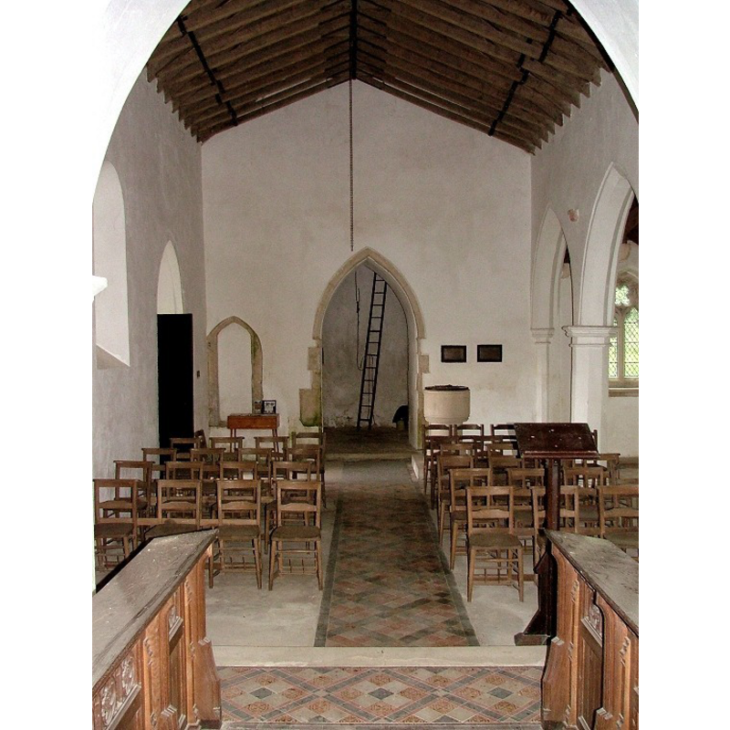
Scene Description: the modern font and cover at the west end, right side (north) of the tower arch
Copyright Statement: Image copyright © Simon Knott, 2006
Image Source: digital photograph September 2006 taken by Simon Knott [www.norfolkchurches.co.uk/barmer/barmer.htm] [accessed 4 June 2013]
Copyright Instructions: Standing permission
view of church interior - nave - looking east
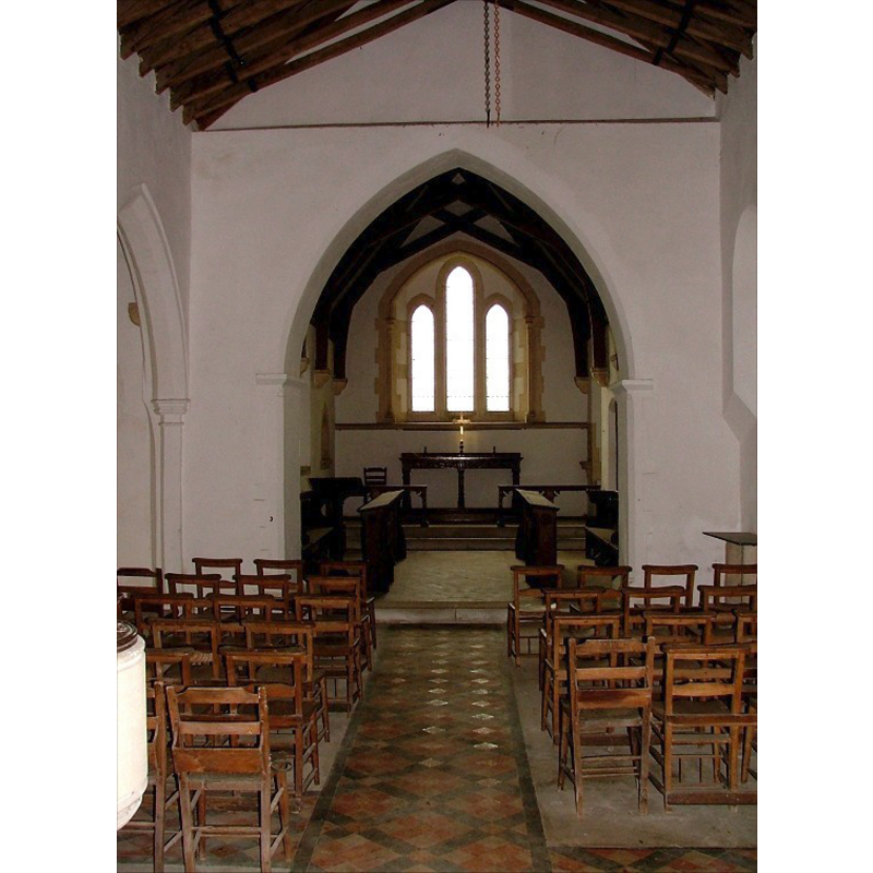
Copyright Statement: Image copyright © Simon Knott, 2006
Image Source: digital photograph September 2006 taken by Simon Knott [www.norfolkchurches.co.uk/barmer/barmer.htm] [accessed 4 June 2013]
Copyright Instructions: Standing permission
INFORMATION
Font ID: 14985BAR
Object Type: Baptismal Font1?
Font Century and Period/Style: 11th century, Pre-Conquest? / Norman
Church / Chapel Name: Parish Church of All Saints [redundant]
Church Patron Saint(s): All Saints
Church Notes: round-tower church
Church Address: Bagthorpe, Norfolk PE31 8SP
Site Location: Norfolk, East Anglia, England, United Kingdom
Directions to Site: Located off (N) the B1454, WNW of Fakenham
Ecclesiastic Region: Diocese of Norwich
Historical Region: Hundreds of Gallow and Brothercross
Additional Comments: disappeared font? (the one from the original Domesday-time church here)
Font Notes:
Click to view
There is an entry for Barmer [variant spelling] in the Domesday survey [http://domesdaymap.co.uk/place/TF8033/barmer/] [accessed 10 June 2014] with a church reported in it. Blomefield (1805-1810) writes: "B[armere], Called Benemare, in Domesday book, when it was the lordship of William Earl Warren, and held of him by Ralf. It was a beruite to Rudham: four socmen held then sixty acres of land, and three bordarers had one carucate and an half, and a church belonged to it. [...] The Church is a little pile; stands on a hill, and is covered with tiles: the chancel and the north isle are in ruins; it is dedicated to All-Saints, and has a round tower or steeple. It was a rectory, valued at ten marks". Blomefield (ibid.) names "Andrew de Cutun" first recorded vicar here, in 1302, and notes "John Willys" as the last recorded vicar, in 1404, "I find no institutions after this, and is held of a curacy in the patronage of the Earl of Orford." Knott (2006) writes on this church: "there is no village, and in any case it had ceased to be parish church at the Reformation. But here it is, a small Victorianised Norman church hidden in a thick copse of trees and entirely surrounded by fields, a quarter of a mile or so from the nearest road [...] All Saints was, in fact, a ruin for three centuries. Then, in 1885, the Kerslake family, who owned the land, decided to restore it as a mausoleum in the fashion of the day. This meant engaging London architect Frederick Preedy, who rebuilt the north aisle in a Decorated style and added an Early English chancel [...] The chancel arch and tower arch both survive from the original Norman church, but have been altered at some time to be pointed. [...] The Victorian furnishings have been replaced by modern chairs, which creates a sense of space and allows Preedy's font to dominate the little nave." Preedy's modern font consists of a cylindrical basin raised on a cylindrical base, plain but a few thin mouldings and grooves; on a rectangular plinth. The wooden cover is round, flat and plain. Both font and cover date from the 1885 renovation by Preedy. [NB: we have no information on the earlier font(s) of this church].
Credit and Acknowledgements: We are grateful to Simon Knott, of Norfolk Churches [www.norfolkchurches.co.uk], for his photographs of this church and modern font; we are also grateful to Jonathan Plunkett for the photograph of this church taken by his father, George Plunkett, in 1978
COORDINATES
UTM: 31U 344269 5860327
Latitude & Longitude (Decimal): 52.870091, 0.686243
Latitude & Longitude (DMS): 52° 52′ 12.33″ N, 0° 41′ 10.48″ E
REFERENCES
- Blomefield, Francis, An essay towards a topographical history of Norfolk, 1805-1810, vol. 7: 2-4 / [www.british-history.ac.uk/report.aspx?compid=78289] [accessed 4 June 2013]
- Knott, Simon, The Norfolk Churches Site, Simon Knott, 2004. [standing permission to reproduce images received from Simon (February 2005]. URL: www.norfolkchurches.co.uk.