Barford / Bereford / Bereforda / Berefort
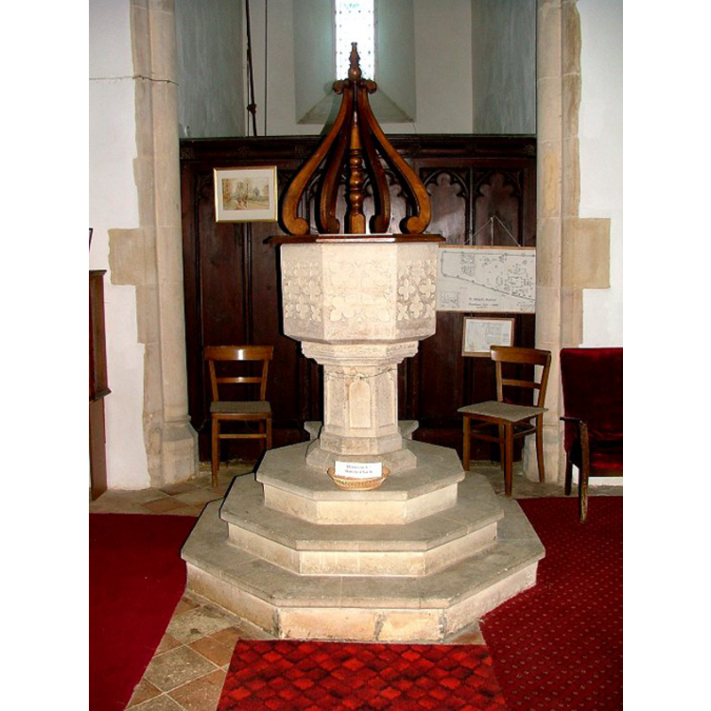
Image copyright © Simon Knott, 2009
Standing permission
Results: 7 records
view of font and cover
Copyright Statement: Image copyright © Simon Knott, 2009
Image Source: digital photograph taken February 2006 by Simon Knott [www.norfolkchurches.co.uk/barford/barford.htm] [accessed 10 July 2009]
Copyright Instructions: Standing permission
design element - patterns - tracery
Copyright Statement: Image copyright © Simon Knott, 2009
Image Source: digital photograph taken February 2006 by Simon Knott [www.norfolkchurches.co.uk/barford/barford.htm] [accessed 10 July 2009]
Copyright Instructions: Standing permission
design element - motifs - moulding
Copyright Statement: Image copyright © Simon Knott, 2009
Image Source: digital photograph taken February 2006 by Simon Knott [www.norfolkchurches.co.uk/barford/barford.htm] [accessed 10 July 2009]
Copyright Instructions: Standing permission
view of church exterior - southeast view
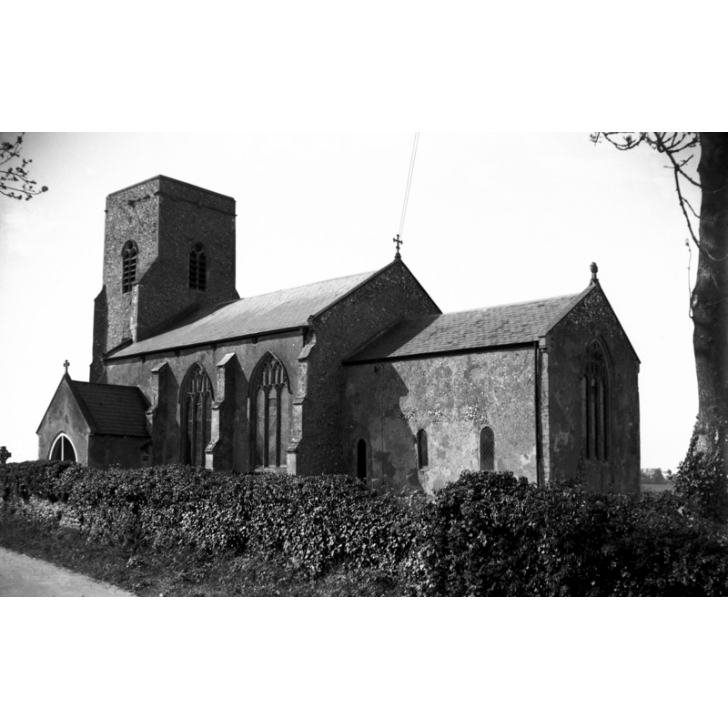
Scene Description: Photo caption: "13c tower and chancel"
Copyright Statement: Image copyright © George Plunkett, 2014
Image Source: B&W photograph taken 19 May 1940 by George Plunkett [www.georgeplunkett.co.uk/Norfolk/B/Barford St Botolph's church from SE [3428] 1940-05-19.jpg] [accessed 10 June 2014]
Copyright Instructions: Standing permission by Jonathan Plunkett
view of church exterior - south view
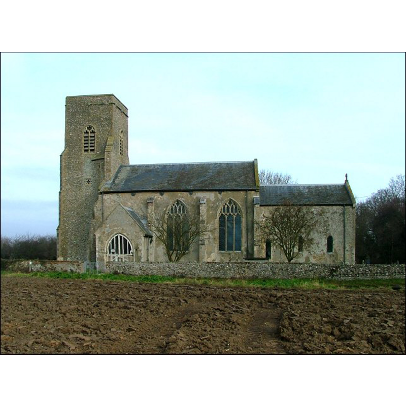
Copyright Statement: Image copyright © Simon Knott, 2009
Image Source: digital photograph taken February 2006 by Simon Knott [www.norfolkchurches.co.uk/barford/barford.htm] [accessed 10 July 2009]
Copyright Instructions: Standing permission
view of church interior - nave - looking east
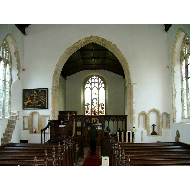
Copyright Statement: Image copyright © Simon Knott, 2009
Image Source: digital photograph taken February 2006 by Simon Knott [www.norfolkchurches.co.uk/barford/barford.htm] [accessed 10 July 2009]
Copyright Instructions: Standing permission
design element - architectural - arch or window - trefoiled - 8
Copyright Statement: Image copyright © Simon Knott, 2009
Image Source: digital photograph taken February 2006 by Simon Knott [www.norfolkchurches.co.uk/barford/barford.htm] [accessed 10 July 2009]
Copyright Instructions: Standing permission
INFORMATION
Font ID: 14984BAR
Object Type: Baptismal Font1
Font Century and Period/Style: 14th century, Decorated
Church / Chapel Name: Parish Church of St. Botolph [aka Butolph's]
Font Location in Church: Inside the church, at the W end of the nave
Church Patron Saint(s): St. Botulph [aka St. Botolph, Botolph of Thorney, Botulf]
Church Address: Church Road, Barford, Norfolk, NR9 4AU
Site Location: Norfolk, East Anglia, England, United Kingdom
Directions to Site: Located 11 km N of Norwich
Ecclesiastic Region: Diocese of Norwich
Historical Region: Hundred of Forehoe [aka Forehou]
Additional Comments: disappeared font? (the font from the earlier church here)
Font Notes:
Click to view
Blomefield (1805-1810) writes: "The Church is dedicated to St. Butolph; Norwich Domesday tells us, that the rector of the mediety had a house and 12 acres of glebe [...] The church consists of a nave and chancel, both which are leaded, the south porch is tiled, the tower is square [...] about 50 feet high." Blomefield (ibid.) names "Nic. de Hedersete" as first recorded rector, in 1308. The present font is noted in Pevsner & Wilson (1999): "Octagonal, C14, with blind tracery." Illustrated in Knott (2006). The font consists of an octagonal basin with vertical sides covered in quatrefoil tracery, moulded underbowl, raised on an octagonal stem with trefoiled arches on the sides; on a three-step octagonal plinth. The wooden cover has a flat octagonal platform with four vertical scroll ribs around a centre pivot; appears modern (Victorian?). [NB: we have no information on the font from the earlier church here].
Credit and Acknowledgements: We are grateful to Simon Knott, of Norfolk Churches, for his photographs of this font;
COORDINATES
UTM: 31U 372199 5832678
Latitude & Longitude (Decimal): 52.629024, 1.111715
Latitude & Longitude (DMS): 52° 37′ 44.48″ N, 1° 6′ 42.17″ E
MEDIUM AND MEASUREMENTS
Material: stone
Font Shape: octagonal, mounted
Basin Interior Shape: round
Basin Exterior Shape: octagonal
LID INFORMATION
Date: 19th-century?
Material: wood, oak?
Apparatus: no
Notes: [cf. FontNotes]
REFERENCES
- Blomefield, Francis, An essay towards a topographical history of Norfolk, 1805-1810, vol. 2: 483-486 / [www.british-history.ac.uk/report.aspx?compid=78101] [accessed 19 March 2013]
- Knott, Simon, The Norfolk Churches Site, Simon Knott, 2004. [standing permission to reproduce images received from Simon (February 2005]. URL: www.norfolkchurches.co.uk.
- Pevsner, Nikolaus, Norfolk 2: North-West and South (2nd ed.), London: Penguin, 1999, p. 192