Appleton / Apletuna / Applatuna / Appletuna
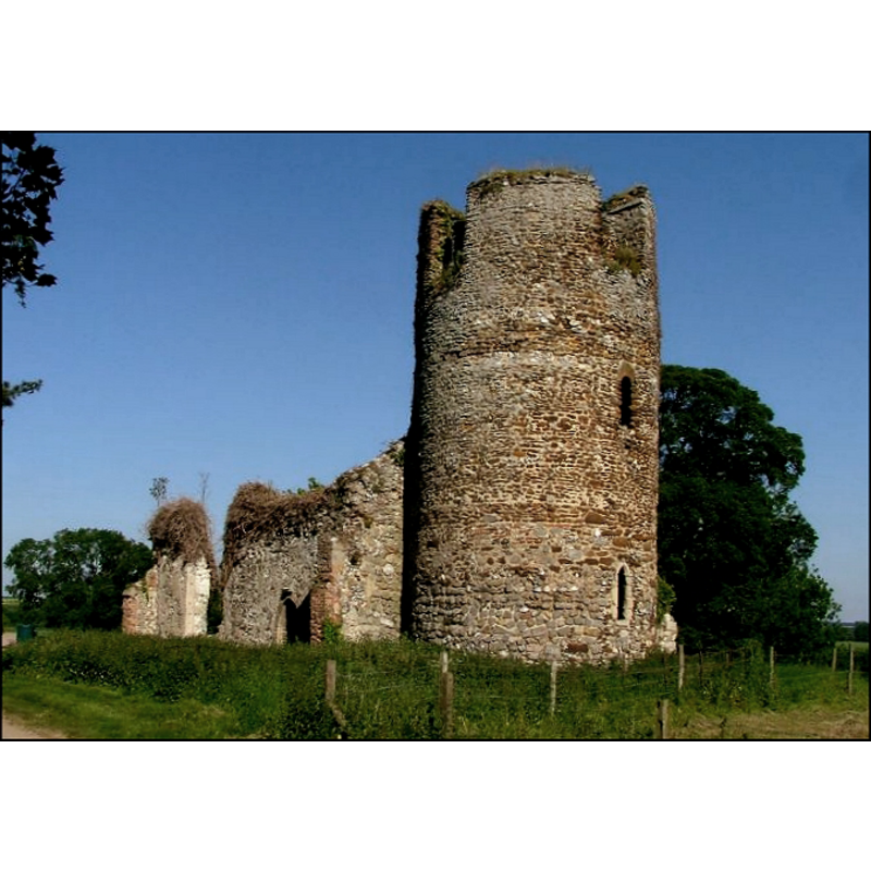
Image copyright © Simon Knott, 2006
Standing permission
Results: 6 records
view of church exterior - southwest view
Scene Description: the ruins of St. Mary's
Copyright Statement: Image copyright © Simon Knott, 2006
Image Source: digital photograph July 2006 by Simon Knott [www.norfolkchurches.co.uk/appleton/appleton.htm] [accessed 6 November 2013]
Copyright Instructions: Standing permission
view of church exterior - northwest view
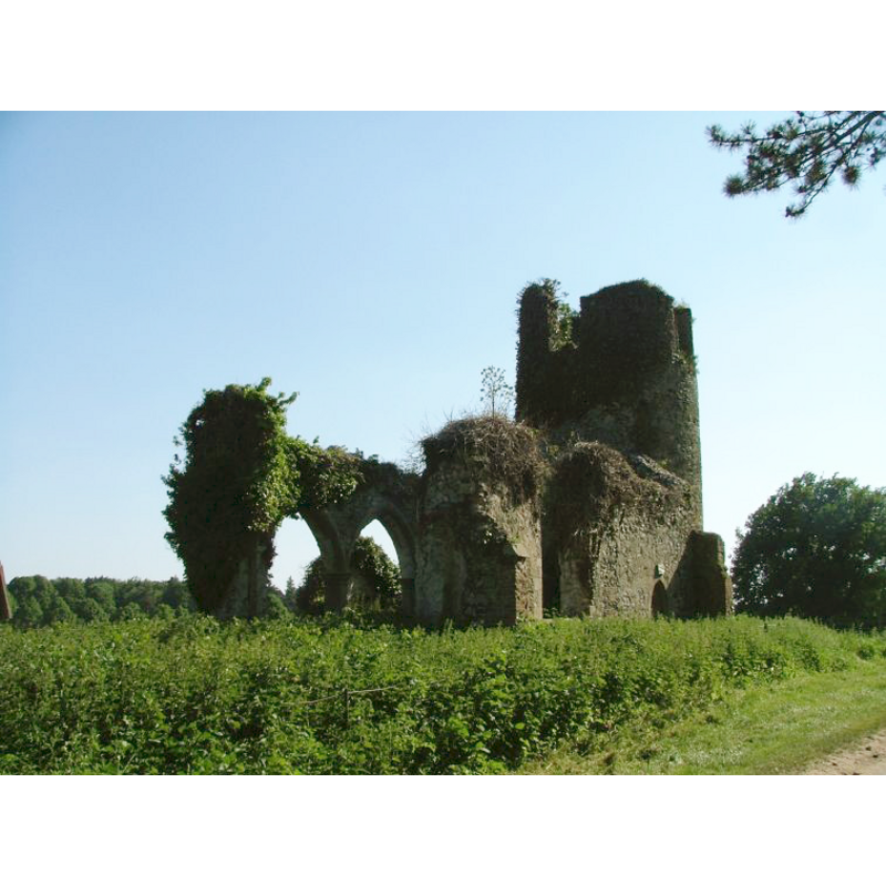
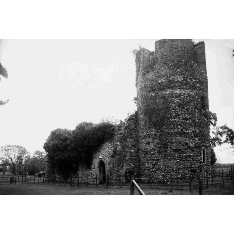
Scene Description: the ruins of St. Mary's -- Photo caption: "It has been a ruin since 1707 when the hall was burnt down and the famous Paston family left the place" -- showing the north entrance, of a much later date than the tower
Copyright Statement: Image copyright © George Plunkett, 2013
Image Source: B&W photograph taken 10 May 1998 by George Plunkett [www.georgeplunkett.co.uk/Norfolk/A/Appleton St Mary's church ruin from SW [7545] 1998-05-10.jpg] [accessed 6 November 2013]
Copyright Instructions: Standing permission by Jonathan Plunkett
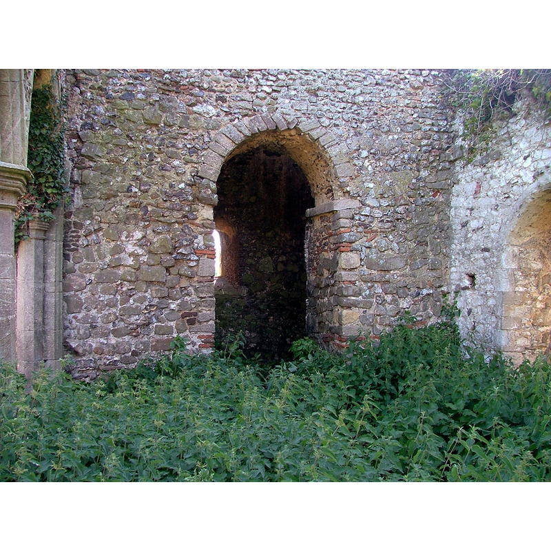
view of church interior - south arcade
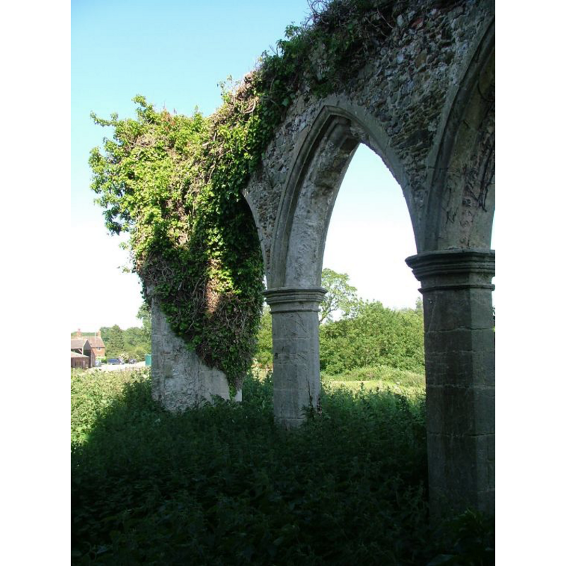
Scene Description: the ruins of St. Mary's
Copyright Statement: Image copyright © Simon Knott, 2006
Image Source: digital photograph July 2006 by Simon Knott [www.norfolkchurches.co.uk/appleton/appleton.htm] [accessed 6 November 2013]
Copyright Instructions: Standing permission
view of church interior - nave - looking west
Scene Description: the ruins of St. Mary's -- Photo caption: "Including arch to the round tower"
Copyright Statement: Image copyright © George Plunkett, 2013
Image Source: B&W photograph taken 10 May 1998 by George Plunkett [www.georgeplunkett.co.uk/Norfolk/A/Appleton St Mary's church ruin from SW [7545] 1998-05-10.jpg] [accessed 6 November 2013]
Copyright Instructions: Standing permission by Jonathan Plunkett
INFORMATION
Font ID: 14973APP
Object Type: Baptismal Font1
Font Century and Period/Style: 11th century, Pre-Conquest? / Norman
Church / Chapel Name: Parish Church of St. Mary [in ruins]
Font Location in Church: [cf. FontNotes]
Church Patron Saint(s): St. Mary the Virgin
Church Notes: round-tower church; much of the fabric appears to be a re-building of the Norman church, of which the tower remains, but there are earlier traces in the tower that point to a pre-Conquest date, perhaps as early as ca.1000
Site Location: Norfolk, East Anglia, England, United Kingdom
Directions to Site: Located just SE of West Newton
Ecclesiastic Region: Diocese of Norwich
Historical Region: Hundred and half of Freebridge
Additional Comments: disappeared font? (the one from the pre-Conquest church here)
Font Notes:
Click to view
There are two entries for this Appleton [variant spelling] in the Domesday survey [http://opendomesday.org/place/TF7027/appleton/] [accessed 28 May 2015], one of which mentions a church and 0.1 hide of church lands in it. Blomefield (1805-1810) writes, the Domesday survey has two entries for this place, "Applatuna" and "Appletuna", each with a different lord holder; the first, which "was held in King Edward's time by Aba, under Stigand the Archbishop", included at the time "a church then endowed with 12 acres". That church, adds Blomefield (ibid.), "was dedicated to St. Mary; the rectory was appropriated to Westacre priory", but it obviously had fallen into hard times by the time of his visit: "The church is mostly in ruins; it was covered with lead, and had a round tower, and is a single pile; I found horses chained together in the porch, and in the church, both in a filthy condition, and no door to the church." Plunkett [cf. ImagesArea] notes on this church: "It has been a ruin since 1707 when the hall was burnt down and the famous Paston family left the place." [NB: we have no information on the baptismal font of the earlier church here]
Credit and Acknowledgements: We are grateful to Simon Knott, of Norfolk Churches [www.norfolkchurches.co.uk], for his photographs of this church; we are also grateful to Jonathan Plunkett for the photographs of this church, taken by his father, George Plunkett, in May 1998
COORDINATES
UTM: 31U 333568 5854637
Latitude & Longitude (Decimal): 52.81579, 0.530322
Latitude & Longitude (DMS): 52° 48′ 56.84″ N, 0° 31′ 49.16″ E
REFERENCES
- Blomefield, Francis, An essay towards a topographical history of Norfolk, 1805-1810, vol. 8: 328-332 / [www.british-history.ac.uk/report.aspx?compid=78474] [accessed 6 November 2013]