Anmer, in Sandringham estate / Anemere / Anmere
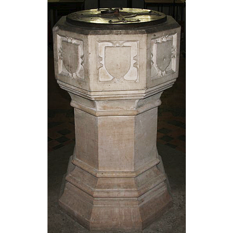
Image copyright © Brokentaco, 2007
CC-BY-SA-3.0
Results: 9 records
view of font and cover - east side
Scene Description: the re-cut side of the font [cf. FontNotes]
Copyright Statement: Image copyright © Brokentaco, 2007
Image Source: detail of a digital photograph taken 5 July 2007 by Brokentaco [www.flickr.com/photos/brokentaco/816100562/] [accessed 6 November 2013]
Copyright Instructions: CC-BY-SA-3.0
view of font
![the 18th-century font [cf. FontNotes]](/static-50478a99ec6f36a15d6234548c59f63da52304e5/compressed/1131106022_compressed.png)
Scene Description: the 18th-century font [cf. FontNotes]
Copyright Statement: Image copyright © Simon Knott, 2005
Image Source: digital photograph October 2005 taken by Simon Knott [www.norfolkchurches.co.uk/anmer/anmer.htm] [accessed 6 November 2013]
Copyright Instructions: Standing permission
view of font and cover - west side
![the side of the font that was not re-cut [cf. FontNotes]](/static-50478a99ec6f36a15d6234548c59f63da52304e5/compressed/1131106021_compressed.png)
Scene Description: the side of the font that was not re-cut [cf. FontNotes]
Copyright Statement: Image copyright © Simon Knott, 2005
Image Source: detail of a digital photograph October 2005 taken by Simon Knott [www.norfolkchurches.co.uk/anmer/anmer.htm] [accessed 6 November 2013]
Copyright Instructions: Standing permission
symbol - shield - blank - in a quatrefoil - cusped quatrefoil
Scene Description: the re-cut panels of the basin [cf. FontNotes]
Copyright Statement: Image copyright © Brokentaco, 2007
Image Source: detail of a digital photograph taken 5 July 2007 by Brokentaco [www.flickr.com/photos/brokentaco/816100562/] [accessed 6 November 2013]
Copyright Instructions: CC-BY-SA-3.0
view of church exterior - southeast view
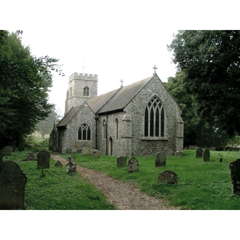
Copyright Statement: Image copyright © Simon Knott, 2005
Image Source: digital photograph October 2005 taken by Simon Knott [www.norfolkchurches.co.uk/anmer/anmer.htm] [accessed 6 November 2013]
Copyright Instructions: Standing permission
view of church exterior - southeast view
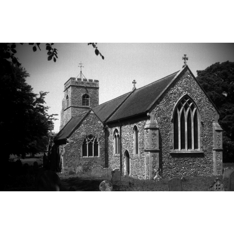
Scene Description: Photo caption: "Mostly early to mid 14c. Excessively restored"
Copyright Statement: Image copyright © George Plunkett, 2013
Image Source: B&W photograph taken 16 June 1996 by George Plunkett [www.georgeplunkett.co.uk/Norfolk/A/Anmer St Mary Virgin church from SE [7335] 1996-06-16.jpg] [accessed 6 November 2013
Copyright Instructions: Standing permission by Jonathan Plunkett
view of font and cover in context
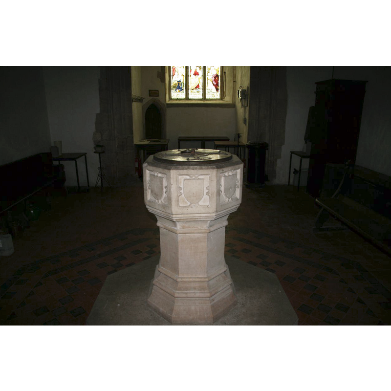
Scene Description: at the west end of the nave
Copyright Statement: Image copyright © Brokentaco, 2007
Image Source: digital photograph taken 5 July 2007 by Brokentaco [www.flickr.com/photos/brokentaco/816100562/] [accessed 6 November 2013]
Copyright Instructions: CC-BY-SA-3.0
view of church interior - nave - looking west
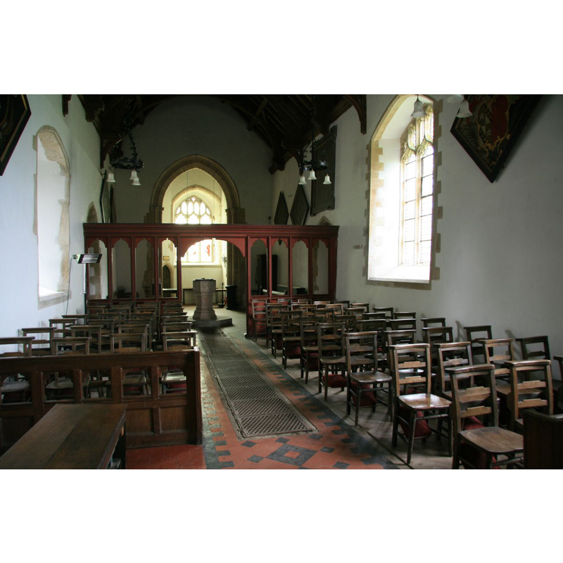
Scene Description: the chancel arch appears much displaced in this image
Copyright Statement: Image copyright © Brokentaco, 2007
Image Source: digital photograph taken 5 July 2007 by Brokentaco [www.flickr.com/photos/brokentaco/816100096/] [accessed 6 November 2013]
Copyright Instructions: CC-BY-SA-3.0
view of church interior - nave - looking east
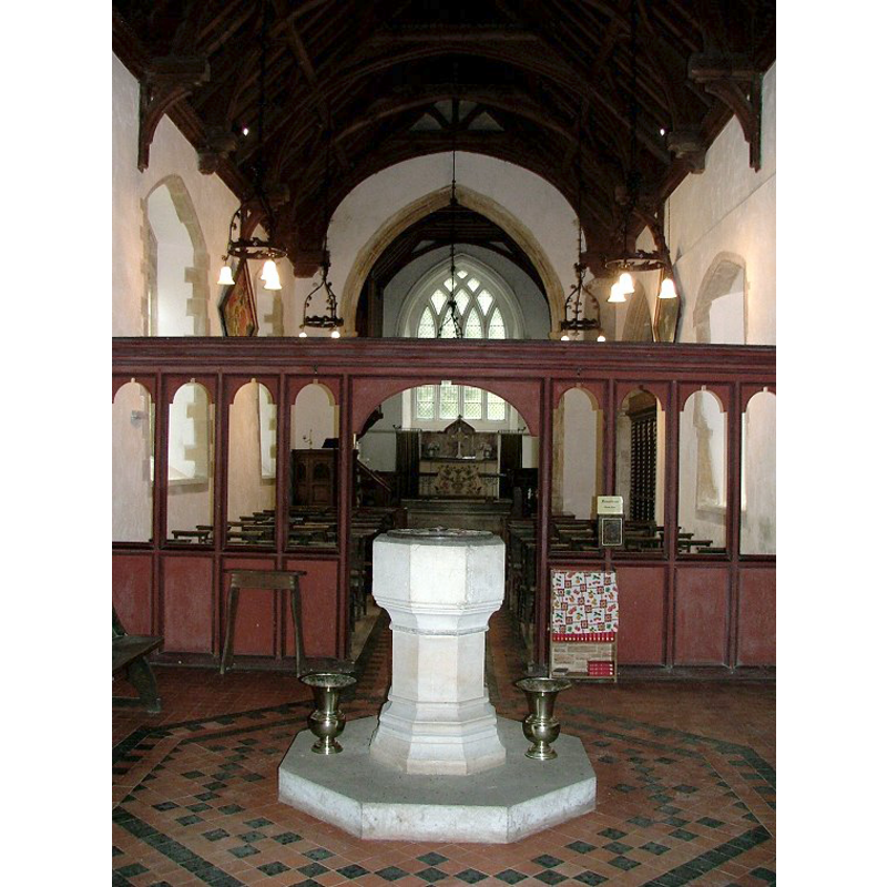
Scene Description: seen from the west end, with the font in the foreground -- the chancel screen appears oddly located now
Copyright Statement: Image copyright © Simon Knott, 2005
Image Source: digital photograph October 2005 taken by Simon Knott [www.norfolkchurches.co.uk/anmer/anmer.htm] [accessed 6 November 2013]
Copyright Instructions: Standing permission
INFORMATION
Font ID: 14972ANM
Object Type: Baptismal Font1
Font Century and Period/Style: 15th century [partially re-cut] / 19th century, Perpendicular [altered?] / Victorian?
Workshop/Group/Artisan: heraldic font [partially re-cut]
Church / Chapel Name: Church of St. Mary
Font Location in Church: Inside the church, at the W end of the nave
Church Patron Saint(s): St. Mary the Virgin
Church Address: Anmer, Norfolk PE31 6RW
Site Location: Norfolk, East Anglia, England, United Kingdom
Directions to Site: Located in the grounds of Anmer Hall, now part of the Sandrigham estate
Ecclesiastic Region: Diocese of Norwich
Historical Region: Hundred and half of Freebridge
Additional Comments: disappeared font? (the one from the 13thC church here)
Font Notes:
Click to view
There are two entries in the Domesday survey for Anemere/Anmer [http://domesdaymap.co.uk/place/TF7329/anmer/] [accessed 6 November 2013], but neither mentions church or cleric in it. Blomefield (1805-1810) reports that the advowson of the church at "Anemere" was involved in a fine levied "In the 6th year of King Henry III." [i.e., 1222], mentions the dedication of this church to St. Mary, and names "William de Anemere" as first recorded rector in the 22nd year of Edward I's reign [i.e., 1294]. Pevsner & Wilson (1999) inform that there are two fonts in this church, one Victorian, another 18th-century. Both are illustrated in Knott (2005). The English Heritage entry for this church [listed 5 June 1953] [www.britishlistedbuildings.co.uk/en-221384-church-of-st-mary-anmer-norfolk] [accessed 6 November 2013] reports "Recut C15 font with shields [and] C18 baluster font" in this church. The 'Victorian' font noted in Pevsner & Wilson is the same as the one described in English Heritage as "Recut C15 font"; we cannot at this point ascertain either way, as it would take a close examination of the basin interior, for example, to decide one way or the other. That said, the font is odd-looking because only one half of it was re-cut, the east half, leaving the panels of the west half un-cut; the re-cut panels show a blank shield in a cusped quatrefoil frame; the rest of the decoration consists of a number of mouldings down the underbowl and base on all sides of the font. What the rationale for such a treatment was is left to speculation, although one could easily think that it probably was a cost-related decision rather than one based on aesthetic onsiderations. [NB: we have no information on the original font of the Early English church]
Credit and Acknowledgements: We are grateful to Simon Knott, of Norfolk Churches [www.norfolkchurches.co.uk], for his photographs of this church and fonts; we are also grateful to Jonathan Plunkett for the photographs of this church, taken by his father, George Plunkett, in June 1996
COORDINATES
UTM: 31U 336887 5856662
Latitude & Longitude (Decimal): 52.834984, 0.578505
Latitude & Longitude (DMS): 52° 50′ 5.94″ N, 0° 34′ 42.62″ E
MEDIUM AND MEASUREMENTS
Material: stone, limestone?
Font Shape: octagonal, mounted
Basin Interior Shape: round
Basin Exterior Shape: octagonal
LID INFORMATION
Date: 19th century?
Material: wood, oak?
Apparatus: no
Notes: round and flat, with metal decoration
REFERENCES
- Blomefield, Francis, An essay towards a topographical history of Norfolk, 1805-1810, vol. 8: 332-336 / [www.british-history.ac.uk/report.aspx?compid=78475] [accessed 6 Norvember 2013]
- Knott, Simon, The Norfolk Churches Site, Simon Knott, 2004. [standing permission to reproduce images received from Simon (February 2005]. URL: www.norfolkchurches.co.uk.
- Pevsner, Nikolaus, Norfolk 2: North-West and South (2nd ed.), London: Penguin, 1999, p. 180