Witton nr. North Walsham / Witton by Walsham / Witton nr. Tunstead / Wittuna
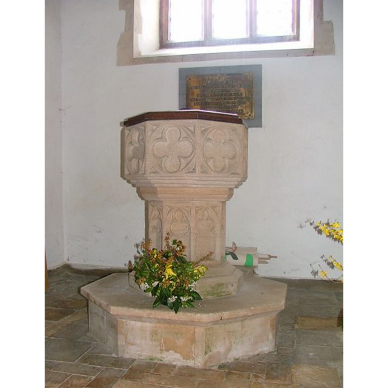
Image copyright © Simon Knott, 2009
Standing permission
Results: 9 records
view of font and cover
Copyright Statement: Image copyright © Simon Knott, 2009
Image Source: digital photograph taken 1 April 2005 by Simon Knott [http://www.norfolkchurches.co.uk/witton/witton.htm] [accessed 9 July 2009]
Copyright Instructions: Standing permission
design element - motifs - quatrefoil - 8
Copyright Statement: Image copyright © Simon Knott, 2009
Image Source: digital photograph taken 1 April 2005 by Simon Knott [http://www.norfolkchurches.co.uk/witton/witton.htm] [accessed 9 July 2009]
Copyright Instructions: Standing permission
design element - motifs - moulding - graded
Copyright Statement: Image copyright © Simon Knott, 2009
Image Source: digital photograph taken 1 April 2005 by Simon Knott [http://www.norfolkchurches.co.uk/witton/witton.htm] [accessed 9 July 2009]
Copyright Instructions: Standing permission
view of church exterior - west view
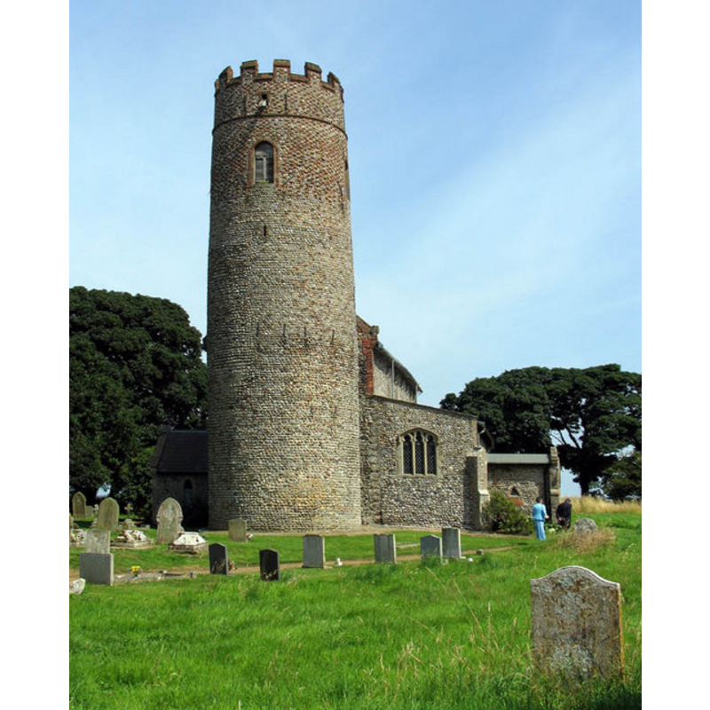
Scene Description: in 2005
Copyright Statement: image copyright © John Salmon, 2005
Image Source: digital photograph taken 23 July 2005 by John Salmon [www.geograph.org.uk/photo/315482] [accessed 13 August 2013]
Copyright Instructions: CC-BY-SA-3.0
view of church exterior - southeast view
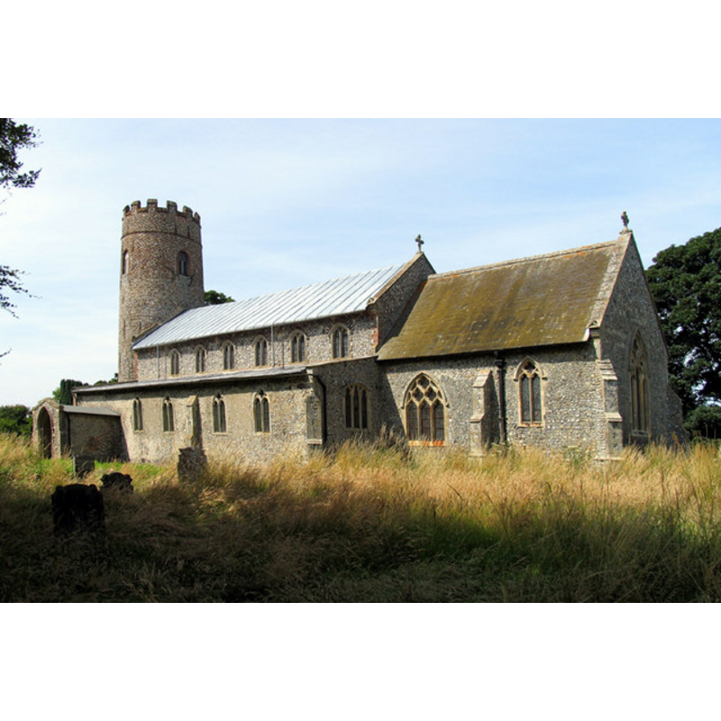
Copyright Statement: image copyright © John Salmon, 2005
Image Source: digital photograph taken 23 July 2005 by John Salmon [www.geograph.org.uk/photo/315480] [accessed 13 August 2013]
Copyright Instructions: CC-BY-SA-3.0
view of church exterior in context

Copyright Statement: Image copyright © Andrew Lowe Watson, 2007
Image Source: digital photograph taken 23 February 2007 by Andrew Lowe Watson [http://en.wikipedia.org/wiki/File:Witton_church.jpg] [accessed 13 August 2013]
Copyright Instructions: CC-BY-SA-3.0
view of church exterior - west view
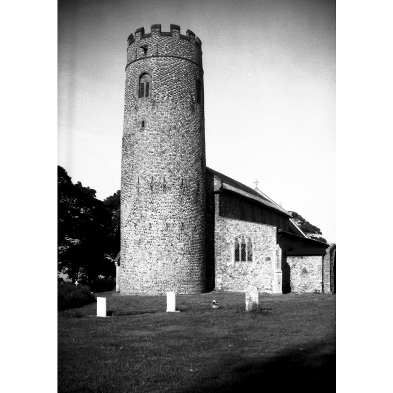
Scene Description: in 1977 -- "Near North Walsham. Round tower probably pre-conquest."
Copyright Statement: Image copyright © George Plunkett, 2013
Image Source: B&W photograph taken 12 June 1977 by George Plunkett [www.georgeplunkett.co.uk/Norfolk/W/Witton St Margaret's church tower [5833] 1977-06-12.jpg] [accessed 13 August 2013]
Copyright Instructions: Standing permission
view of church interior - nave - looking east
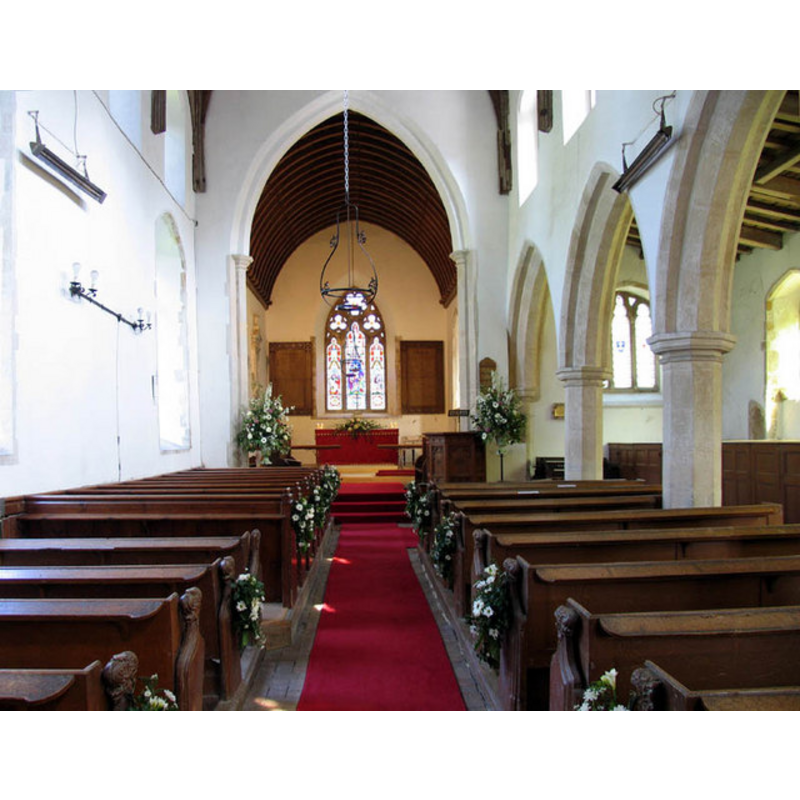
Copyright Statement: image copyright © John Salmon, 2005
Image Source: digital photograph taken 23 July 2005 by John Salmon [www.geograph.org.uk/photo/315484] [accessed 13 August 2013]
Copyright Instructions: CC-BY-SA-3.0
design element - architectural - arcade - blind - cinquefoiled arches - 8
Copyright Statement: Image copyright © Simon Knott, 2009
Image Source: digital photograph taken 1 April 2005 by Simon Knott [http://www.norfolkchurches.co.uk/witton/witton.htm] [accessed 9 July 2009]
Copyright Instructions: Standing permission
INFORMATION
Font ID: 14968WIT
Object Type: Baptismal Font1
Font Century and Period/Style: 14th century, Decorated
Church / Chapel Name: Parish Church of St. Margaret
Font Location in Church: Inside the church, at the W end of the nave
Church Patron Saint(s): St. Margaret of Antioch [aka Margaret the Virgin, Marina]
Church Notes: round-tower church of ca. Conquest time
Church Address: Bacton Road, Witton, Norfolk NR28 9TS
Site Location: Norfolk, East Anglia, England, United Kingdom
Directions to Site: Located near Tunstead, 8 km ENE of North Walsham, 30 km N of Norwich [NB: not to be mistaken with Witton nr. Norwich]
Ecclesiastic Region: Diocese of Norwich
Historical Region: Hundred of Tunsted
Additional Comments: disappeared font? (the one from the ca. Conquest-time church here [cf. FontNotes])
Font Notes:
Click to view
There are three entries for Witton [variant spelling] in the Domesday survey [http://domesdaymap.co.uk/place/TG3331/witton/] [accessed 6 May 2014], with one church and churchlands in the hands of a priest in 1066. Blomefield (1805-1810) writes: "Godric farmed this lordship (or was steward of it, when Domesday book, was compiled) of the King, where we find that a certain priest was deprived of it, who held 30 acres in free alms, and there were 9 socmen with 12 acres of land, and 2 carucates and 2 acres of meadow, and he held it of King Edward by singing 3 masses for the King and Queen daily". There is no mention of a church in this part, but "a church endowed with 10 acres" is reported in the original lordship of Bishop Almer of Elmham in 1066 that had passed on to William of Warenne [aka Earl Warren] by 1086. Blomefield (ibid.) adds: "The Church is dedicated to St. Margaret, and was a rectory [...] appropriated to the priory of Bromholm; and there was a vicarage". The present font here is noted in Pevsner & Wilson (1997): "Simple, octagonal C14 job, with panelled stem and quatrefoiled bowl." Illustrated in Knott (2005). The stem is decorated with tracery, cinquefoil arches; the underbowl chamfer has graded moulding. Raised on an octagonal plinth. The wooden cover is octagonal, flat and plain; appears modern.
Credit and Acknowledgements: We are grateful to Simon Knott, of Norfolk Churches [www.norfolkchurches.co.uk], for his photograph of this font. We are also grateful to Jonathan plunket for the photograph of this church taken by his father, George Plunkett, 12 June 1977
COORDINATES
UTM: 31U 397057 5854273
Latitude & Longitude (Decimal): 52.82838, 1.47207
Latitude & Longitude (DMS): 52° 49′ 42.17″ N, 1° 28′ 19.45″ E
MEDIUM AND MEASUREMENTS
Material: stone
Font Shape: octagonal, mounted
Basin Interior Shape: round
Basin Exterior Shape: octagonal
LID INFORMATION
Date: modern
Material: wood, oak?
Apparatus: no
Notes: [cf. FontNotes]
REFERENCES
- Blomefield, Francis, An essay towards a topographical history of Norfolk, 1805-1810, vol. 11: 82-85 / [www.british-history.ac.uk/report.aspx?compid=78752] [accessed 6 May 2014]
- Knott, Simon, The Norfolk Churches Site, Simon Knott, 2004. [standing permission to reproduce images received from Simon (February 2005]. URL: www.norfolkchurches.co.uk.
- Pevsner, Nikolaus, Norfolk 1: Norwich and North-East [2nd ed.], Harmondsworth: Penguin Books, 1997, p. 727