Tuttington / Tutinghetuna / Tutington
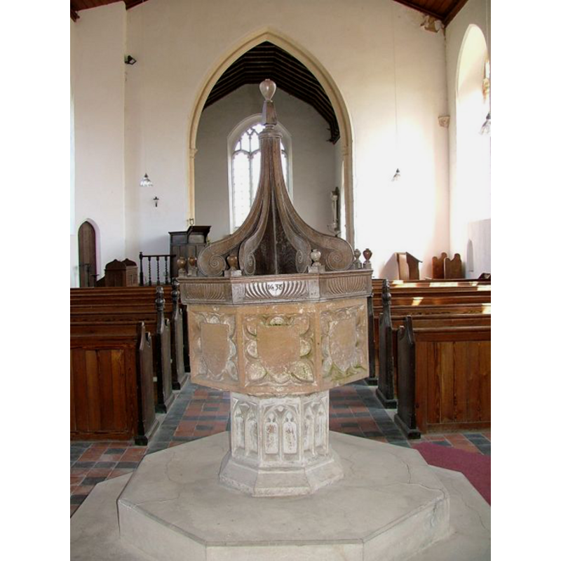
Image copyright © Simon Knott, 2009
Standing permission
Results: 7 records
view of font and cover
Copyright Statement: Image copyright © Simon Knott, 2009
Image Source: digital photograph taken 23 April 2005 by Simon Knott [http://www.norfolkchurches.co.uk/tuttington/tuttington.htm] [accessed 7 July 2009]
Copyright Instructions: Standing permission
symbol - shield - blank - in an octafoil - 8
Copyright Statement: Image copyright © Simon Knott, 2009
Image Source: digital photograph taken 23 April 2005 by Simon Knott [http://www.norfolkchurches.co.uk/tuttington/tuttington.htm] [accessed 7 July 2009]
Copyright Instructions: Standing permission
design element - motifs - tracery
Copyright Statement: Image copyright © Simon Knott, 2009
Image Source: digital photograph taken 23 April 2005 by Simon Knott [http://www.norfolkchurches.co.uk/tuttington/tuttington.htm] [accessed 7 July 2009]
Copyright Instructions: Standing permission
view of church exterior - south portal
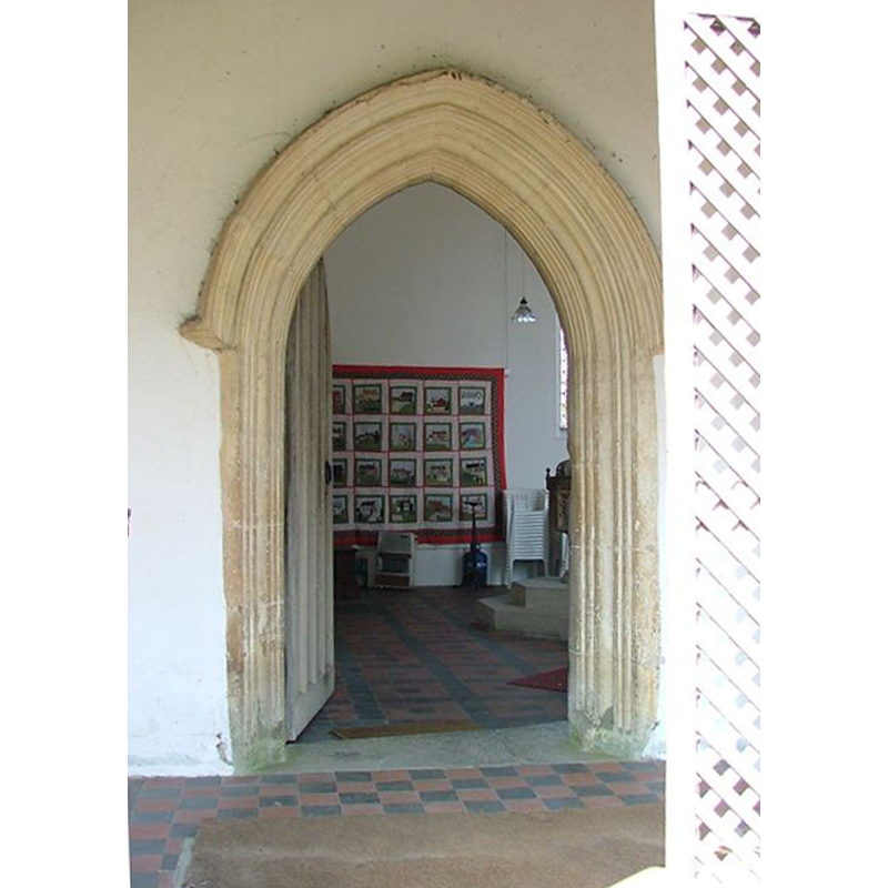
Scene Description: the font and cover are partly visible inside, to the right of the entrance
Copyright Statement: Image copyright © Simon Knott, 2005
Image Source: digital photograph taken 23 April 2005 by Simon Knott [www.norfolkchurches.co.uk/tuttington/tuttington.htm] [accessed 27 May 2013]
Copyright Instructions: Standing permission
view of church exterior - southwest view
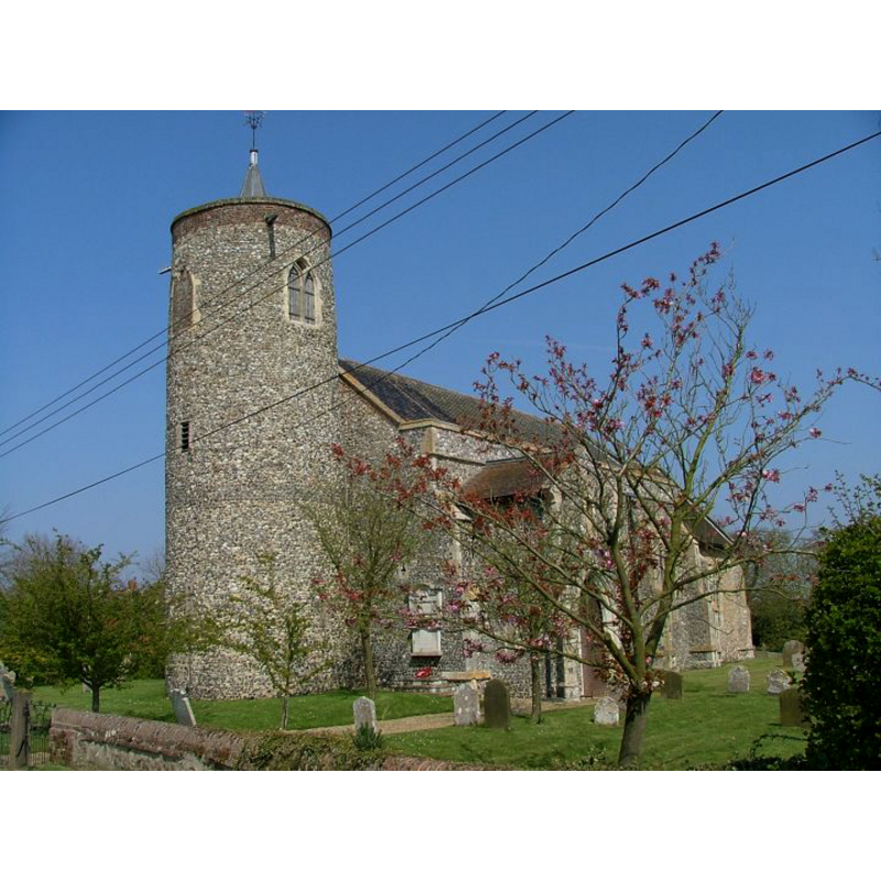
Copyright Statement: Image copyright © Simon Knott, 2005
Image Source: digital photograph taken 23 April 2005 by Simon Knott [www.norfolkchurches.co.uk/tuttington/tuttington.htm] [accessed 27 May 2013]
Copyright Instructions: Standing permission
view of church interior - nave - looking west
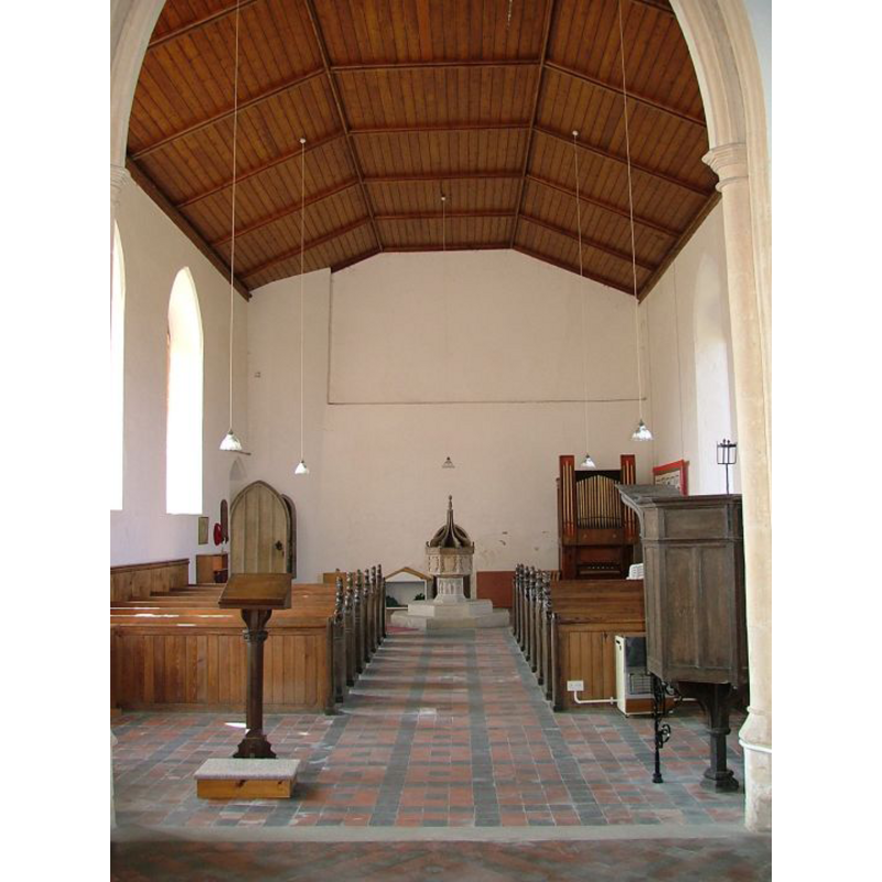
Scene Description: the font and cover at the west end
Copyright Statement: Image copyright © Simon Knott, 2005
Image Source: digital photograph taken 23 April 2005 by Simon Knott [www.norfolkchurches.co.uk/tuttington/tuttington.htm] [accessed 27 May 2013]
Copyright Instructions: Standing permission
view of church interior - nave - looking east
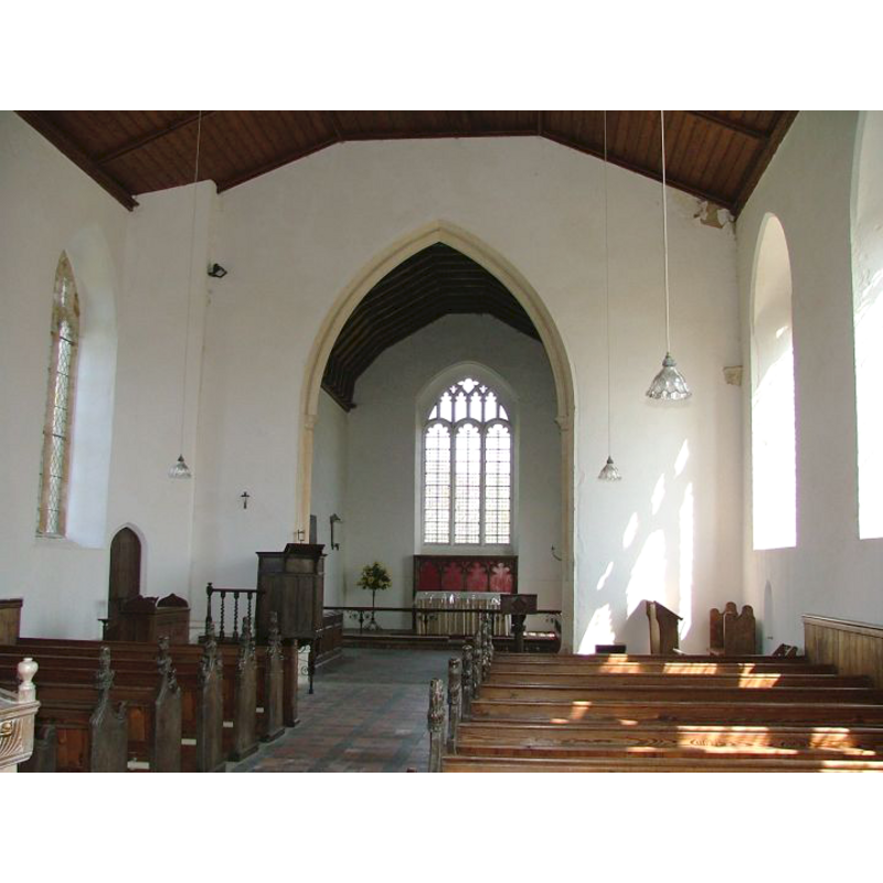
Copyright Statement: Image copyright © Simon Knott, 2005
Image Source: digital photograph taken 23 April 2005 by Simon Knott [www.norfolkchurches.co.uk/tuttington/tuttington.htm] [accessed 27 May 2013]
Copyright Instructions: Standing permission
INFORMATION
Font ID: 14949TUT
Object Type: Baptismal Font1
Font Century and Period/Style: 15th century, Perpendicular
Church / Chapel Name: Parish Church of St. Peter and St. Paul
Font Location in Church: Inside the church, at the W end of the nave
Church Patron Saint(s): St. Peter & St. Paul
Church Notes: round-tower church
Church Address: Burgh and Tuttington NR11 6XE
Site Location: Norfolk, East Anglia, England, United Kingdom
Directions to Site: Located 3 km E of Aylsham
Ecclesiastic Region: Diocese of Norwich
Historical Region: Hundred of South Erpingham
Additional Comments: altered font: modern plinth -- disappeared font? (the one from the Saxon church here [cf. FontNotes])
Font Notes:
Click to view
Blomefield (1805-1810) writes: "This village in the time of the Saxons belonged to Agelwin, an alderman or nobleman of that race, who gave it with the church to the abbey of St. Bennet in the Holm; and it was confirmed to that convent by the charter of King Edward the Confessor", but the entry in Domesday does not mention a church here. Blomefield (ibid.) adds: "its church is dedicated to St. Peter and Paul [...] The Church fell into great decay, upon which, in 1749, a faculty was obtained by which the lead was sold off the nave, and it being new roofed, was covered with tiles; the round tower had a spire on it covered with lead, which was taken down and sold; the second bell is now in the steeple, the first, third, and fourth, being sold; the south porch is leaded and the chancel thatched". Unsusually, Blomefield mentions no recorded rector here. Thomas (1846) notes: "The debased font cover bears date 1638". The present font is noted in Pevsner & Wilson (1997) as an octagonal font of the Perpendicular period, the sides of the basin decorated with "shields in cusped quatrefoils". Of the font cover they write: "Simple, of radial scrolls; dated 1638". Noted and illustrated in Knott (2005). The octagonal stem has tracery decoration on the sides; the two step plinth is modern.
Credit and Acknowledgements: We are grateful to Simon Knott, of Norfolk Churches [www.norfolkchurches.co.uk], for his photographs of this church and font
COORDINATES
UTM: 31U 385476 5850982
Latitude & Longitude (Decimal): 52.796472, 1.30141
Latitude & Longitude (DMS): 52° 47′ 47.3″ N, 1° 18′ 5.08″ E
MEDIUM AND MEASUREMENTS
Material: stone
Font Shape: octagonal, mounted
Basin Interior Shape: round
Basin Exterior Shape: octagonal
LID INFORMATION
Date: 1638
Material: wood
Apparatus: no
Notes: [cf. FontNotes]
REFERENCES
- Blomefield, Francis, An essay towards a topographical history of Norfolk, 1805-1810, vol. 6: 349-352 / [www.british-history.ac.uk/report.aspx?compid=78263] [accessed 27 May 2013]
- Knott, Simon, The Norfolk Churches Site, Simon Knott, 2004. [standing permission to reproduce images received from Simon (February 2005]. URL: www.norfolkchurches.co.uk.
- Pevsner, Nikolaus, Norfolk 1: Norwich and North-East [2nd ed.], Harmondsworth: Penguin Books, 1997, p. 704
- Thomas, Caddy, Sketches for an ecclesiology of the deaneries of Sparham and Taverham, in Norfolk; together with some summary details of Ingworth Deanery, in the same county, Norwich; London: Jarrold and Sons; Hamilton Adams and Co., 1846, p. 181