Thursford / Thursford / Turesfort
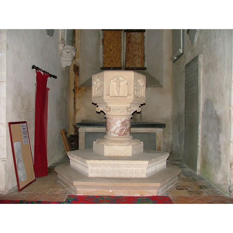
Image copyright © Simon Knott, 2005
Standing permission
Results: 6 records
view of font
Scene Description: the modern font [cf. FontNotes]
Copyright Statement: Image copyright © Simon Knott, 2005
Image Source: digital photograph May 2005 taken by Simon Knott [www.norfolkchurches.co.uk/thursford/thursford.htm] [accessed 12 December 2013]
Copyright Instructions: Standing permission
view of church exterior - north view
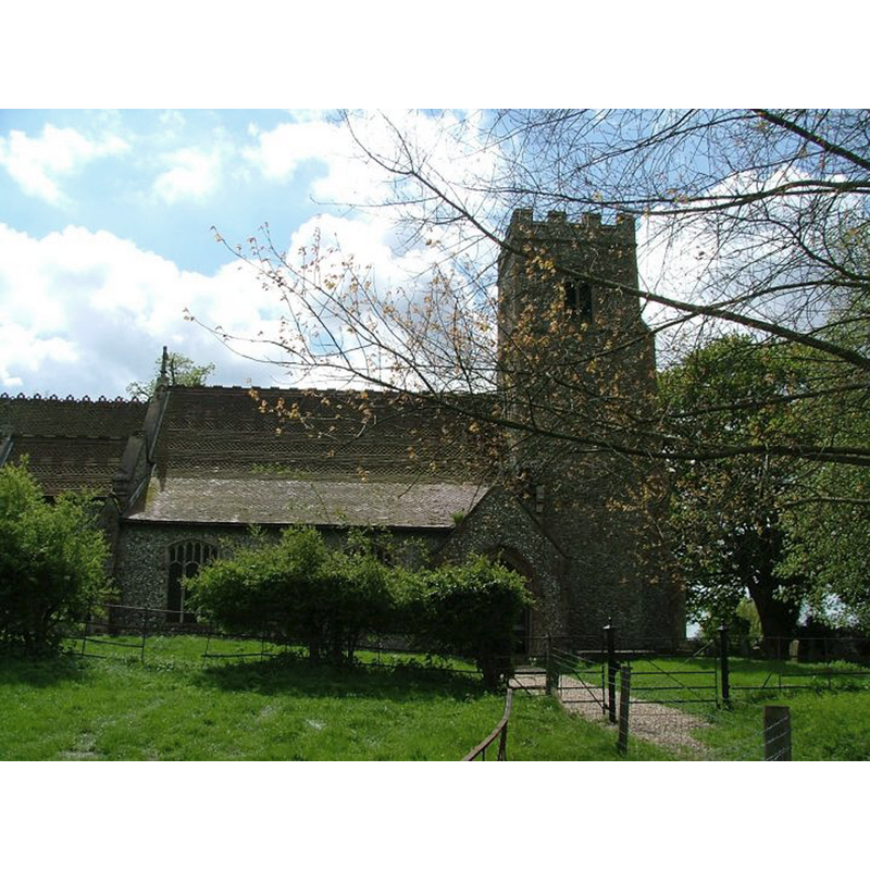
Copyright Statement: Image copyright © Simon Knott, 2005
Image Source: digital photograph May 2005 taken by Simon Knott [www.norfolkchurches.co.uk/thursford/thursford.htm] [accessed 12 December 2013]
Copyright Instructions: Standing permission
view of church exterior - east view
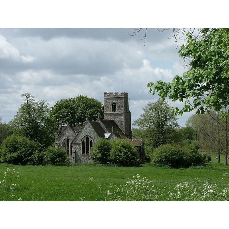
Copyright Statement: Image copyright © Simon Knott, 2005
Image Source: digital photograph May 2005 taken by Simon Knott [www.norfolkchurches.co.uk/thursford/thursford.htm] [accessed 12 December 2013]
Copyright Instructions: Standing permission
view of church exterior - northeast view
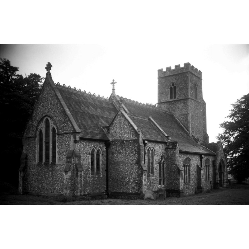
Scene Description: Photo caption: "The chancel and south transept date from 1862, architect W Lightly"
Copyright Statement: Image copyright © George Plunkett, 2013
Image Source: B&W photograph taken 22 May 1994 by George Plunkett [www.georgeplunkett.co.uk/Norfolk/T/Thursford At Andrew's church from NE [7127] 1994-05-22.jpg] [accessed 12 December 2013]
Copyright Instructions: Standing permission by Jonathan Plunkett
view of church interior - nave - looking west
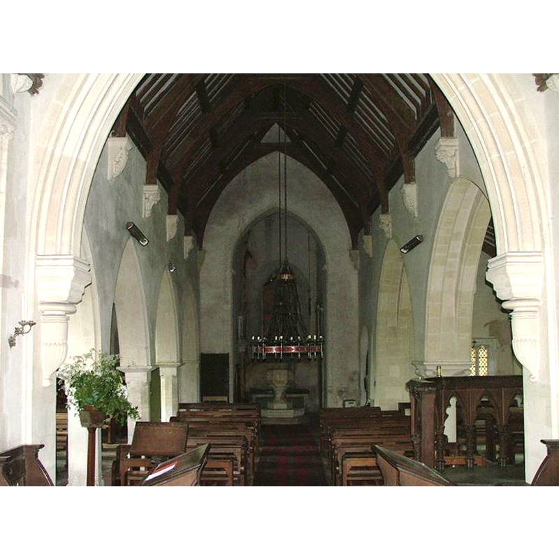
Scene Description: the modern font is visible at the west end, beneath the tower
Copyright Statement: Image copyright © Simon Knott, 2005
Image Source: digital photograph May 2005 taken by Simon Knott [www.norfolkchurches.co.uk/thursford/thursford.htm] [accessed 12 December 2013]
Copyright Instructions: Standing permission
view of church interior - nave - looking east
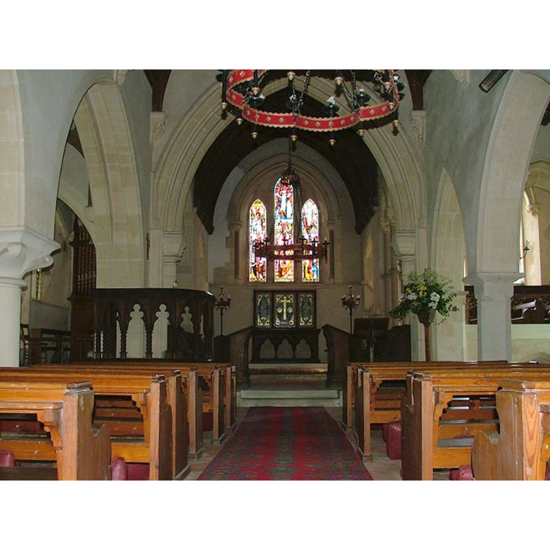
Copyright Statement: Image copyright © Simon Knott, 2005
Image Source: digital photograph May 2005 taken by Simon Knott [www.norfolkchurches.co.uk/thursford/thursford.htm] [accessed 12 December 2013]
Copyright Instructions: Standing permission
INFORMATION
Font ID: 14944THU
Object Type: Baptismal Font1?
Font Date: ca. 1200?
Font Century and Period/Style: 12th - 13th century, Medieval
Church / Chapel Name: Parish Church of St. Andrew
Church Patron Saint(s): St. Andrew
Church Address: Heath Lane, Thursford, Norfolk NR21 0BW
Site Location: Norfolk, East Anglia, England, United Kingdom
Directions to Site: Located 4 km from Kettlestone, 25 km from Cromer
Ecclesiastic Region: Diocese of Norwich
Historical Region: Hundred of North Greehow
Additional Comments: disappeared font? (the one from the medieval church here)
Font Notes:
Click to view
Blomefield (1805-1810) writes: "T[hursford] Was a beruite to Snoring Magna [...] being wrote in Domesday book Turesfort. [...] The church is dedicated to St. Andrew, and is a rectory [...] The Church and chancel are covered with lead, and has a square tower with two bells. [...] Rectors. In 1309, John de Narings was instituted, presented by the Lady Sarah de Burgolyon." This date of the 1309 is the earliest reference to the church in Blomefield (ibid.) The present font is illustrated in Knott (2005); 19th-century (1865) replacement of the earlier font(s) of this church which goes back to ca. 1200 [doorway?]; it is octagonal with a Crucifixion, etc., on the sides; raised on a Corinthian capital, a pink marble stem, an octagonal lower base and a two-stem octagonal plinth. [NB: we have no information on the earlier font of this church].
Credit and Acknowledgements: We are grateful to Simon Knott, of Norfolk Churches [www.norfolkchurches.co.uk], for his photographs of this church and modern font; we are also grateful to Jonathan Plunkett for the photograph of this church taken by his father, George Plunkett, 22 May 1994
COORDINATES
UTM: 31U 361723 5859261
Latitude & Longitude (Decimal): 52.86528, 0.94583
Latitude & Longitude (DMS): 52° 51′ 55.01″ N, 0° 56′ 44.99″ E
REFERENCES
- Blomefield, Francis, An essay towards a topographical history of Norfolk, 1805-1810, vol. 9: 258-260 / [www.british-history.ac.uk/report.aspx?compid=78539] [accessed 12 December 2013]
- Knott, Simon, The Norfolk Churches Site, Simon Knott, 2004. [standing permission to reproduce images received from Simon (February 2005]. URL: www.norfolkchurches.co.uk.