Thurgarton nr. Cromer / Thurgartuna / Turgatuna / Turgartuna
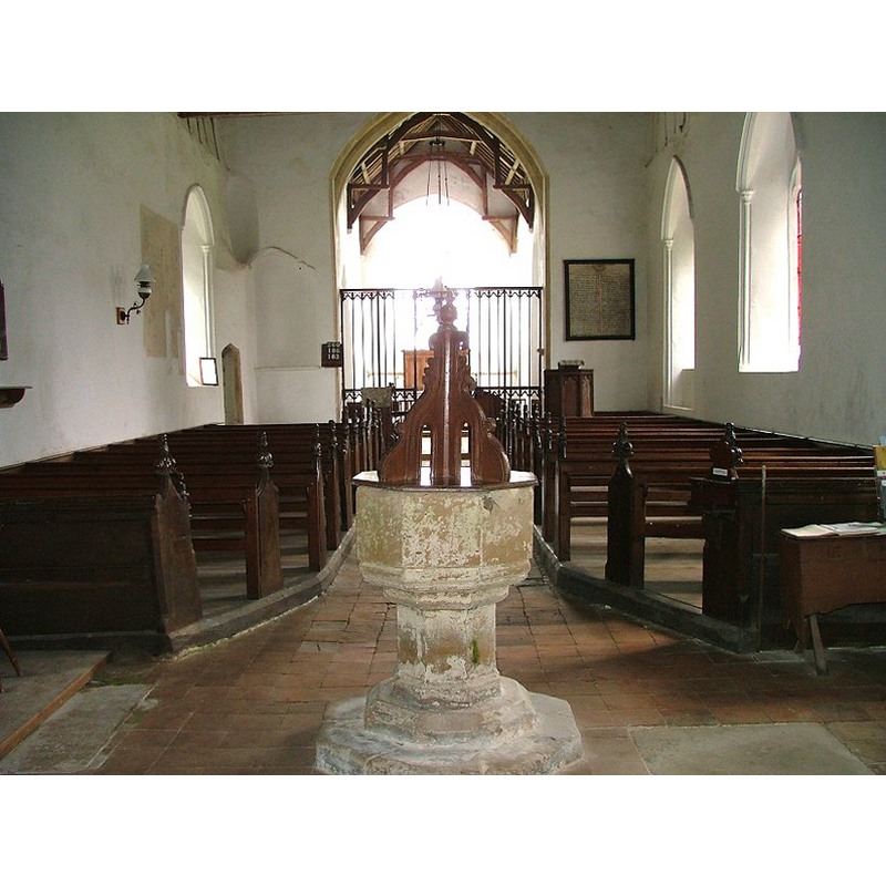
Image copyright © Simon Knott, 2009
Standing permission
Results: 6 records
view of font and cover in context
Copyright Statement: Image copyright © Simon Knott, 2009
Image Source: digital photograph October 2005 taken by Simon Knott [www.norfolkchurches.co.uk/thurgarton/thurgarton.htm] [accessed 7 July 2009]
Copyright Instructions: Standing permission
design element - motifs - moulding
Copyright Statement: Image copyright © Simon Knott, 2009
Image Source: digital photograph October 2005 taken by Simon Knott [www.norfolkchurches.co.uk/thurgarton/thurgarton.htm] [accessed 7 July 2009]
Copyright Instructions: Standing permission
view of church exterior - southeast view
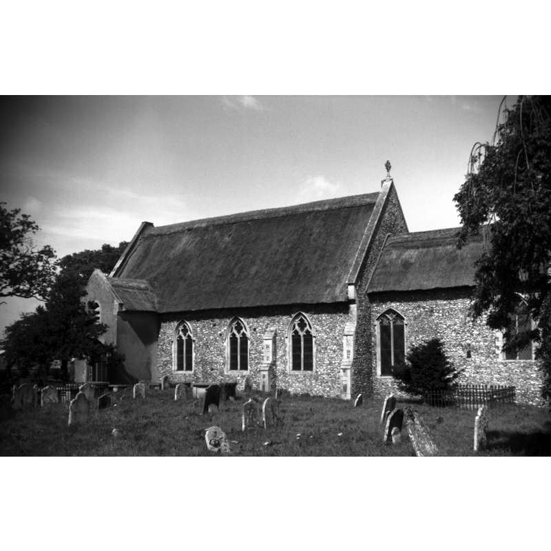
Scene Description: Photo caption: "The church is entirely thatched. The tower, said to have been round, was taken down in 1882
Copyright Statement: Image copyright © George Plunkett, 2013
Image Source: B&W photograph taken 27 August 1965 by George Plunkett [www.georgeplunkett.co.uk/Norfolk/T/Thurgarton All Saints church south side [5016] 1965-08-27.jpg] [accessed 27 September 2013]
Copyright Instructions: Standing permission by Jonathan Plunkett
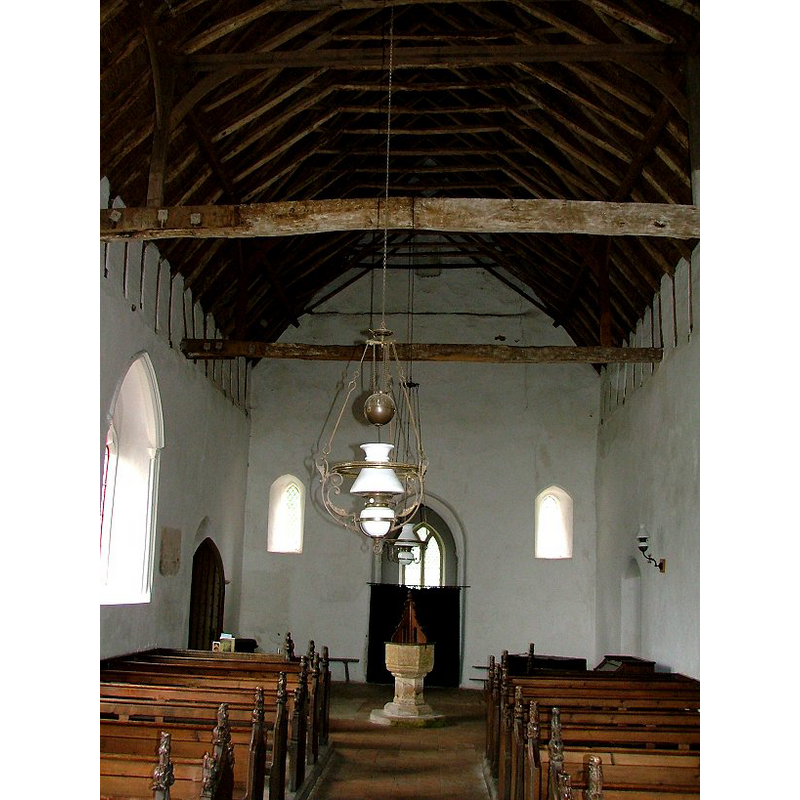
view of church interior - nave - looking west
Copyright Statement: Image copyright © Simon Knott, 2009
Image Source: digital photograph October 2005 taken by Simon Knott [www.norfolkchurches.co.uk/thurgarton/thurgarton.htm] [accessed 27 September 2013]
Copyright Instructions: Standing permission
view of church interior - nave - northeast corner
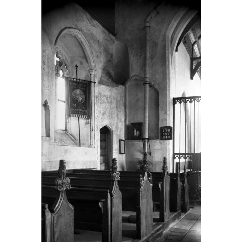
Scene Description: the small doorway opening on the left leads to the rood
Copyright Statement: Image copyright © George Plunkett, 2013
Image Source: B&W photograph taken 27 August 1965 by George Plunkett [www.georgeplunkett.co.uk/Norfolk/T/Thurgarton All Saints church rood stairs [5015] 1965-08-27.jpg] [accessed 27 September 2013]
Copyright Instructions: Standing permission by Jonathan Plunkett
design element - motifs - moulding
Copyright Statement: Image copyright © Simon Knott, 2009
Image Source: digital photograph October 2005 taken by Simon Knott [www.norfolkchurches.co.uk/thurgarton/thurgarton.htm] [accessed 7 July 2009]
Copyright Instructions: Standing permission
INFORMATION
Font ID: 14943THU
Object Type: Baptismal Font1
Font Century and Period/Style: 14th century, Decorated
Church / Chapel Name: Parish Church of All Saints [redundant]
Font Location in Church: Inside the church, at the W end of the nave
Church Patron Saint(s): All Saints
Church Notes: the tower, believed to have been a 'round-tower', fell in 1822 -- church redundant, in the care of the Churches Preservation Trust
Church Address: Aldborough and Thurgarton, Norfolk NR11 7HT
Site Location: Norfolk, East Anglia, England, United Kingdom
Directions to Site: Located off (W) the A140, 9 km SW of Cromer, 10 km N of Aylsham
Ecclesiastic Region: Diocese of Norwich
Historical Region: Hundred of North Erpingham
Font Notes:
Click to view
This location appears in the Blomefield (1805-1810) transcription and translation of the Domesday survey entries with three spellings: Thurgartuna. Turgartuna and Turgatuna; it mentions neither church nor cleric in it, and it was held since pre-Conquest times by the abbot of St. Bennet of Holme. Blomefield (ibid.) writes: "The Church is a rectory formerly in the patronage of the abbot of St. Bennet of Holm [...] Dedicated to All-Saints. [...] The Bishop of Norwich is patron. [...] Rectors. In 1316, John de Claxton held it by sequestration". This is the only date relating to the Thurgarton church found in Blomefield's entry. as there is no other mention of advowson or patronage than what is noted above. There are some un=documented suggestions that the fallen tower was round and of early date. The font cover, not the font, is noted in Pevsner & Wilson (1997): "Modest, C18, with volute brackets of C17 type." The font and cover are illustrated in Knott (2005). The font consists of a plain octagonal basin with vertical sides, the underbowl chamfer moulded; mouldings also at the base of the otherwise plain octagonal stem; octagonal lower base and plinth.
Credit and Acknowledgements: We are grateful to Simon Knott, of www.norfolkchurches.co.uk, for his photograph of this font; we are also grateful to Jonathan Plunkett for the photographs of this church taken by his father, George Plunkett, in August 1965
COORDINATES
UTM: 31U 381540 5859961
Latitude & Longitude (Decimal): 52.8763, 1.2398
Latitude & Longitude (DMS): 52° 52′ 34.68″ N, 1° 14′ 23.28″ E
MEDIUM AND MEASUREMENTS
Material: stone
Font Shape: octagonal, mounted
Basin Interior Shape: round
Basin Exterior Shape: octagonal
LID INFORMATION
Date: 18th-century?
Material: wood, oak?
Apparatus: no
Notes: [cf. FontNotes]
REFERENCES
- Blomefield, Francis, An essay towards a topographical history of Norfolk, 1805-1810, vol. 8: 175-178 / [www.british-history.ac.uk/report.aspx?compid=78438] [accessed 26 September 2013]
- Knott, Simon, The Norfolk Churches Site, Simon Knott, 2004. [standing permission to reproduce images received from Simon (February 2005]. URL: www.norfolkchurches.co.uk.
- Pevsner, Nikolaus, Norfolk 1: Norwich and North-East [2nd ed.], Harmondsworth: Penguin Books, 1997, p. 694