Thrigby / Thrickby / Trikebei / Trikeby / Trukeboj / Trikebyde
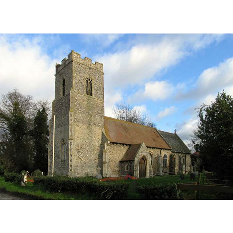
Image copyright © John Salmon, 2007
CC-BY-SA-3.0
Results: 8 records
view of church exterior - southwest view
Copyright Statement: Image copyright © John Salmon, 2007
Image Source: digital photograph taken 4 January 2007 by John Salmon [www.geograph.org.uk/photo/306893] [accessed 3 June 2014]
Copyright Instructions: CC-BY-SA-3.0
view of church exterior - southeast view
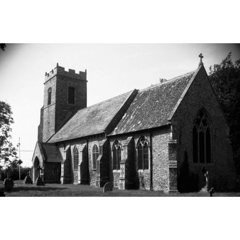
Scene Description: Photo caption: "Largely Decorated but some restoration in 1896"
Copyright Statement: Image copyright © George Plunkett, 2014
Image Source: B&W photograph taken 14 June 1992 by George Plunkett [www.georgeplunkett.co.uk/Norfolk/T/Thrigby St Mary's church from SE [6833] 1992-06-14.jpg] [accessed 4 June 2014]
Copyright Instructions: Standing permission by Jonathan Plunkett
view of church interior - nave - looking west
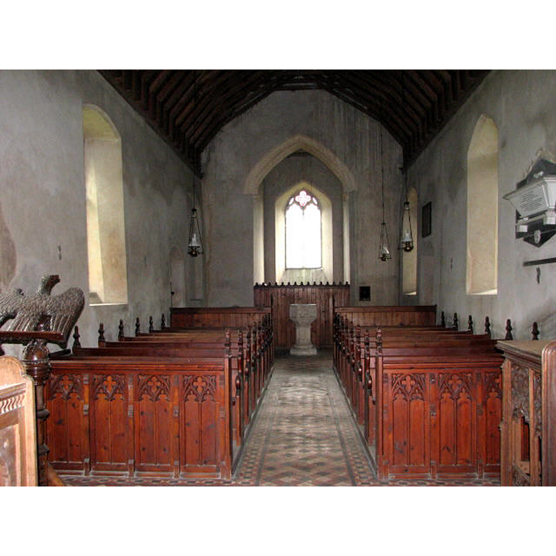
Scene Description: with the Perpendicular font at the west end
Copyright Statement: Image copyright © Evelyn Simak, 2007
Image Source: digital photograph taken June 2007 by Evelyn Simak [www.geograph.org.uk/photo/599506] [accessed 3 June 2014]
Copyright Instructions: CC-BY-SA-3.0
view of church interior - nave - looking east
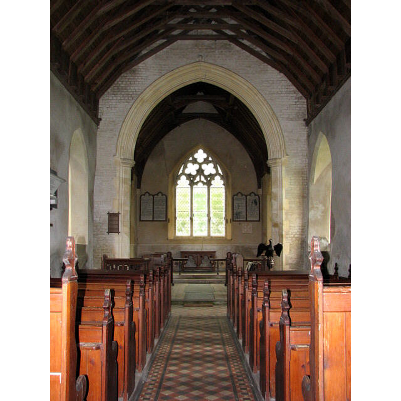
Copyright Statement: Image copyright © Evelyn Simak, 2007
Image Source: digital photograph taken June 2007 by Evelyn Simak [www.geograph.org.uk/photo/599506] [accessed 3 June 2014]
Copyright Instructions: CC-BY-SA-3.0
design element - motifs - quatrefoil - 4

Scene Description: rounded; alternating with cusped quatrefoils on the other four sides

design element - motifs - quatrefoil - cusped - 4
Scene Description: alternating with rounded quatrefoils on the other four sides
design element - architectural - niche or window - trefoiled - 8
Scene Description: re-cut [cf. FontNotes]
design element - motifs - moulding
Scene Description: top and bottom
INFORMATION
Font ID: 14942THR
Object Type: Baptismal Font1
Font Century and Period/Style: 15th century [re-cut?], Perpendicular [altered?]
Church / Chapel Name: Parish Church of St. Mary
Font Location in Church: Inside the church, at the W end of the nave
Church Patron Saint(s): St. Mary the Virgin
Church Address: Thrigby Road, Mautby, Norfolk NR29 3DS
Site Location: Norfolk, East Anglia, England, United Kingdom
Directions to Site: Located just SW of Filby, about 10 km NW of Yarmouth
Ecclesiastic Region: Diocese of Norwich
Historical Region: Hundred of East Flegg
Additional Comments: altered font? (the present one [cf. FontNotes]) -- disappeared font? (the one from the Domesday-period church here)
Font Notes:
Click to view
There are four entries for Thrigby [variant spelling] in the Domesday book [http://domesdaymap.co.uk/place/TG4612/thrigby/] [accessed 3 June 2014], one of which mentions a church and churchlands in it. Blomefield (1805-1810) writes: "The church and chancel is covered with reed, and has a square tower. [...] The church is a vicarage, dedicated to St. Mary, the rectory was appropriated to Langley abbey". The present font is noted in Pevsner & Wilson (1997): "Octagonal, plain, with two patterns of quatrefoils. The stem at least recut."
Credit and Acknowledgements: We are grateful to Jonathan Plunkett for the photographs of this church, taken by his father, George Plunkett, in 1992
COORDINATES
UTM: 31U 407768 5834574
Latitude & Longitude (Decimal): 52.653278, 1.636526
Latitude & Longitude (DMS): 52° 39′ 11.8″ N, 1° 38′ 11.5″ E
MEDIUM AND MEASUREMENTS
Material: stone
Font Shape: octagonal, mounted
Basin Interior Shape: round
Basin Exterior Shape: octagonal
Drainage Notes: lead-lined
REFERENCES
- Blomefield, Francis, An essay towards a topographical history of Norfolk, 1805-1810, vol. 11: 252-254 / [www.british-history.ac.uk/report.aspx?compid=78793] [accessed 9 June 2014]
- Pevsner, Nikolaus, Norfolk 1: Norwich and North-East [2nd ed.], Harmondsworth: Penguin Books, 1997, p. 694