Stokesby / Stokesbey / Stokesby-cum-Herringby
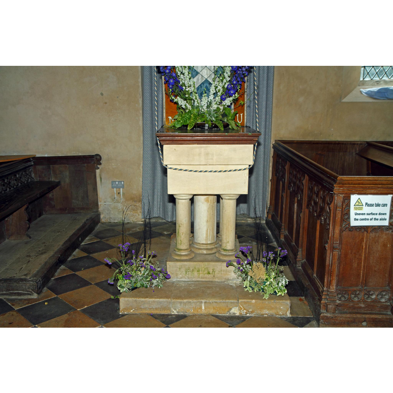
Image copyright © Brokentaco, 2012
CC-BY-SA-3.0
Results: 4 records
view of font and cover in context
Scene Description: the modern font and cover [cf. FontNotes]
Copyright Statement: Image copyright © Brokentaco, 2012
Image Source: digital photograph taken 20 May 2012 by Brokentaco [www.flickr.com/photos/brokentaco/12257492436/] [accessed 3 June 2014]
Copyright Instructions: CC-BY-SA-3.0
view of church exterior - northwest view
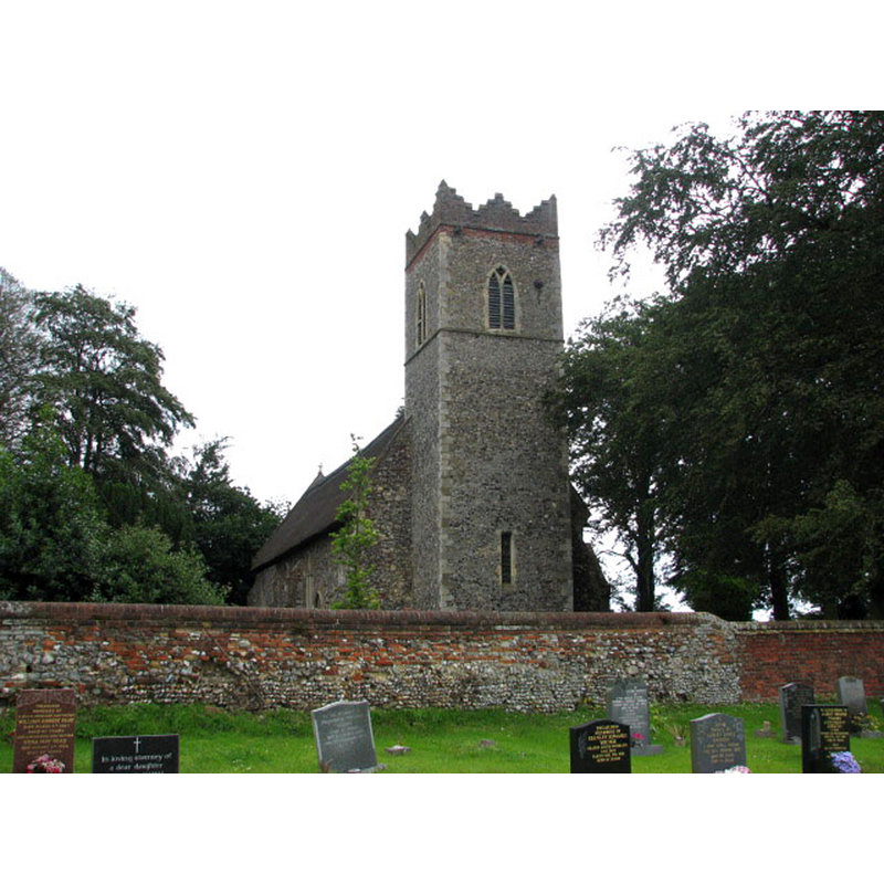
Copyright Statement: Image copyright © Evelyn Simak, 2007
Image Source: digital photograph taken 27 June 2007 by Evelyn Simak [www.geograph.org.uk/photo/1553466] [accessed 3 June 2014]
Copyright Instructions: CC-BY-SA-3.0
view of church exterior - south view
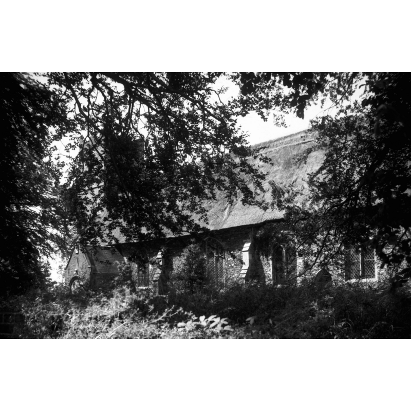
Copyright Statement: Image copyright © George Plunkett, 2014
Image Source: B&W photograph taken 14 June 1992 by George Plunkett [www.georgeplunkett.co.uk/Norfolk/S/Stokesby St Andrew's church south side [6830] 1992-06-14.jpg] [accessed 4 June 2014]
Copyright Instructions: Standing permission by Jonathan Plunkett
view of church exterior - northwest view
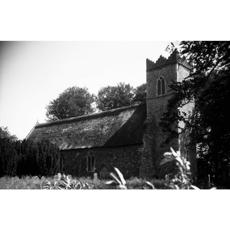
Scene Description: Photo caption: "The triple-stepped brick battlements of the tower are 16c. All but one of the windows are Decorated"
Copyright Statement: Image copyright © George Plunkett, 2014
Image Source: B&W photograph taken 14 June 1992 by George Plunkett [www.georgeplunkett.co.uk/Norfolk/S/Stokesby St Andrew's church from NW [6831] 1992-06-14.jpg] [accessed 4 June 2014]
Copyright Instructions: Standing permission by Jonathan Plunkett
INFORMATION
Font ID: 14929STO
Object Type: Baptismal Font1?
Font Century and Period/Style: 11th century, Pre-Conquest? / Norman
Church / Chapel Name: Parish Church of St. Andrew
Church Patron Saint(s): St. Andrew
Church Address: Stokesby, Norfolk, NR29 3EP
Site Location: Norfolk, East Anglia, England, United Kingdom
Directions to Site: Located 11 km NW of Yarmouth
Ecclesiastic Region: Diocese of Norwich
Historical Region: Hundred of East Flegg
Additional Comments: disappeared font? (the one from the Domesday-period church here)
Font Notes:
Click to view
There is an entry for Stokesby in the Domesday book [http://domesdaymap.co.uk/place/TG4310/stokesby/] [accessed 3 June 2014], and it reports a church and churchlands in it. Blomefield (1805-1810) transcribes and translates the Domesday entry: "a church endowed with 24 acres of land, and 3 of meadow", and further adds: "The Church is dedicated to St. Andrew, and is a rectory, [...] and the priory of Longueville had a portion therein". The present font here is reported in White (1883) as modern. It consists of a plain square basin raiseed on a central shaft and four outer colonnettes, all with moulded capitals and bases, on a plain square lower base and an equally shaped plinth; all modern. [NB: we have no information on the font of the Domesday-period church here].
Credit and Acknowledgements: We are grateful to Jonathan Plunkett for the photographs of this church taken by his father, George Plunkett, in 1992
COORDINATES
UTM: 31U 405117 5832895
Latitude & Longitude (Decimal): 52.637731, 1.59783
Latitude & Longitude (DMS): 52° 38′ 15.83″ N, 1° 35′ 52.19″ E
REFERENCES
- White, William, History, Gazetteer, and Directory of Norfolk, [s.l.]: [printed for the author], 1883, [transcription in http://www.origins.org.uk/genuki/NFK/places/s/stokesby/white1883.shtml [accessed 6 July 2009]]