Stiffkey No. 1 / Stivecai / Stivekey
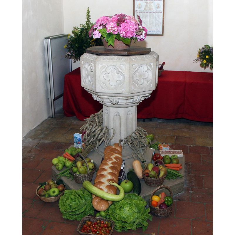
Image copyright © Brokentaco, 2008
CC-BY-SA-3.0
Results: 5 records
view of font and cover
Scene Description: the modern font of 1953
Copyright Statement: Image copyright © Brokentaco, 2008
Image Source: digital photograph taken 28 September 2008 by Brokentaco [www.flickr.com/photos/brokentaco/2992103049/] [accessed 12 December 2013]
Copyright Instructions: CC-BY-SA-3.0
view of church exterior - northwest view
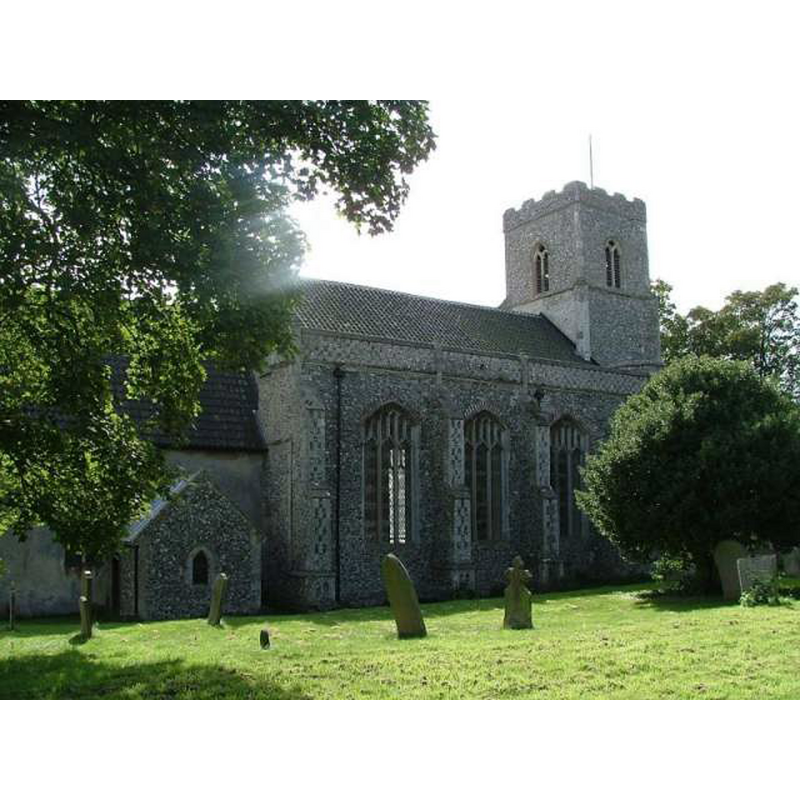
Copyright Statement: Image copyright © Simon Knott, 2004
Image Source: digital photograph November 2004 taken by Simon Knott [www.norfolkchurches.co.uk/stiffkey/stiffkey.htm] [accessed 12 December 2013]
Copyright Instructions: Standing permission
view of church exterior in context
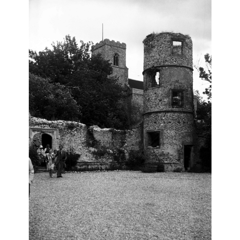
Scene Description: Photo caption: "NE inner tower, and church of St John Baptist behind"
Copyright Statement: Image copyright © George Plunkett, 2013
Image Source: B&W photograph taken 12 July 1984 by George Plunkett [www.georgeplunkett.co.uk/Norfolk/S/Stiffkey Old Hall corner tower ruin [6307] 1984-07-12.jpg] [accessed 12 December 2013]
Copyright Instructions: Standing permission by Jonathan Plunkett
view of church exterior - south view
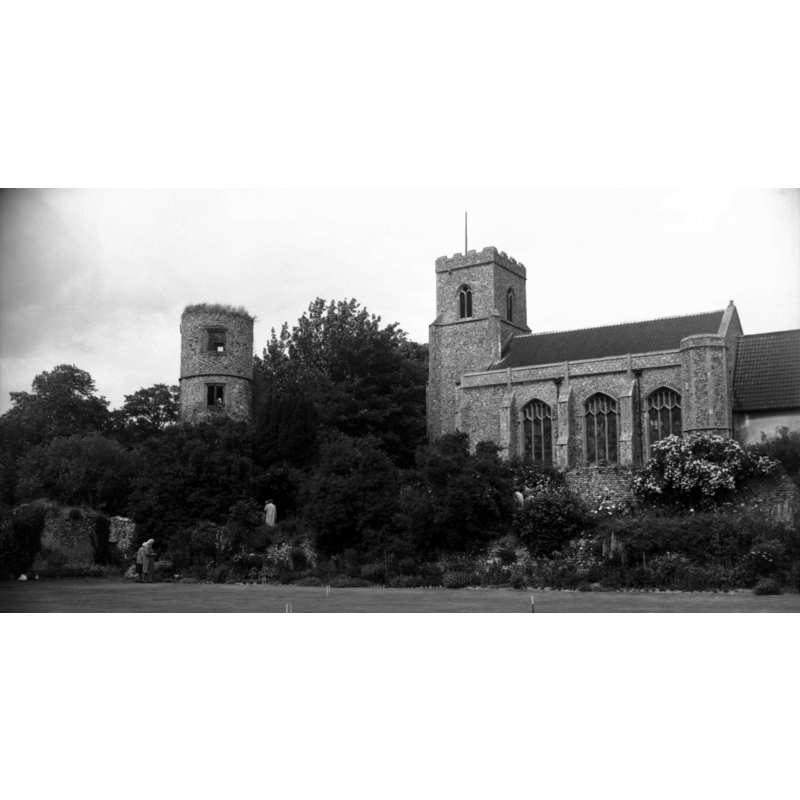
Scene Description: the old round tower is part of the Old Hall, not of the church
Copyright Statement: Image copyright © George Plunkett, 2013
Image Source: B&W photograph taken 12 July 1984 by George Plunkett [www.georgeplunkett.co.uk/Norfolk/S/Stiffkey St John Baptist church from hall [6311] 1984-07-12.jpg] [accessed 12 December 2013]
Copyright Instructions: Standing permission by Jonathan Plunkett
view of church interior - nave - looking east
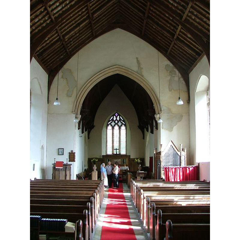
Copyright Statement: Image copyright © Simon Knott, 2004
Image Source: digital photograph November 2004 taken by Simon Knott [www.norfolkchurches.co.uk/stiffkey/stiffkey.htm] [accessed 12 December 2013]
Copyright Instructions: Standing permission
INFORMATION
Font ID: 14928STI
Object Type: Baptismal Font1
Font Century and Period/Style: 13th - 14th century, Medieval
Church / Chapel Name: Parish Church of St. John the Baptist [aka St. John and St. Mary's] [redundant]
Font Location in Church: [cf. FontNotes]
Church Patron Saint(s): St. John the Baptist [& St. Mary?]
Church Notes: another church, dedicated to St. Mary and long since in ruins, formerly stood in the churchyard of St. John's -- some local sources argue that the surviving church is actually old St. Mary's
Church Address: Church Street, Stiffkey, Norfolk NR23 1QJ
Site Location: Norfolk, East Anglia, England, United Kingdom
Directions to Site: Located on the A149, 6 km ESE of Wells-next-the-Sea, 24 km from Cromer, 44 km NW of Norwich
Ecclesiastic Region: Diocese of Norwich
Historical Region: Hundred of North Greehow
Additional Comments: Stiffkey is pronounced "stoo-kee" or "/ˈstjuːki/ "
Font Notes:
Click to view
There are four entries for Stiffkey [variant spelling] in the Domesday survey [http://domesdaymap.co.uk/place/TF9743/stiffkey/] [accessed 12 December 2013], the largest part of which mentions a church in it. Blomefield (1805-1810) writes; "In this village are two churches, St. John Baptist's and St. Mary's; that there was a church at the conquest, endowed with 30 acres, appears from Domesday book. This church belonged to Ralph, son of Ivo, and so to the honour of Clare, and was afterwards (if not then) dedicated to St. John Baptist. It was a rectory [...] The other church was also a rectory, dedicated to St. Mary". Blomefield (ibid.) names the first recorded rectors for both churches; in St. John's, Robert Turtevile occurs rector in the 13th of Edward II" [i.e., 1320]; and, in St. Mary's, 1310, Walter Alexander instituted, presented by Audom. de Valentia Earl of Pembroke", but the earliest date for St. Mary's noted in this source is a reference to "the advowson of St. Mary's church in this town" being involved in a grant dated to 1251. The entry for Stiffkey in Wilson's gazetteer of 1870-1872 [www.visionofbritain.org.uk/place/5344] [accessed 12 December 2013] reads: "There were two churches; and the one is in ruins,-the other old." Kelly's Directory of 1883 notes: "The church of St. Mary, which formerly stood in the same churchyard [St. John the Baptist's], is now in ruins".
We have no information on the original font from the 13th or 14th century church. The Parish web site [www.northnorfolkcentral.co.uk/balestiffkey/stiffkey/Tour.html] [accessed 6 July 2009] informs that "The font is a modern memorial consecrated in 1953", and shows a stone font of octagonal shape located at the west end, beneath the tower. [cf. Index entry for Stiffkey St. Mary's]
We have no information on the original font from the 13th or 14th century church. The Parish web site [www.northnorfolkcentral.co.uk/balestiffkey/stiffkey/Tour.html] [accessed 6 July 2009] informs that "The font is a modern memorial consecrated in 1953", and shows a stone font of octagonal shape located at the west end, beneath the tower. [cf. Index entry for Stiffkey St. Mary's]
Credit and Acknowledgements: We are grateful to Simon Knott, of Norfolk Churches [www.norfolkchurches.co.uk], for his photographs of this church; we are also grateful to Jonathan Plunkett for the photographs of this church, taken by his father, George Plunkett, in 1984
COORDINATES
UTM: 31U 361367 5868385
Latitude & Longitude (Decimal): 52.94716, 0.936655
Latitude & Longitude (DMS): 52° 56' 49.78" N, 0° 56' 11.96" E
REFERENCES
- Blomefield, Francis, An essay towards a topographical history of Norfolk, 1805-1810, vol. 9: 249-254 / [www.british-history.ac.uk/report.aspx?compid=78537] [accessed 12 December 2013]
- Kelly, Kelly's Directory for Cambridge, Norfolk & Suffolk, London: Kelly's Directories Ltd., 1883, p. 502