Stibbard / Estanbyrda / Staberd / Stabrigge / Stabyrda / Stiberde
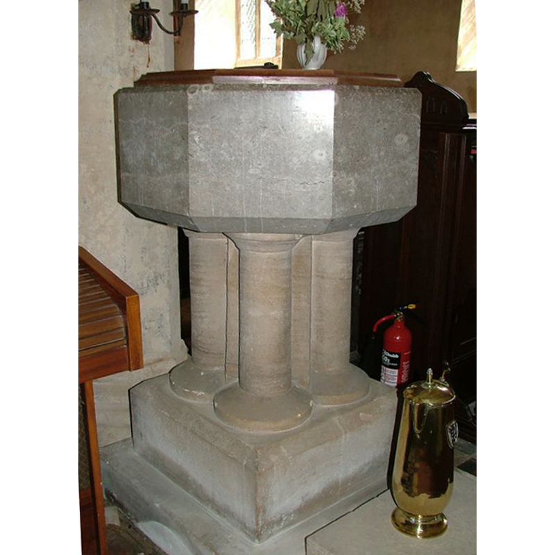
Image copyright © Simon Knott, 2006
Standing permission
Results: 3 records
view of font and cover
Scene Description: the modern font [cf. FontNotes]
Copyright Statement: Image copyright © Simon Knott, 2006
Image Source: digital photographs taken by Simon Knott July 2006 [www.norfolkchurches.co.uk/stibbard/stibbard.htm] [accessed 1 August 2013]
Copyright Instructions: Standing permission
view of church exterior - southeast view
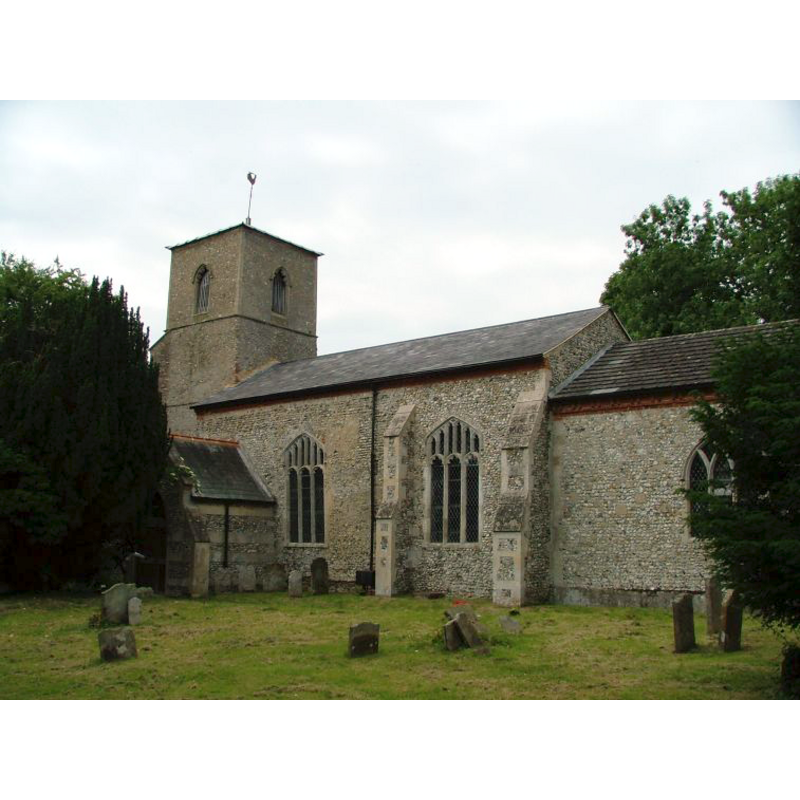
Copyright Statement: Image copyright © Simon Knott, 2006
Image Source: digital photographs taken by Simon Knott July 2006 [www.norfolkchurches.co.uk/stibbard/stibbard.htm] [accessed 1 August 2013]
Copyright Instructions: Standing permission
view of church interior - nave - looking east
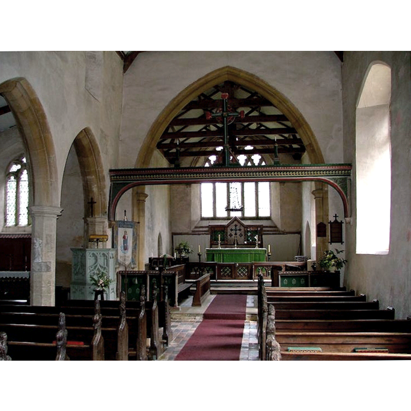
Copyright Statement: Image copyright © Simon Knott, 2006
Image Source: digital photographs taken by Simon Knott July 2006 [www.norfolkchurches.co.uk/stibbard/stibbard.htm] [accessed 1 August 2013]
Copyright Instructions: Standing permission
INFORMATION
Font ID: 14927STI
Object Type: Baptismal Font1?
Font Century and Period/Style: 11th - 12th century, Norman
Church / Chapel Name: Parish Church of All Saints
Church Patron Saint(s): All Saints
Church Address: Fulmerston Road, Stibbard, Norfolk, NR21 0NA
Site Location: Norfolk, East Anglia, England, United Kingdom
Directions to Site: Located off (N) the A1067, 6 km E of Fakenham, 35 km NW of Norwich
Ecclesiastic Region: Diocese of Norwich
Historical Region: Hundreds of Gallow and Brothercross
Additional Comments: disappeared font? (the one from the original 11th-12thC church here)
Font Notes:
Click to view
Blomefield (1805-1810) reports that in the Domesday survey of 1086, Earl Warren held "the moiety of a church endowed with 3 acres" here, and writes; "The Church is dedicated to All-Saints, and is a rectory [...] It has a nave, with a north isle, and a square tower with two bells." Blomefield (ibid.) names "Richard de Reppes" as the first recorded rector, in 1325. The present font is noted in Pevsner & Wilson (1997): "1861-3 by Butterfield, close in style to one illustrated in 'Instrumenta ecclesiastica'". Illustrated in Knott (2006). The font consists of an octagonal basin with plain chamfered upper and lower rims, raised on a central shaft with clustered colonnettes with moulded caps and bases, and a square lower base. The wooden cover is octagonal and flat, with metal decoration and ring handle; probably contemporary with the font. [NB: the fabric of the church goes back to the 12th century but we have no information on the earlier font(s) of this church]
Credit and Acknowledgements: We are grateful to Simon Knott, of Norfolk Churches [www.norfolkchurches.co.uk], for his photographs of church and modern font
COORDINATES
UTM: 31U 361279 5853890
Latitude & Longitude (Decimal): 52.816917, 0.941518
Latitude & Longitude (DMS): 52° 49′ 0.9″ N, 0° 56′ 29.47″ E
LID INFORMATION
Date: modern
Material: wood, oak
Apparatus: no
Notes: [cf. FontNotes]
REFERENCES
- Blomefield, Francis, An essay towards a topographical history of Norfolk, 1805-1810, vol. 7: 188-190 / [www.british-history.ac.uk/report.aspx?compid=78326] [accessed 1 August 2013]
- Knott, Simon, The Norfolk Churches Site, Simon Knott, 2004. [standing permission to reproduce images received from Simon (February 2005]. URL: www.norfolkchurches.co.uk.
- Pevsner, Nikolaus, Norfolk 1: Norwich and North-East [2nd ed.], Harmondsworth: Penguin Books, 1997, p. 675