Stanninghall / Staningehalla
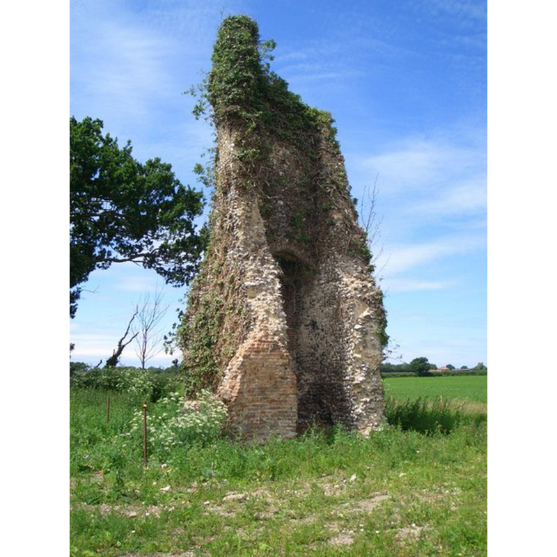
Image copyright © Gareth Hughes, 2008
CC-BY-SA-3.0
Results: 2 records
view of church exterior - tower - southeast view
Scene Description: Photo caption: "Ruins of St Peter's, Stanninghall. As it looked after partial removal of the ivy in June 2008"
Copyright Statement: Image copyright © Gareth Hughes, 2008
Image Source: digital photograph taken 27 June 2008 by Gareth Hughes [www.geograph.org.uk/photo/862219] [accessed 22 April 2014]
Copyright Instructions: CC-BY-SA-3.0
view of church exterior - tower - southeast view
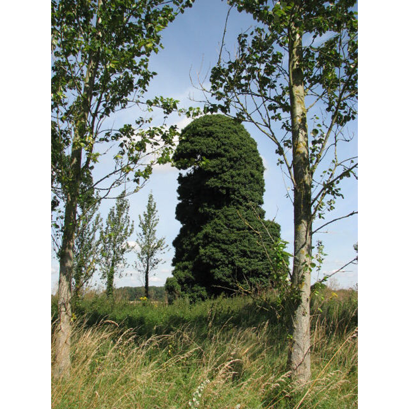
Scene Description: Ruins of Stanninghall St. Peter's covered in ivy in August 2007
Copyright Statement: Image copyright © Evelyn Simak, 2007
Image Source: digital photograph taken 3 August 2007 by Evelyn Simak [www.geograph.org.uk/photo/514308] [accessed 22 April 2014]
Copyright Instructions: CC-BY-SA-3.0
INFORMATION
Font ID: 14926STA
Object Type: Baptismal Font1?
Font Century and Period/Style: 13th century (mid?), Early English? / Decorated?
Church / Chapel Name: Parish Church of St. Peter [in ruins]
Font Location in Church: [cf. FontNotes]
Church Patron Saint(s): St. Peter
Church Notes: church said to have been "standing in 1505", but in ruins ca.1600 [cf. FontNotes]
Church Address: Stanninghall Road, Horstead, Norfolk NR12 7LX
Site Location: Norfolk, East Anglia, England, United Kingdom
Directions to Site: Located just SE of Frettenham, near Horstead
Ecclesiastic Region: [Diocese of Norwich]
Historical Region: Hundred of Taverham
Additional Comments: disappeared font? (the one from the 13thC church here)
Font Notes:
Click to view
There is an entry for Stanninghall [variant spelling] in the Domesday survey [http://domesdaymap.co.uk/place/TG2517/stanninghall/] [accessed 22 April 2014], but it mentions neither church nor cleric in it. Blomefield (1805-1810) writes: "The Church is a rectory [...] The church was dilapidated in the reign of Queen Elizabeth [i.e., 1558-1603]; it was standing in 1505." The first recorded rector is given in Blomefield (ibid.) as "In 1300, Peter le Courzun, instituted, presented by the prior and convent of Beeston in Norfolk", but his first mention of the church is: "In the 52d of King Henry III. Lucia, lady abbess, granted by fine, to Roger the prior of Beeston in Norfolk, the advowson of this church", which means the church here existed as early as 1268. Pevsner & Wilson (1997) inform that this church was "in ruins already in 1602" [NB: we have no information on its font]
COORDINATES
UTM: 31U 387462 5841075
Latitude & Longitude (Decimal): 52.707865, 1.334247
Latitude & Longitude (DMS): 52° 42′ 28.31″ N, 1° 20′ 3.29″ E
REFERENCES
- Blomefield, Francis, An essay towards a topographical history of Norfolk, 1805-1810, vol. 10: 464-467 / [www.british-history.ac.uk/report.aspx?compid=78721] [accessed 22 April 2014]
- Pevsner, Nikolaus, Norfolk 1: Norwich and North-East [2nd ed.], Harmondsworth: Penguin Books, 1997, p. 674