Sharrington / Scarnetuna / Scarnetune / Sharington
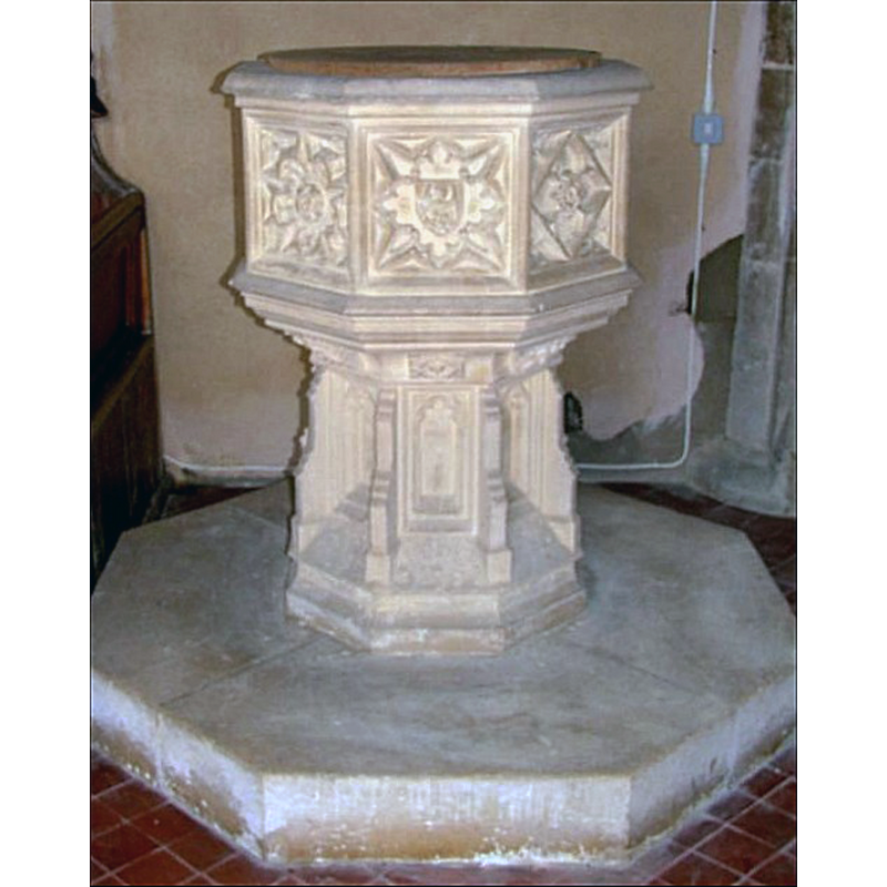
Image copyright © Simon Knott, 2006
Standing permission
Results: 6 records
view of font and cover
Scene Description: the modern font
Copyright Statement: Image copyright © Simon Knott, 2006
Image Source: digital photograph July 2006 taken by Somon Knott [www.norfolkchurches.co.uk/sharrington/sharrington.htm] [accessed 29 January 2014]
Copyright Instructions: Standing permission
view of church exterior - northwest view
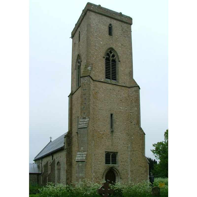
Copyright Statement: Image copyright © Simon Knott, 2006
Image Source: digital photograph July 2006 taken by Somon Knott [www.norfolkchurches.co.uk/sharrington/sharrington.htm] [accessed 29 January 2014]
Copyright Instructions: Standing permission
view of church exterior - southwest end
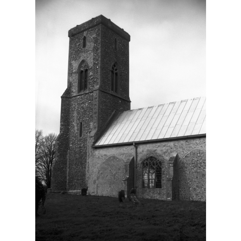
Scene Description: Photo caption: "Former aisles of three bays blocked up"
Copyright Statement: Image copyright © George Plunkett, 2014
Image Source: B&W photograph taken 6 March 1994 by Georges Plunkett [www.georgeplunkett.co.uk/Norfolk/S/Sharrington All Saints church from SE [7116] 1994-03-06.jpg] [accessed 29 January 2014]
Copyright Instructions: Standing permission by Jonathan Plunkett
view of font and cover in context
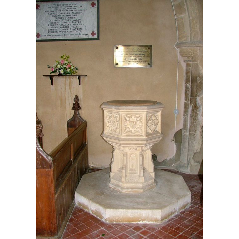
Scene Description: the modern font
Copyright Statement: Image copyright © Simon Knott, 2006
Image Source: digital photograph July 2006 taken by Somon Knott [www.norfolkchurches.co.uk/sharrington/sharrington.htm] [accessed 29 January 2014]
Copyright Instructions: Standing permission
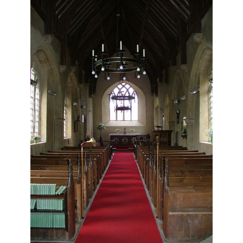
view of church interior - nave - looking west
![the top of the modern font is visible at the west end, south [left] side](/static-50478a99ec6f36a15d6234548c59f63da52304e5/compressed/1140129027_compressed.png)
Scene Description: the top of the modern font is visible at the west end, south [left] side
Copyright Statement: Image copyright © Simon Knott, 2006
Image Source: digital photograph July 2006 taken by Somon Knott [www.norfolkchurches.co.uk/sharrington/sharrington.htm] [accessed 29 January 2014]
Copyright Instructions: Standing permission
view of church interior - nave - looking east
Copyright Statement: Image copyright © Simon Knott, 2006
Image Source: digital photograph July 2006 taken by Somon Knott [www.norfolkchurches.co.uk/sharrington/sharrington.htm] [accessed 29 January 2014]
Copyright Instructions: Standing permission
INFORMATION
Font ID: 14918SHA
Object Type: Baptismal Font1?
Font Date: ca. 1323?
Font Century and Period/Style: 14th century, Decorated
Church / Chapel Name: Parish Church of All Saints
Church Patron Saint(s): All Saints
Church Address: Bale Road, Brinton, Norfolk NR24 2PQ
Site Location: Norfolk, East Anglia, England, United Kingdom
Directions to Site: Located on the A148, 6 km W of Holt, 16 km ENE of Fakenham
Ecclesiastic Region: Diocese of Norwich
Historical Region: Hundred of Holt
Additional Comments: disappeared font? (the one from the original ca.1323 (?) church here)
Font Notes:
Click to view
There are two entries for Sharrington [variant spelling] in the Domesday survey [http://domesdaymap.co.uk/place/TG0336/sharrington/] [accessed 29 January 2014], neither of which mentions a church or cleric in it. Blomefield (1805-1810) writes: "The Church is a rectory dedicated to All-Saints"; the earliest mention related to the church here is to the namng of the first recorded rector: "In 1323, Simon de Morton instituted, presented by John de Broughton." The present font is illustrated in Knott (2006); octagonal font is of general Perpendicular design but of late-Victorian manufacture [NB: we have no information on the font of the original church here].
COORDINATES
UTM: 31U 366569 5861779
Latitude & Longitude (Decimal): 52.889128, 1.016732
Latitude & Longitude (DMS): 52° 53′ 20.86″ N, 1° 1′ 0.23″ E
REFERENCES
- Blomefield, Francis, An essay towards a topographical history of Norfolk, 1805-1810, vol. 9: 436-438 / [www.british-history.ac.uk/report.aspx?compid=78587] [accessed 29 January 2014]
- Knott, Simon, The Norfolk Churches Site, Simon Knott, 2004. [standing permission to reproduce images received from Simon (February 2005]. URL: www.norfolkchurches.co.uk.