Paston nr. Crome / Pastuna
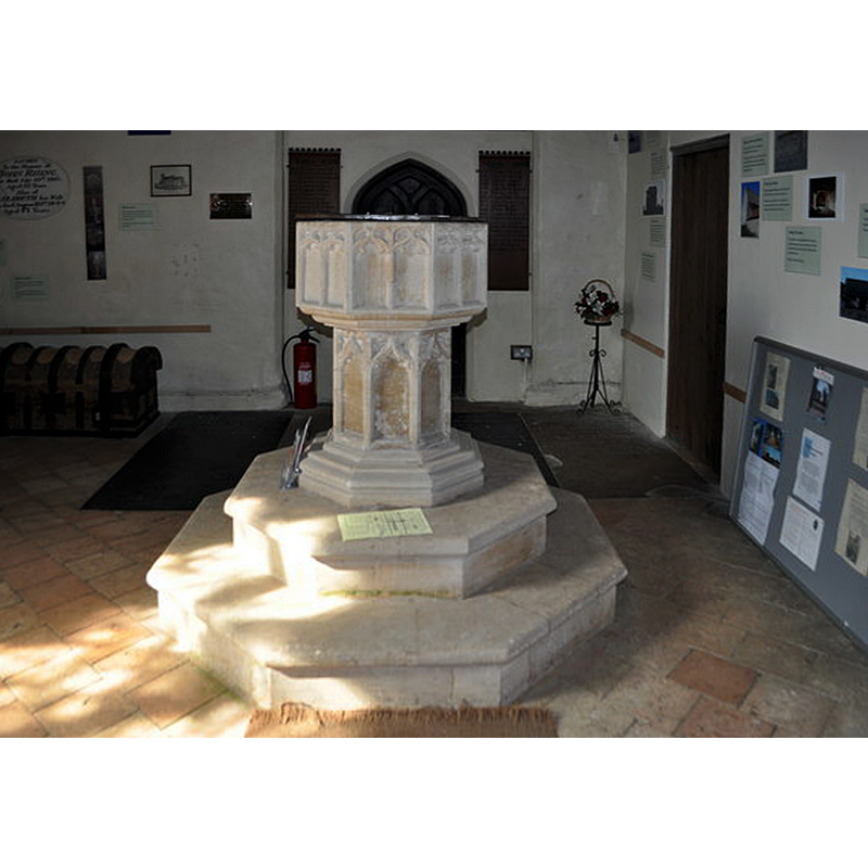
Image copyright © Ashley Dace, 2010
CC-BY-SA-3.0
Results: 6 records
view of font in context - east side
Scene Description: the font at the west end of the nave, seen from the east
Copyright Statement: Image copyright © Ashley Dace, 2010
Image Source: digital photograph taken 22 September 2010 by Ashley Dace [www.geograph.org.uk/photo/2078771] [accessed 29 April 2014]
Copyright Instructions: CC-BY-SA-3.0
design element - patterns - tracery - window tracery
Copyright Statement: Image copyright © Ashley Dace, 2010
Image Source: digital photograph taken 22 September 2010 by Ashley Dace [www.geograph.org.uk/photo/2078771] [accessed 29 April 2014]
Copyright Instructions: CC-BY-SA-3.0
view of church exterior - north view
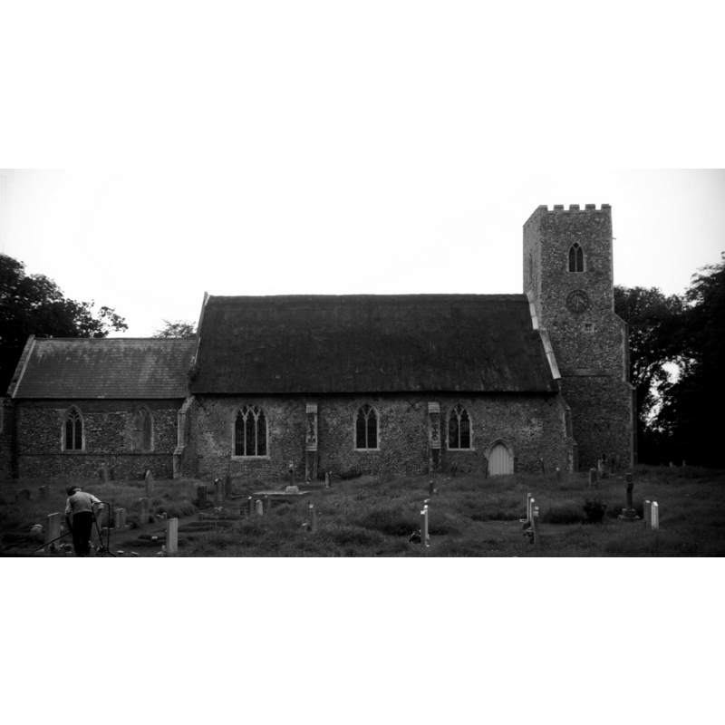
Scene Description: Photo caption: "The church is Decorated almost throughout"
Copyright Statement: Image copyright © George Plunkett, 2014
Image Source: B&W photograph taken 18 August 1993 by George Plunkett [www.georgeplunkett.co.uk/Norfolk/P/Paston St Margaret's church north side [7059] 1993-08-18.jpg] [accessed 29 April 2014]
Copyright Instructions: Standing permission by Jonathan Plunkett
view of church interior - nave - looking west
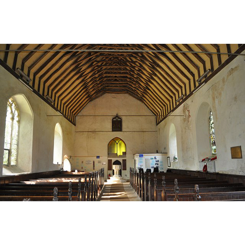
Scene Description: the font at the end of the nave
Copyright Statement: Image copyright © Ashley Dace, 2010
Image Source: digital photograph taken 22 September 2010 by Ashley Dace [www.geograph.org.uk/photo/2078780] [accessed 29 April 2014]
Copyright Instructions: CC-BY-SA-3.0
view of church interior - nave - looking east
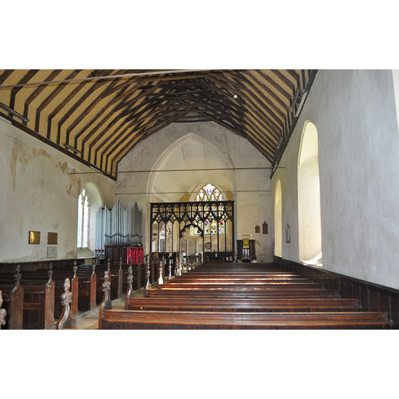
Copyright Statement: Image copyright © Ashley Dace, 2010
Image Source: digital photograph taken 22 September 2010 by Ashley Dace [www.geograph.org.uk/photo/2078765] [accessed 29 April 2014]
Copyright Instructions: CC-BY-SA-3.0
design element - patterns - tracery - window tracery
Copyright Statement: Image copyright © Ashley Dace, 2010
Image Source: digital photograph taken 22 September 2010 by Ashley Dace [www.geograph.org.uk/photo/2078771] [accessed 29 April 2014]
Copyright Instructions: CC-BY-SA-3.0
INFORMATION
Font ID: 14905PAS
Object Type: Baptismal Font1
Font Century and Period/Style: 14th century (late?), Decorated? / Perpendicular?
Church / Chapel Name: Parish Church of St. Margaret
Font Location in Church: Inside the church, at the W end of the nave
Church Patron Saint(s): St. Margaret of Antioch [aka Margaret the Virgin, Marina]
Church Address: Bacton Road, Paston, Norfolk, NR28 9TA
Site Location: Norfolk, East Anglia, England, United Kingdom
Directions to Site: Located 15 km SE of Cromer
Ecclesiastic Region: Diocese of Norwich
Historical Region: Hundred of Tunstede
Additional Comments: disappeared font? (The one from the Domesday-time church here)
Font Notes:
Click to view
There are three entries for Paston [variant spelling] in the Domesday survey [http://domesdaymap.co.uk/place/TG3234/paston/] [accessed 29 April 2014], one of which reports a church and churchlands in it. Blomefield (1905-1810) writes: "The church was a rectory, dedicated to St. Margaret, [...] it consists of one isle, and a chancel covered with reed, has a square tower and 5 bells [...] and was granted by Bartholomew de Glanvile to Bromholm priory, with 52 acres of land, and being appropriated, a vicarage was settled". The present font is described in Pevsner & Wilson (1997): "Octagonal. Late C14. Panelled stem, two-light mouchette tracery patterns on each side of the bowl." The graded lower base and the two-step plinth appear modern, as does the plain flat cover.
Credit and Acknowledgements: We are grateful to Jonathan Plunkett for the photograph of this church taken by his father, George Plunkett, in 1993
COORDINATES
UTM: 31U 395559 5857504
Latitude & Longitude (Decimal): 52.85712, 1.4488
Latitude & Longitude (DMS): 52° 51′ 25.63″ N, 1° 26′ 55.68″ E
MEDIUM AND MEASUREMENTS
Material: stone
Font Shape: octagonal, mounted
Basin Interior Shape: round
Basin Exterior Shape: octagonal
LID INFORMATION
Date: modern
Material: wood
Apparatus: no
Notes: octagonal flat and plain; modern
REFERENCES
- Blomefield, Francis, An essay towards a topographical history of Norfolk, 1805-1810, vol. 11: 57-59 / [www.british-history.ac.uk/report.aspx?compid=78744] [accessed 29 April 2014]
- Knott, Simon, The Norfolk Churches Site, Simon Knott, 2004. [standing permission to reproduce images received from Simon (February 2005]. URL: www.norfolkchurches.co.uk.
- Pevsner, Nikolaus, Norfolk 1: Norwich and North-East [2nd ed.], Harmondsworth: Penguin Books, 1997, p. 637