Little Plumstead / Plumstead Parva / Plumsteda / Plumstede / Plumstede Parva
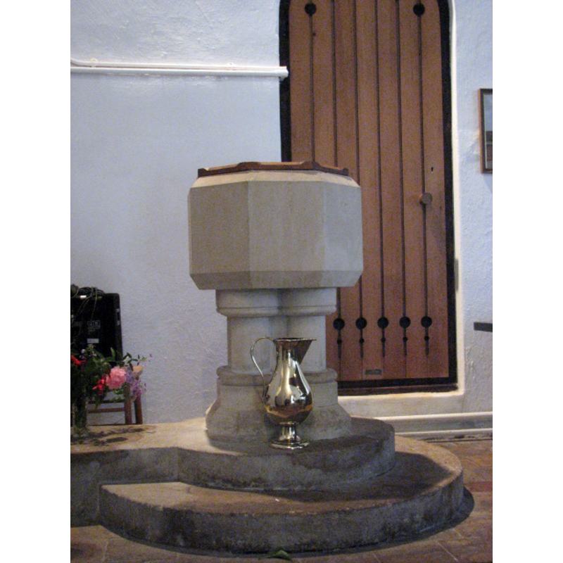
Image copyright © Evelyn Simak, 2008
CC-BY-SA-3.0
Results: 6 records
view of font and cover
Scene Description: the modern font [cf. FontNotes]
Copyright Statement: Image copyright © Evelyn Simak, 2008
Image Source: digital photograph taken 4 August 2008 by Evelyn Simak [www.geograph.org.uk/photo/911587] [accessed 12 August 2013]
Copyright Instructions: CC-BY-SA-3.0
view of church exterior - south portal
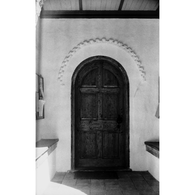
Scene Description: the Norman portal, inside the south porch
Copyright Statement: Image copyright © George Plunkett, 2013
Image Source: B&W photograph taken 19 July 1989 by George Plunkett [www.georgeplunkett.co.uk/Norfolk/L/Lt Plumstead Ss Gervase and Protase S door [5480] 1975-09-12.jpg] [accessed 15 August 2013]
Copyright Instructions: Standing permission by Jonathan Plunkett
view of church exterior - southwest end
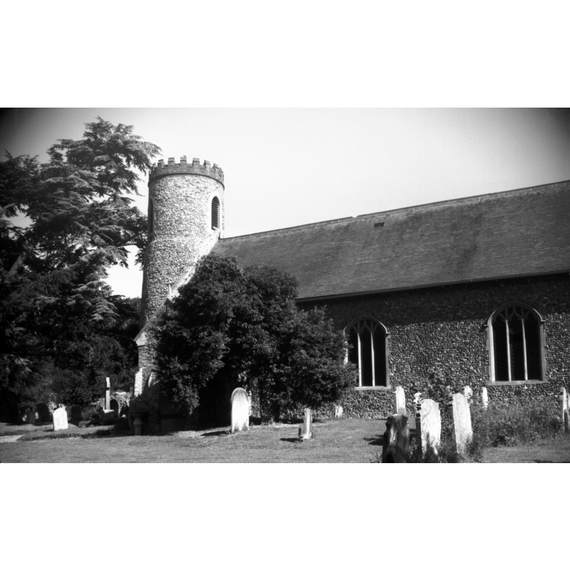
Copyright Statement: Image copyright © George Plunkett, 2013
Image Source: B&W photograph taken 19 July 1989 by George Plunkett [www.georgeplunkett.co.uk/Norfolk/L/Lt Plumstead Ss Garvase and Protase church [6565] 1989-07-19.jpg] [accessed 15 August 2013]
Copyright Instructions: Standing permission by Jonathan Plunkett
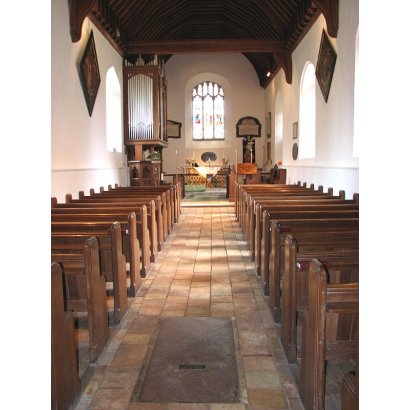
view of church interior - nave - looking west
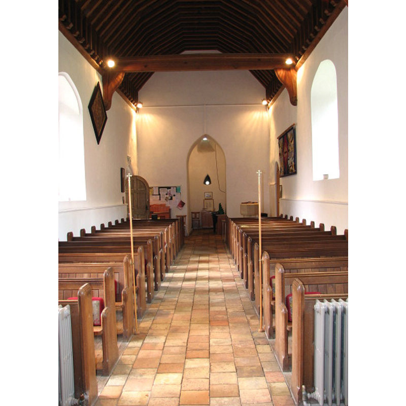
Scene Description: the modern font partially visible on the right (north) side, at the back (west end)
Copyright Statement: Image copyright © Evelyn Simak, 2008
Image Source: digital photograph taken 4 August 2008 by Evelyn Simak [www.geograph.org.uk/photo/911582] [accessed 12 August 2013]
Copyright Instructions: CC-BY-SA-3.0
view of church interior - nave - looking east
Copyright Statement: Image copyright © Evelyn Simak, 2008
Image Source: digital photograph taken 4 August 2008 by Evelyn Simak [www.geograph.org.uk/photo/911547] [accessed 12 August 2013]
Copyright Instructions: CC-BY-SA-3.0
view of stoup in context
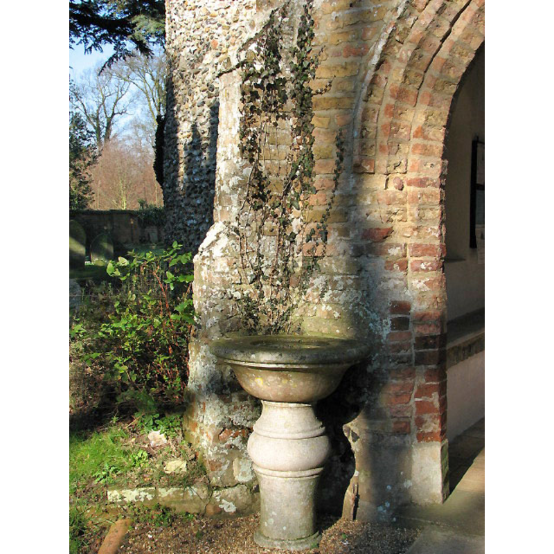
Scene Description: the former font now serving asholy-water stoup outside the south porch
Copyright Statement: Image copyright © Evelyn Simak, 2008
Image Source: digital photograph taken 4 August 2008 by Evelyn Simak [www.geograph.org.uk/photo/911543] [accessed 12 August 2013]
Copyright Instructions: CC-BY-SA-3.0
INFORMATION
Font ID: 14896PLU
Object Type: Baptismal Font1
Font Century and Period/Style: 17th - 18th century
Church / Chapel Name: Parish Church of St. Gervase and St. Protase
Font Location in Church: Outside the church, by the porch
Church Patron Saint(s): St. Gervase & St. Protase [aka Gervasius and Protasius, Gervasis and Prothasis]
Church Notes: round-towered church
Church Address: Little Plumstead NR13 5FB, Norfolk
Site Location: Norfolk, East Anglia, England, United Kingdom
Directions to Site: Located 10 km NE of Norwich
Ecclesiastic Region: Diocese of Norwich
Historical Region: Hundred of Blofield
Additional Comments: re-cycled font (the former 17thC font now a stoup outside the S porch -- disappeared font (the one from the original Norman church here)
Font Notes:
Click to view
There is no memention of a church or cleric in the Domesday entries for "Plumsteda" and "Plumstede". Blomefield (1805-1810) writes: "In the 16th of Edward I.[i.e., 1288] Isolda de Mounteny impleaded Adam de Creting for the patronage of this church; her plea was, that Ernold de Mounteney, as lord of Sprouston, was patron of this church, and had enfeoffed her; but Adam proving himself to be lord of Sprouston, he recovered it.", therefore noting the presence of a church here before 1288; he notes: "The Church is a rectory dedicated to St. Gervase", and names "William de Hoveden " as first recorded rector here, in 1303. The 17th-century former font here now servind as a holy-water stoup outside is noted in Pevsner & Wilson (1997): "A course C17 baluster, now outside the porch." The present font in use is of the 19th century, plain octagonal basin with chamfered rims, on moulded attached colums, and two-step plinth. The wooden cover is octagonal and flat, also modern. [NB: the fabric of the church goes back to the 12th century, but we have no information on the original Norman font of this church].
Credit and Acknowledgements: We are grateful to Jonathan Plunkett for the photograph of this church, take by his father, George Plunkett, in 1975 and 1989
COORDINATES
UTM: 31U 392369 5834132
Latitude & Longitude (Decimal): 52.646464, 1.409123
Latitude & Longitude (DMS): 52° 38′ 47.27″ N, 1° 24′ 32.84″ E
MEDIUM AND MEASUREMENTS
Material: stone
Font Shape: round, mounted
Basin Interior Shape: round
Basin Exterior Shape: round
REFERENCES
- Blomefield, Francis, An essay towards a topographical history of Norfolk, 1805-1810, vol. 7: 240-248 / [www.british-history.ac.uk/report.aspx?compid=78346] [accessed 12 August 2013]
- Knott, Simon, The Norfolk Churches Site, Simon Knott, 2004. [standing permission to reproduce images received from Simon (February 2005]. URL: www.norfolkchurches.co.uk.
- Pevsner, Nikolaus, Norfolk 1: Norwich and North-East [2nd ed.], Harmondsworth: Penguin Books, 1997, p. 588