Itteringham / Instrincham / Utrincham
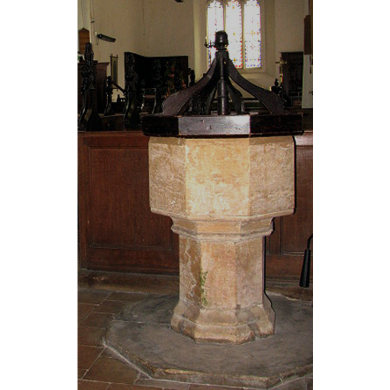
Image copyright © Evelyn Simak, 2008
CC-BY-SA-3.0
Results: 8 records
view of font and cover
Copyright Statement: Image copyright © Evelyn Simak, 2008
Image Source: detail of a digital photograph taken 8 July 2008 by Evelyn Simak [www.geograph.org.uk/photo/876204] [accessed 3 June 2013]
Copyright Instructions: CC-BY-SA-3.0
design element - motifs - moulding
Copyright Statement: Image copyright © Evelyn Simak, 2008
Image Source: detail of a digital photograph taken 8 July 2008 by Evelyn Simak [www.geograph.org.uk/photo/876204] [accessed 3 June 2013]
Copyright Instructions: CC-BY-SA-3.0
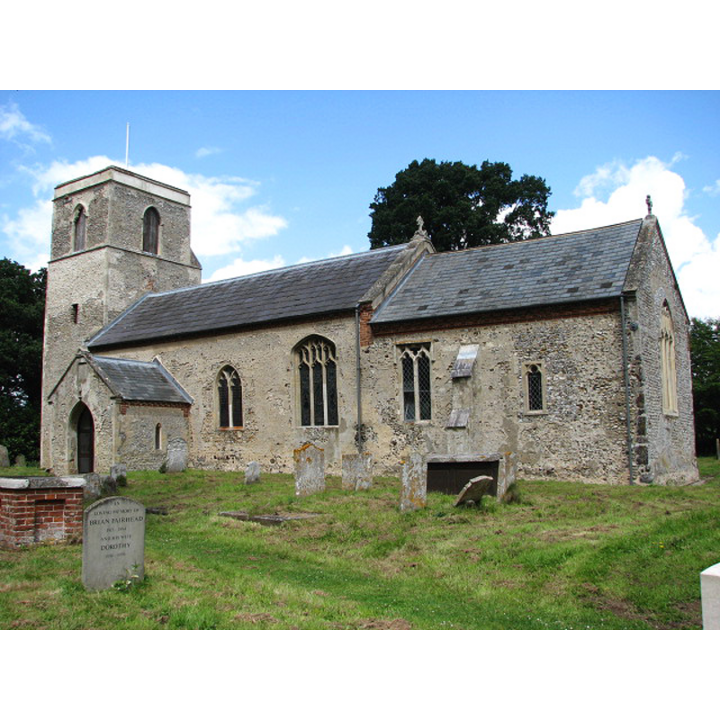
view of church exterior - southeast view
Copyright Statement: Image copyright © Evelyn Simak, 2008
Image Source: digital photograph taken 8 July 2008 by Evelyn Simak [www.geograph.org.uk/photo/876180] [accessed 3 June 2013]
Copyright Instructions: CC-BY-SA-3.0
view of font and cover in context
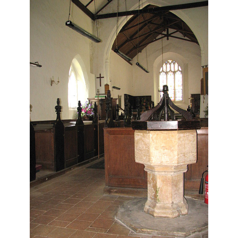
Scene Description: at the southwest corner of the nave
Copyright Statement: Image copyright © Evelyn Simak, 2008
Image Source: digital photograph taken 8 July 2008 by Evelyn Simak [www.geograph.org.uk/photo/876204] [accessed 3 June 2013]
Copyright Instructions: CC-BY-SA-3.0
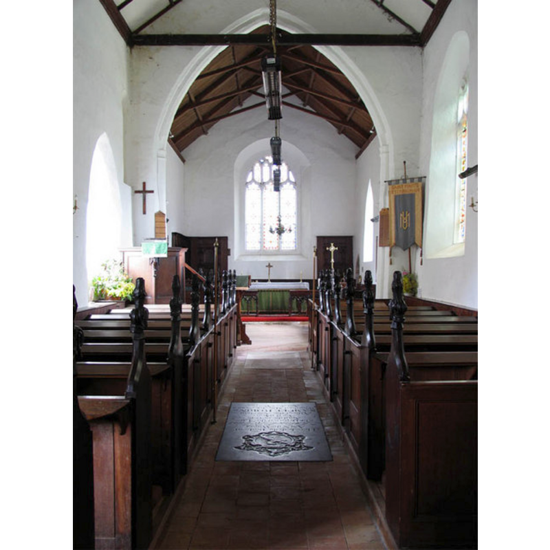
view of church interior - nave - looking west
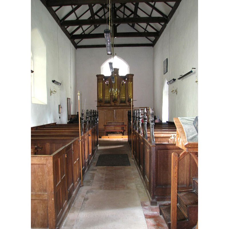
Scene Description: the font cover is partially visible at the back (west end), behind the left (south) bank of pews
Copyright Statement: Image copyright © Evelyn Simak, 2008
Image Source: digital photograph taken 8 July 2008 by Evelyn Simak [www.geograph.org.uk/photo/876207] [accessed 3 June 2013]
Copyright Instructions: CC-BY-SA-3.0
view of church interior - nave - looking east
Copyright Statement: Image copyright © John Salmon, 2005
Image Source: digital photograph taken 4 August 2005 by John Salmon [www.geograph.org.uk/photo/316194] [accessed 3 June 2013]
Copyright Instructions: CC-BY-SA-3.0
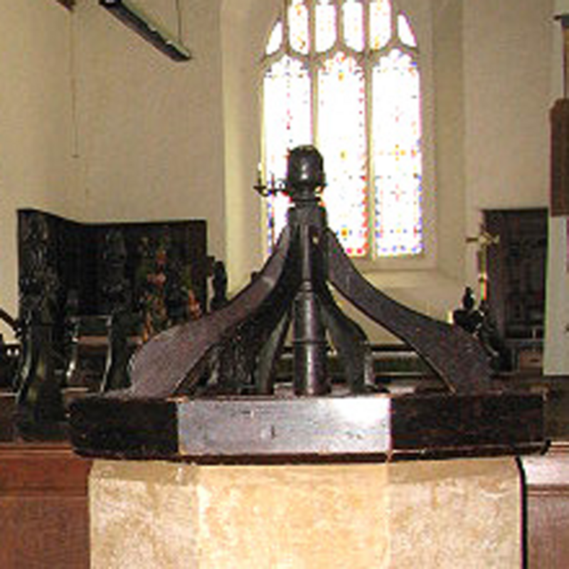
view of font cover
Copyright Statement: Image copyright © Evelyn Simak, 2008
Image Source: digital photograph taken 8 July 2008 by Evelyn Simak [www.geograph.org.uk/photo/876204] [accessed 3 June 2013]
Copyright Instructions: CC-BY-SA-3.0
design element - motifs - moulding - 2
Scene Description: forming the splaying lower base
Copyright Statement: Image copyright © Evelyn Simak, 2008
Image Source: detail of a digital photograph taken 8 July 2008 by Evelyn Simak [www.geograph.org.uk/photo/876204] [accessed 3 June 2013]
Copyright Instructions: CC-BY-SA-3.0
INFORMATION
Font ID: 14894ITT
Object Type: Baptismal Font1
Font Century and Period/Style: Medieval
Church / Chapel Name: Parish Church of St. Mary [formerly St. Agnes']
Font Location in Church: Inside the church, in the nave, W end, S side
Church Patron Saint(s): St. Mary the Virgin [formerly dedicated to St. Agnes]
Church Address: Church Road, Itteringham, Norfolk, NR11 7AY
Site Location: Norfolk, East Anglia, England, United Kingdom
Directions to Site: Located 7 km NW of Aylsham, 14 km SW of Cromer
Ecclesiastic Region: Diocese of Norwich
Historical Region: Hundred of Itteringham
Additional Comments: font not yet in Knott (June 2013)
Font Notes:
Click to view
Blomefield (1805-1810) writes: "Itteringham, At the Confessor's survey this town was divided into three parts or manors [...] In In the reign of Henry II. the Earl Warren enfeoffed the ancestor of the family of Wolterton in this, who had a third part or portion in the advowson of the church, and this part passed (as may be seen in Wolterton) together with their manor there, through many hands, to James Grey, Esq. and from his sisters to the Honourable Horace Walpole, Esq. [...] The Curch was dedicated to St. Agnes, and after rededicated to the Virgin Mary, the chancel and church is covered with lead, there has been a chapel on the north side, now in ruins; the tower is square and has three bells. [...] The rectory had three portions, and on each a rector instituted for many years." Blomefield (ibid.) names the first recorded rectors of the three parts: 1)"Tho. de Wolterton", in 1301; 2)"Wm. de Boton", in 1227; 3)"Rt. de Skeyton", in 1275. The present font here is noted in Pevsner & Wilson (1997): "Octagonal and plain, but with a simple C17 cover." The font has a single moulding where the underbowl meets the pedestal base, and two broad mouldings on the splaying lower base; on an octagonal plinth. The font cover consists of an octagonal platform with eight raised scroll ribs around a central pivot, with an acorn-shaped finial.
COORDINATES
UTM: 31U 377627 5855246
Latitude & Longitude (Decimal): 52.833062, 1.183459
Latitude & Longitude (DMS): 52° 49′ 59.02″ N, 1° 11′ 0.45″ E
MEDIUM AND MEASUREMENTS
Material: stone
Font Shape: octagonal, mounted
Basin Interior Shape: round
Basin Exterior Shape: octagonal
LID INFORMATION
Date: 17th-century?
Material: wood
Apparatus: oak
Notes: [cf. FontNotes]
REFERENCES
- Blomefield, Francis, An essay towards a topographical history of Norfolk, 1805-1810, vol. 6: 472-477 / [www.british-history.ac.uk/report.aspx?compid=78282] [accessed 3 June 2013]
- Pevsner, Nikolaus, Norfolk 1: Norwich and North-East [2nd ed.], Harmondsworth: Penguin Books, 1997, p. 579