Hellesdon / Hailesduna / Haylesdon
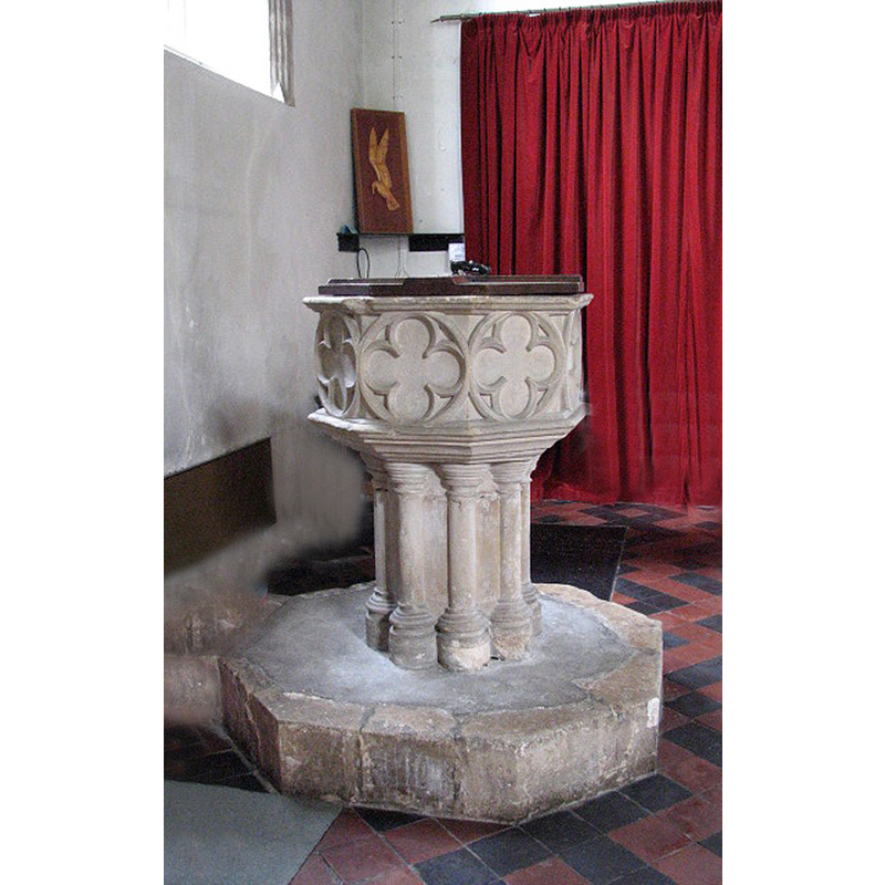
Image copyright © Evelyn Simak, 2008
CC-BY-SA-3.0
Results: 8 records
view of font and cover
Copyright Statement: Image copyright © Evelyn Simak, 2008
Image Source: digital photograph taken 18 June 2008 by Evelyn Simak [www.geograph.org.uk/photo/850796] [accessed 15 April 2014]
Copyright Instructions: CC-BY-SA-3.0
design element - motifs - quatrefoil - in a circle - 8
Copyright Statement: Image copyright © Evelyn Simak, 2008
Image Source: digital photograph taken 18 June 2008 by Evelyn Simak [www.geograph.org.uk/photo/850796] [accessed 15 April 2014]
Copyright Instructions: CC-BY-SA-3.0
design element - motifs - moulding - graded
Copyright Statement: Image copyright © Evelyn Simak, 2008
Image Source: digital photograph taken 18 June 2008 by Evelyn Simak [www.geograph.org.uk/photo/850796] [accessed 15 April 2014]
Copyright Instructions: CC-BY-SA-3.0
view of church exterior - south view
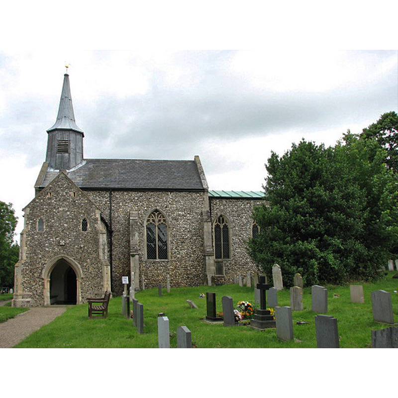
Copyright Statement: Image copyright © Evelyn Simak, 2008
Image Source: digital photograph taken 18 June 2008 by Evelyn Simak [www.geograph.org.uk/photo/850769] [accessed 15 April 2014]
Copyright Instructions: CC-BY-SA-3.0
view of church exterior - southwest view
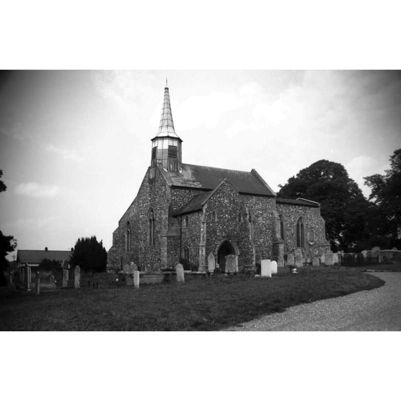
Copyright Statement: Image copyright © George Plunkett, 2014
Image Source: B&W photograph taken 28 August 1964 by George Plunkett [www.georgeplunkett.co.uk/Norfolk/H/Hellesdon St Mary's church from SW [4854] 1964-08-28.jpg] [accessed 15 April 2014]
Copyright Instructions: Standing permission by Jonathan Plunkett
view of church interior - north aisle - looking west
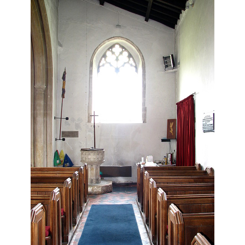
Scene Description: the baptismal font at the far end, left side
Copyright Statement: Image copyright © Evelyn Simak, 2008
Image Source: digital photograph taken 18 June 2008 by Evelyn Simak [www.geograph.org.uk/photo/850794] [accessed 15 April 2014]
Copyright Instructions: CC-BY-SA-3.0
view of church interior - nave - looking east
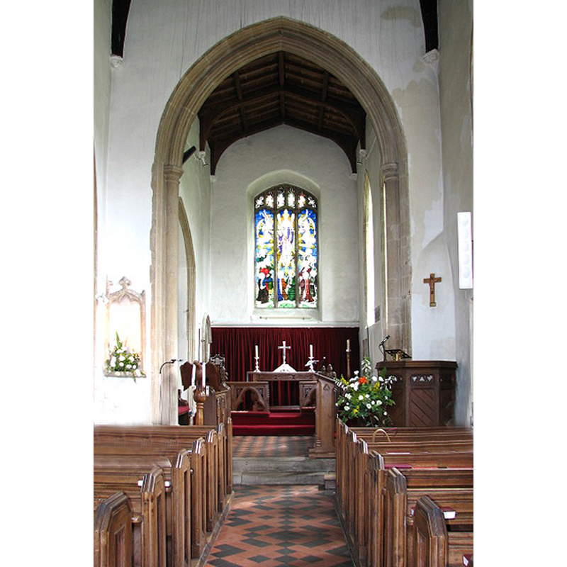
Copyright Statement: Image copyright © Evelyn Simak, 2008
Image Source: digital photograph taken 18 June 2008 by Evelyn Simak [www.geograph.org.uk/photo/850777] [accessed 15 April 2014]
Copyright Instructions: CC-BY-SA-3.0
design element - architectural - column - clustered columns - with capitals and bases - 8
Copyright Statement: Image copyright © Evelyn Simak, 2008
Image Source: digital photograph taken 18 June 2008 by Evelyn Simak [www.geograph.org.uk/photo/850796] [accessed 15 April 2014]
Copyright Instructions: CC-BY-SA-3.0
INFORMATION
Font ID: 14885HEL
Object Type: Baptismal Font1
Font Century and Period/Style: 15th century, Perpendicular
Church / Chapel Name: Parish Church of St. Mary
Font Location in Church: Inside the church, at the W end of the N aisle
Church Patron Saint(s): St. Mary the Virgin
Church Address: Low Road, Hellesdon, Norfolk, NR6 5AT
Site Location: Norfolk, East Anglia, England, United Kingdom
Directions to Site: Located W of Norwich, now a suburb of it
Ecclesiastic Region: Diocese of Norwich
Historical Region: Hundred of Taverham
Additional Comments: disappeared font? (the one from the Domesday-time church here)
Font Notes:
Click to view
There is an entry for Hellesdon [variant spelling] in the Domesday survey [http://domesdaymap.co.uk/place/TG2010/hellesdon/] [accessed 15 April 2014], and it reports a church in it but no church lands. Blomefield (1805-1810) writes: "The Church is a rectory, dedicated to St. Mary [...] The church is a small pile, consisting of a body, or nave, and a chancel, and a north isle that runs the length of the body, all covered with lead; and has an octangular tower, and one bell, with a cap, or cupola of wood, covered with lead." Blomefield (ibid.) further notes: "On the deprivation of Stigand Archbishop of Canterbury, (who held it as a lay fee) the Conqueror granted it to Godwin Halden [...] This Godwin Halden seems to be of Danish extraction, and one thing is remarkable of him, that he held under Earl Guert, brother of King Harold, the lordship of Nettington in Smethdon hundred, in King Edward's time, and at the Conquest, when he was also rewarded with this lordship, those of Oxnead and Bernham in South Erpingham and Fourhow hundreds; a proof that he was a rebel against King Harold, and assisted the Conqueror." The present font is noted in Pevsner & Wilson (1997): "Octagonal, with quatrefoils, on a shafted stem." [NB: we have no information on the font of the Domesday-time church here].
Credit and Acknowledgements: We are grateful to Jonathan Plunkett for the photographs of this church taken by his father, George Plunkett, in August 1964
COORDINATES
UTM: 31U 381724 5834641
Latitude & Longitude (Decimal): 52.648825, 1.251674
Latitude & Longitude (DMS): 52° 38′ 55.77″ N, 1° 15′ 6.02″ E
MEDIUM AND MEASUREMENTS
Material: stone
Font Shape: octagonal, mounted
Basin Interior Shape: round
Basin Exterior Shape: octagonal
LID INFORMATION
Date: modern
Material: wood, oak?
Apparatus: no
Notes: octagonal and flat, with metal decoration and ring handle; appears modern
REFERENCES
- Blomefield, Francis, An essay towards a topographical history of Norfolk, 1805-1810, vol. 10: 425-432 / [www.british-history.ac.uk/report.aspx?compid=78710] [accessed 15 April 2014]
- Pevsner, Nikolaus, Norfolk 1: Norwich and North-East [2nd ed.], Harmondsworth: Penguin Books, 1997, p. 544