Hanworth nr. Cromer / Hagan-Worda / Haganaworda
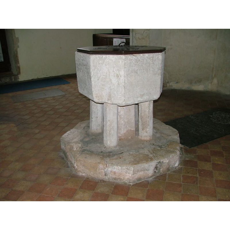
Image copyright © Simon Knott, 2009
Standing permission
Results: 5 records
view of font and cover
Copyright Statement: Image copyright © Simon Knott, 2009
Image Source: digital photograph September 2005 taken by Simon Knott [www.norfolkchurches.co.uk/hanworth/hanworth.htm] [accessed 23 June 2009]
Copyright Instructions: Standing permission
view of church exterior - north view
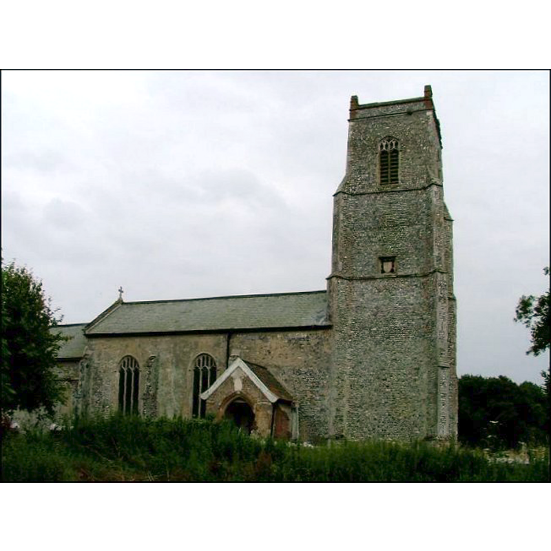
Copyright Statement: Image copyright © Simon Knott, 2005
Image Source: digital photograph September 2005 taken by Simon Knott [www.norfolkchurches.co.uk/hanworth/hanworth.htm] [accessed 19 September 2013]
Copyright Instructions: Standing permission
view of church exterior - northeast view
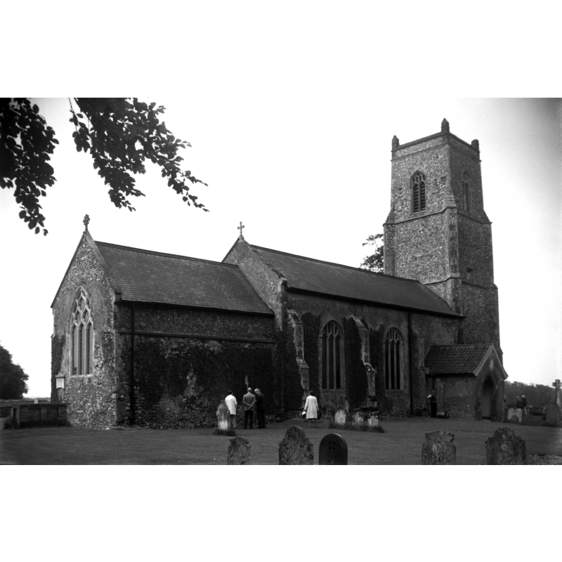
Copyright Statement: Image copyright © George Plunkett, 2013
Image Source: B&W photograph taken 2 June 1973 by George Plunkett [www.georgeplunkett.co.uk/Norfolk/H/Hanworth St Bartholomew's church from NE [5346] 1973-06-02.jpg] [accessed 19 September 2013]
Copyright Instructions: Standing permission by Jonathan Plunkett
view of church exterior - southeast view
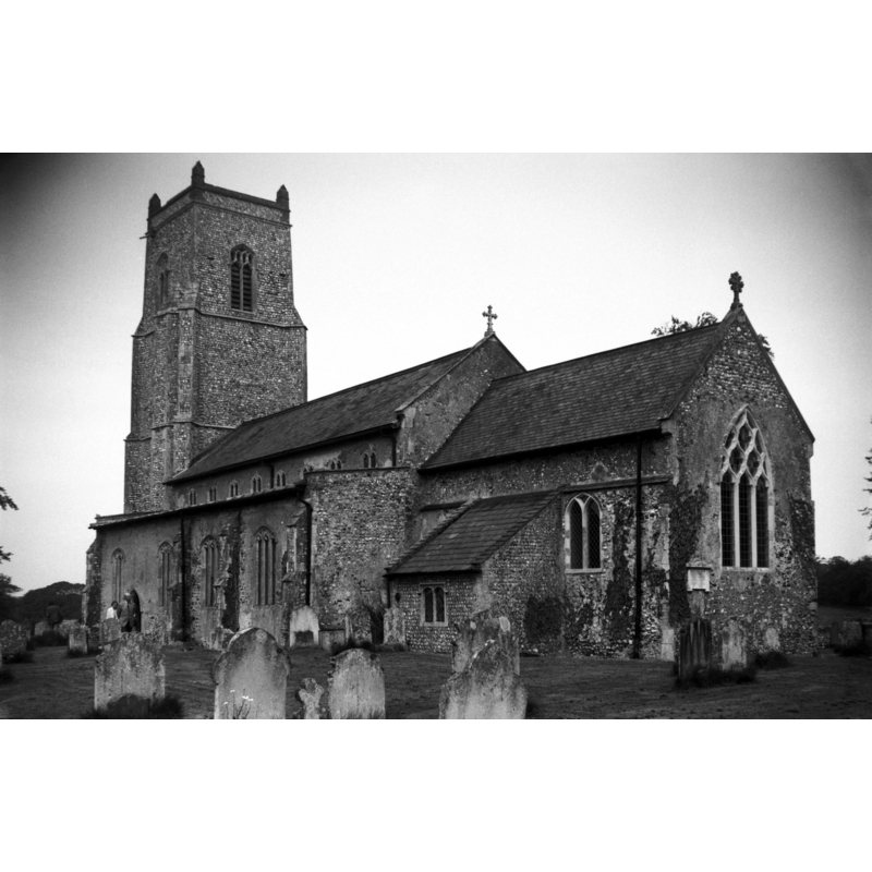
Copyright Statement: Image copyright © George Plunkett, 2013
Image Source: B&W photograph taken 2 June 1973 by George Plunkett [www.georgeplunkett.co.uk/Norfolk/H/Hanworth St Bartholomew's church from SE [5345] 1973-06-02.jpg] [accessed 19 September 2013]
Copyright Instructions: Standing permission by Jonathan Plunkett
view of church interior - nave - looking east
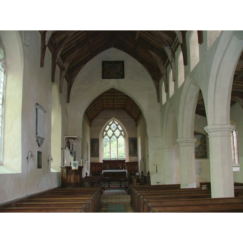
Copyright Statement: Image copyright © Simon Knott, 2005
Image Source: digital photograph September 2005 taken by Simon Knott [www.norfolkchurches.co.uk/hanworth/hanworth.htm] [accessed 19 September 2013]
Copyright Instructions: Standing permission
INFORMATION
Font ID: 14883HAN
Object Type: Baptismal Font1
Font Century and Period/Style: 14th century [re-cut?], Decorated [altered]
Church / Chapel Name: Parish Church of St. Bartholomew
Font Location in Church: Inside the church, at the W end of the nave
Church Patron Saint(s): St. Bartholomew
Church Address: High Street, Hanworth, Norfolk NR11 7HJ
Site Location: Norfolk, East Anglia, England, United Kingdom
Directions to Site: Located 9 km SW of Cromer, 30 km N of Norwich
Ecclesiastic Region: Diocese of Norwich
Historical Region: Hundred of North Erpingham
Additional Comments: altered font? (re-cut?) / disappeared font? (the one from the ca.1300 church here)
Font Notes:
Click to view
There are two entries for this Hanworth [variant spellings] in the Domesday survey [https://opendomesday.org/place/TG1935/hanworth/] [accessed 28 May 2019] neither of which mentions cleric or church in it. Blomefield (1805-1810) writes: "The Church was formerly a rectory [...] and dedicated to St. Bartholomew. The prior and convent of Thetford, had a portion of tithe in King Edward the First's time [i.e., 1272-1307] [...], valued at 3 marks per ann. and at that time the prior of Hickling held it appropriated to him with 30 acres of land, when there was a vicar who had a house, but no land". The present font here is illustrated in Knott (2005). The baptismal font consists of an octagonal basin that appears to have been drastically re-cut, raised on a central shaft and four angle colonnettes, all polygonal and plain, and an octagonal plinth. The font may be of the same date as the fabric of the present church, the 14th century. The wooden cover is flat, octagonal and plain; appears modern. This font is not noted in Pevsner & Wilson (1997).
Credit and Acknowledgements: We are grateful to Simon Knott, of www.norfolkchurches.co.uk, for his photograph of this font
COORDINATES
UTM: 31U 383670 5858853
Latitude & Longitude (Decimal): 52.866811, 1.271828
Latitude & Longitude (DMS): 52° 52′ 0.52″ N, 1° 16′ 18.58″ E
MEDIUM AND MEASUREMENTS
Material: stone
Font Shape: octagonal, mounted
Basin Interior Shape: round
Basin Exterior Shape: octagonal
LID INFORMATION
Date: modern?
Material: wood
Apparatus: no
Notes: [cf. FontNotes]
REFERENCES
- Blomefield, Francis, An essay towards a topographical history of Norfolk, 1805-1810, vol. 8: 129-132 / [www.british-history.ac.uk/report.aspx?compid=78423] [accessed 19 September 2013]
- Knott, Simon, The Norfolk Churches Site, Simon Knott, 2004. [standing permission to reproduce images received from Simon (February 2005]. URL: www.norfolkchurches.co.uk.