Fishley / Fiscele / Fischele / Fishley St Mary
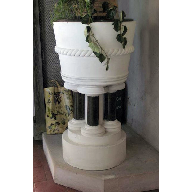
Image copyright © John Salmon, 2007
CC-BY-SA-3.0
Results: 6 records
view of font and cover
Scene Description: the modern font [cf. FontNotes]: the basin is much in a style of what could have been the original Norman font here, but the support structure spoils the effect
Copyright Statement: Image copyright © John Salmon, 2007
Image Source: digital photograph taken 2 June 2007 by John Salmon [www.geograph.org.uk/photo/474918] [accessed 7 May 2014]
Copyright Instructions: CC-BY-SA-3.0
view of church exterior - northeast view
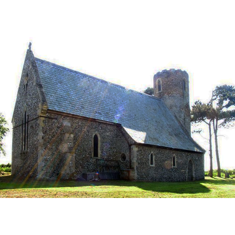
Copyright Statement: Image copyright © John Salmon, 2007
Image Source: digital photograph taken 2 June 2007 by John Salmon [www.geograph.org.uk/photo/474920] [accessed 7 May 2014]
Copyright Instructions: CC-BY-SA-3.0
view of church exterior - south portal
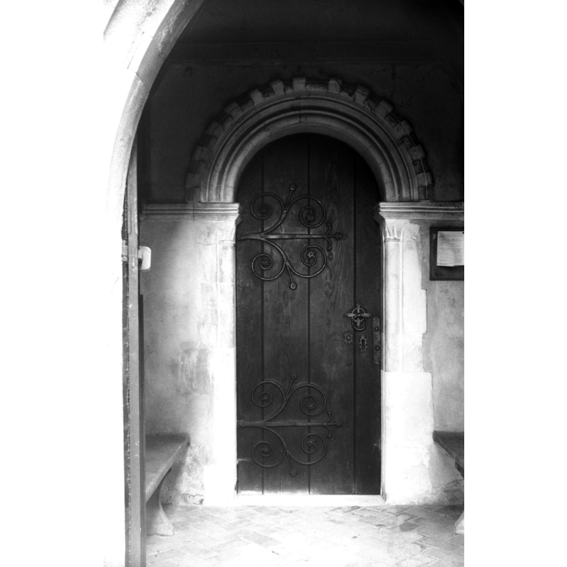
Scene Description: Norman -- Photo caption: "Billet frieze on hood-mould. Scalloped capitals"
Copyright Statement: Image copyright © George Plunkett, 2014
Image Source: B&W photograph taken 13 September 1975 by George Plunkett [www.georgeplunkett.co.uk/Norfolk/F/Fishley St Mary's church Norman south door [5481] 1975-09-13.jpg] [accessed 7 May 2014]
Copyright Instructions: Standing permission by Jonathan Plunkett
view of church exterior - west view
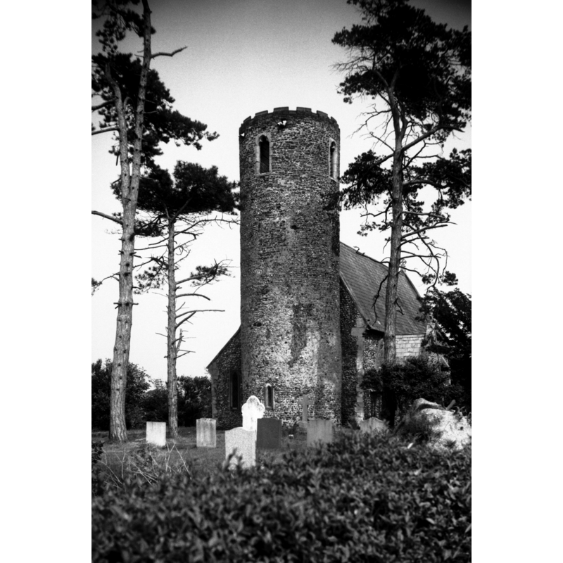
Scene Description: Photo caption: "Round tower probably Norman but with later brick top"
Copyright Statement: Image copyright © George Plunkett, 2014
Image Source: B&W photograph taken 27 May 1992 by George Plunkett [www.georgeplunkett.co.uk/Norfolk/F/Fishley St Mary's church from SW [6810] 1992-05-27.jpg] [accessed 7 May 2014]
Copyright Instructions: Standing permission by Jonathan Plunkett
view of church interior - nave - looking west
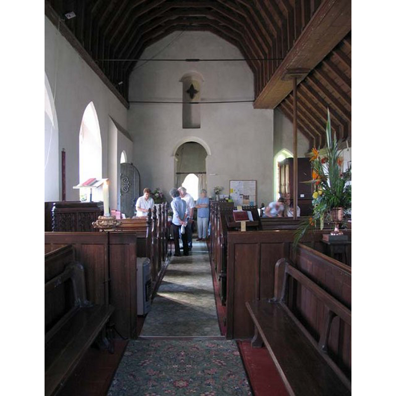
Copyright Statement: Image copyright © John Salmon, 2007
Image Source: digital photograph taken 2 June 2007 by John Salmon [www.geograph.org.uk/photo/474915] [accessed 7 May 2014]
Copyright Instructions: CC-BY-SA-3.0
view of church interior - nave - looking east
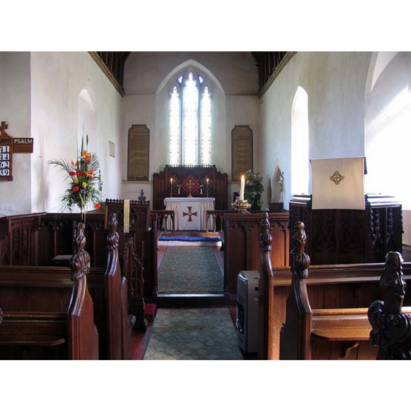
Copyright Statement: Image copyright © John Salmon, 2007
Image Source: digital photograph taken 2 June 2007 by John Salmon [www.geograph.org.uk/photo/474914] [accessed 7 May 2014]
Copyright Instructions: CC-BY-SA-3.0
INFORMATION
Font ID: 14872FIS
Object Type: Baptismal Font1?
Font Century and Period/Style: 11th - 12th century, Norman
Church / Chapel Name: Parish Church of St. Mary
Church Patron Saint(s): St. Mary the Virgin
Church Notes: round-tower church; base appears Norman
Church Address: Walsham Road, Fishley, Norfolk, NR13 6DA
Site Location: Norfolk, East Anglia, England, United Kingdom
Directions to Site: The church is located just S of Upton, 2 km N of Acle [NB: there is no longer a Fishley village]
Ecclesiastic Region: Diocese of Norwich
Historical Region: Hundred of Walsham
Additional Comments: disappeared font? (the one from the Norman church here)
Font Notes:
Click to view
There are three entries for Fishley [variant spelling] in the Domesday survey [http://domesdaymap.co.uk/place/TG3911/fishley/] [accessed 7 May 2014], but there is no mention of either church or cleric in them. Blomefield (1805-1810) notes: "The Church is dedicated to St. Mary, and was a rectory, consisting of two portions", and the earliest date mentioned in relation to this church in Blomefield (ibid.) is 1310, with "John Spike, presented to a mediety, by Matthew de Redham", even though the base of thge round tower is probaly Norman. The present font is noted in Pevsner & Wilson (1997): "Font. Circular with Purbeck shafts, C19." [NB: the base of the round tower and tyhe south portal go back to Norman times but we have no information on the font of that church].
Credit and Acknowledgements: We are grateful to Jonathan Plunkett for the photographs of this church taken by his father, George Plunkett, in 1975 and 1992
COORDINATES
UTM: 31U 401459 5834031
Latitude & Longitude (Decimal): 52.647286, 1.543457
Latitude & Longitude (DMS): 52° 38′ 50.23″ N, 1° 32′ 36.44″ E
REFERENCES
- Blomefield, Francis, An essay towards a topographical history of Norfolk, 1805-1810, vol. 11: 100-104 / [www.british-history.ac.uk/report.aspx?compid=78758] [acessed 7 May 2014]
- Pevsner, Nikolaus, Norfolk 1: Norwich and North-East [2nd ed.], Harmondsworth: Penguin Books, 1997, p. 470