Troston / Trostuna
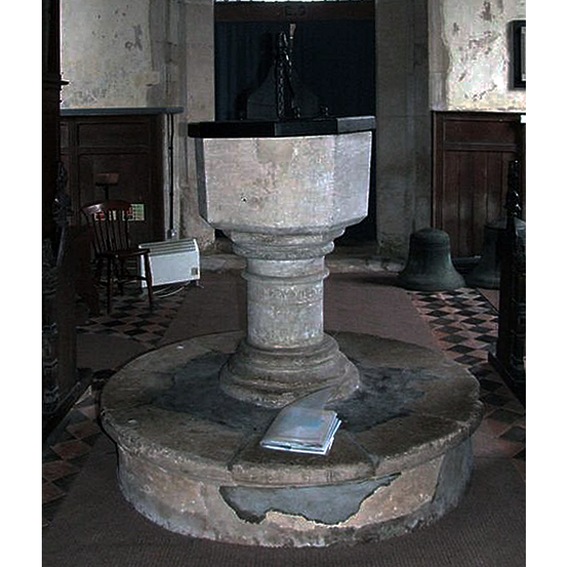
Image copyright © Simon Knott, 2009
Standing permission
Results: 4 records
view of font and cover
Copyright Statement: Image copyright © Simon Knott, 2009
Image Source: detail of a digital photograph by Simon Knott [http://www.suffolkchurches.co.uk/Troston.htm] [accessed 2 June 2009]
Copyright Instructions: Standing permission
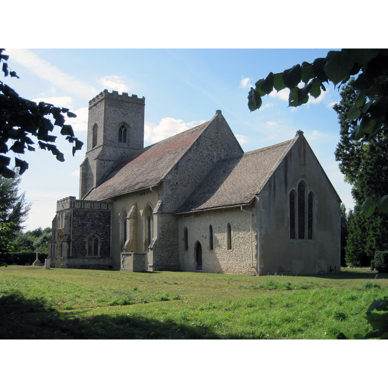
view of church exterior - southeast view
Copyright Statement: Image copyright © Smb1001, 2009
Image Source: digital photograph taken 23 August 2009 by Smb1001 [https://commons.wikimedia.org/wiki/File:St_Mary's_Church,_Troston.jpg] [accessed 31 December 2019]
Copyright Instructions: GFDL / CC-BY-SA-3.0
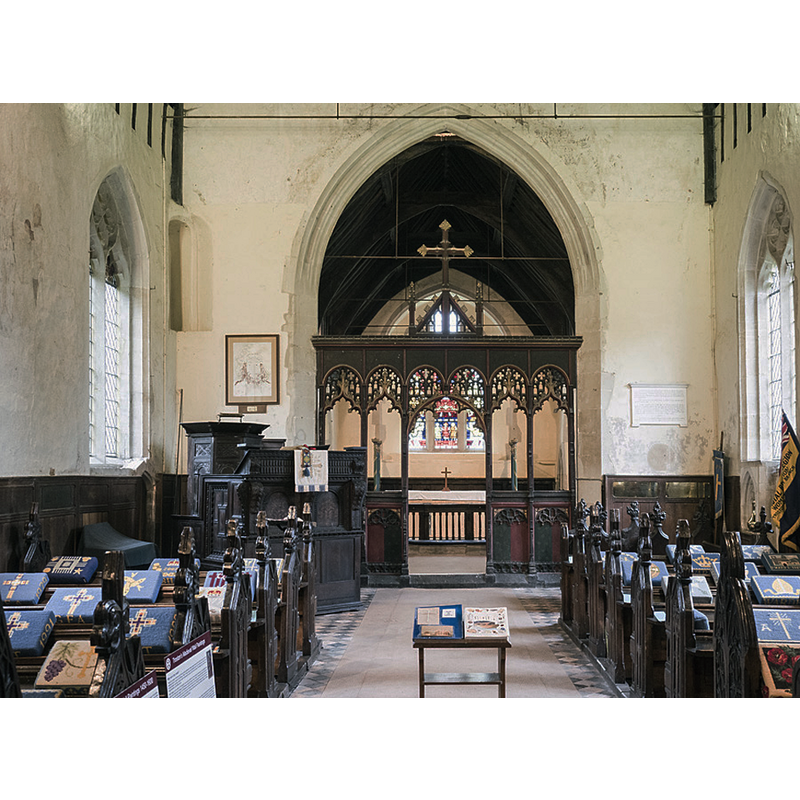
view of church interior - looking east
Copyright Statement: Image copyright © John Salmon, 2017
Image Source: digital photograph taken 9 August 2017 by John Salmon [www.geograph.org.uk/photo/5538912] [accessed 31 December 2019]
Copyright Instructions: CC-BY-SA-2.0
design element - motifs - moulding
Copyright Statement: Image copyright © Simon Knott, 2009
Image Source: detail of a digital photograph by Simon Knott [http://www.suffolkchurches.co.uk/Troston.htm] [accessed 2 June 2009]
Copyright Instructions: Standing permission
INFORMATION
Font ID: 14778TRO
Object Type: Baptismal Font1
Font Century and Period/Style: 13th century, Early English
Church / Chapel Name: Parish Church of St. Mary
Font Location in Church: Inside the church, at the W end
Church Patron Saint(s): St. Mary the Virgin
Church Address: Church Ln, Troston, Bury St Edmunds IP31 1EX. UK -- Tel.: +44 7546 491388
Site Location: Suffolk, East Anglia, England, United Kingdom
Directions to Site: Located off (W) the A1088, 8-9 km NE of Bury St. Edmunds
Ecclesiastic Region: Diocese of St. Edmundsbury & Ipswich
Historical Region: Hundred of Blackburn
Font Notes:
Click to view
There is an entry for Troston [variant spelling] in the Domesday survey [https://opendomesday.org/place/TL9072/troston/] [accessed 31 December 2019] but it mentions neither cleric nor church in it. Parker (1855) writes: "E[arly] E[nglish]; a plain octagon, on a circular pedestal". Cautley (1982) reports a simple 17th-century cover in this church. Both font and cover are illustrated in Knott (2008). The entry for this church in Historic England [Listing NGR: TL9003172270] notes: "Parish church. C13 and later. [...] the font: a plain octagonal bowl and moulded shaft on a high round base, with a damaged Jacobean cover." The font consists of a plain octagonal basin with slightly tapering sides, ill-matched to a moulded stem and lower base; circular plinth. The cover consists of a flat octagonal platform with a finial or handle.
Credit and Acknowledgements: We are grateful to Simon Knott, of Suffolk Churches, for his photograph of this font
COORDINATES
UTM: 31U 349123 5798448
Latitude & Longitude (Decimal): 52.315g, 0.786513
Latitude & Longitude (DMS): 52° 18′ 56.16″ N, 0° 47′ 11.45″ E
MEDIUM AND MEASUREMENTS
Material: stone
Font Shape: octagonal, mounted
Basin Interior Shape: round
Basin Exterior Shape: octagonal
LID INFORMATION
Date: 17th-century?
Material: wood, oak?
Apparatus: no
Notes: [cf. FontNotes]
REFERENCES
- Cautley, Henry Munro, Suffolk churches and their treasures, Woodbridge: The Boydell Press, 1982, p. 87
- Knott, Simon, The Suffolk Churches Site, Simon Knott, 1999-. [standing permission to reproduce images received from Simon [February 2005]. URL: www.suffolkchurches.co.uk.
- Parker, John Henry, The Ecclesiastical and architectural topography of England [...] Suffolk, 1855, [unpaged]