Stanningfield / Stanesfelda / Stanfella
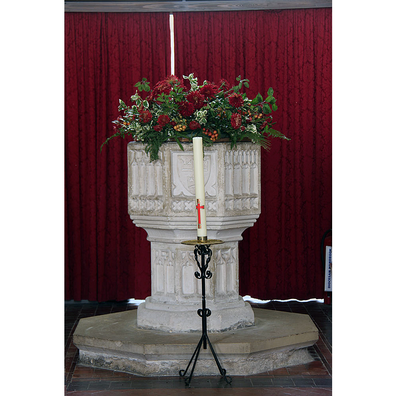
Image copyright © John Salmon, 2014
CC-BY-SA-2.0
Results: 14 records
view of font and cover in context - east side
Copyright Statement: Image copyright © John Salmon, 2014
Image Source: digital photograph taken 14 October 2014 by John Salmon [www.geograph.org.uk/photo/4231843] [accessed 1 January 2020]
Copyright Instructions: CC-BY-SA-2.0
view of font and cover - northeast side
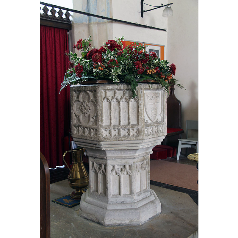
Copyright Statement: Image copyright © John Salmon, 2014
Image Source: digital photograph taken 14 October 2014 by John Salmon [www.geograph.org.uk/photo/4231845] [accessed 1 January 2020]
Copyright Instructions: CC-BY-SA-2.0
view of font
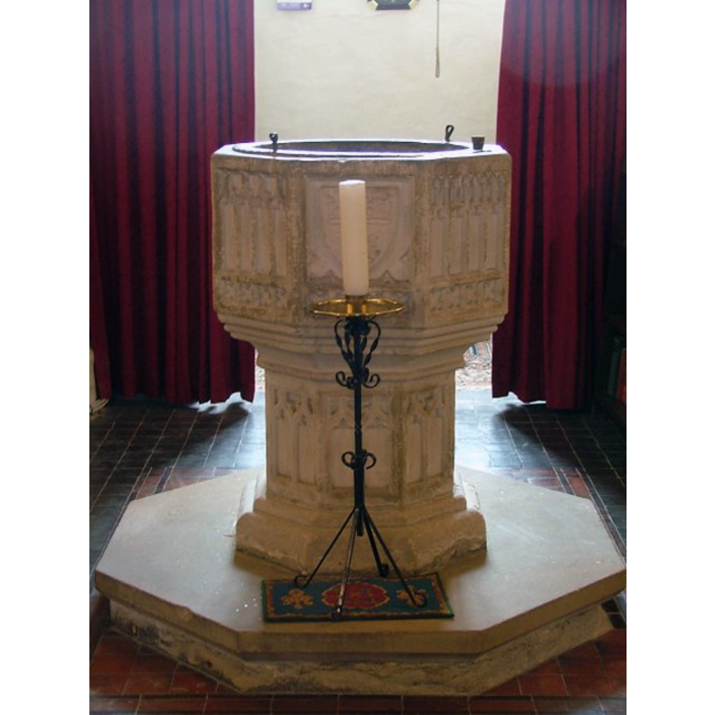
Scene Description: the lead lining of the inner basin, and the staples in the rim are visible here
Copyright Statement: Image copyright © Simon Knott, 2009
Image Source: digital photograph by Simon Knott [http://www.suffolkchurches.co.uk/stanningfield.html] [accessed 1 June 2009]
Copyright Instructions: Standing permission
symbol - shield - coat of arms - Rookwoods
Scene Description: [cf. Font notes]
Copyright Statement: Image copyright © John Salmon, 2014
Image Source: digital photograph taken 14 October 2014 by John Salmon [www.geograph.org.uk/photo/4231845] [accessed 1 January 2020]
Copyright Instructions: CC-BY-SA-2.0
design element - patterns - tracery
Scene Description: [cf. Font notes]
Copyright Statement: Image copyright © John Salmon, 2014
Image Source: digital photograph taken 14 October 2014 by John Salmon [www.geograph.org.uk/photo/4231845] [accessed 1 January 2020]
Copyright Instructions: CC-BY-SA-2.0
design element - motifs - moulding - graded
Scene Description: [cf. Font notes]
Copyright Statement: Image copyright © John Salmon, 2014
Image Source: digital photograph taken 14 October 2014 by John Salmon [www.geograph.org.uk/photo/4231845] [accessed 1 January 2020]
Copyright Instructions: CC-BY-SA-2.0
design element - motifs - floral - rosette - in a quatrefoil
Copyright Statement: Image copyright © John Salmon, 2014
Image Source: digital photograph taken 14 October 2014 by John Salmon [www.geograph.org.uk/photo/4231845] [accessed 1 January 2020]
Copyright Instructions: CC-BY-SA-2.0
design element - motifs - quatrefoil - 32
Scene Description: tiny ones, four per side of the octagonal basin
Copyright Statement: Image copyright © John Salmon, 2014
Image Source: digital photograph taken 14 October 2014 by John Salmon [www.geograph.org.uk/photo/4231845] [accessed 1 January 2020]
Copyright Instructions: CC-BY-SA-2.0
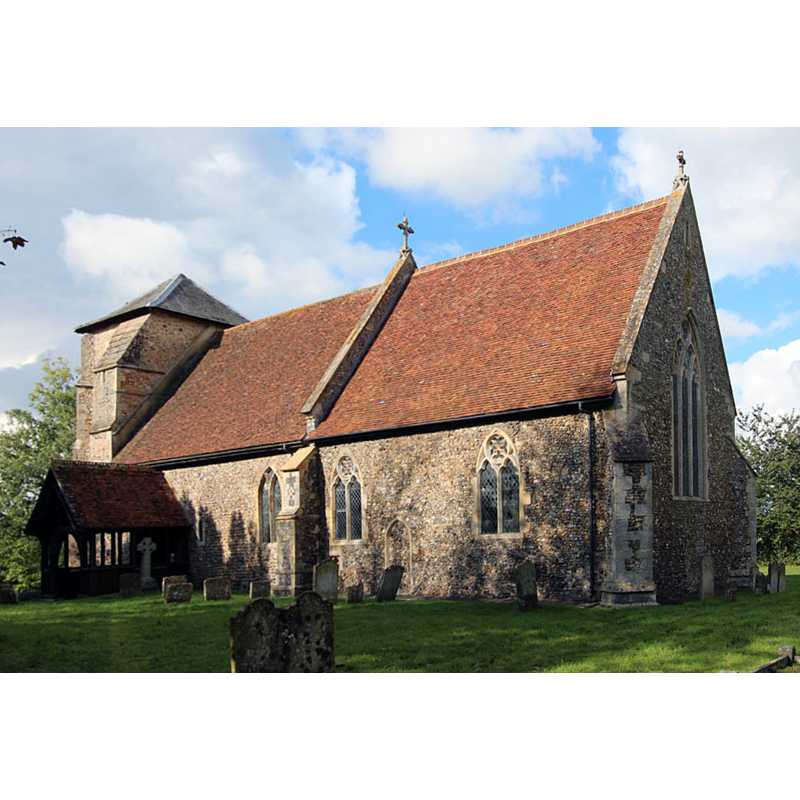
view of church exterior - southwest view
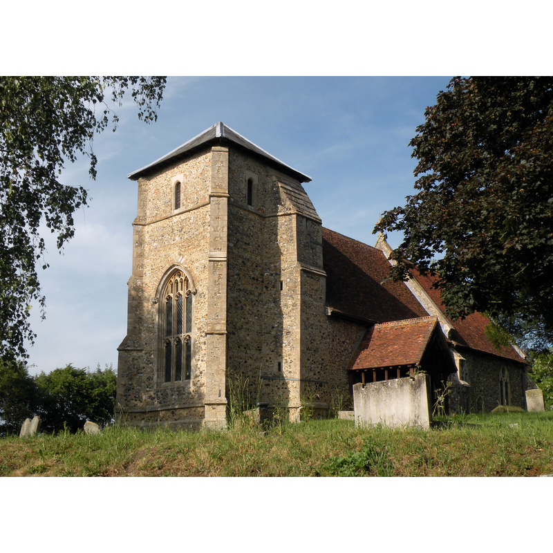
Scene Description: Source caption: "St. Nicholas: the parish church of Stanningfield. This church once had a much taller 14th century tower but the top was removed as it was classed as dangerous. Inside the church is an early 19th century photograph that shows the original tower."
Copyright Statement: Image copyright © Robert Edwards, 2011
Image Source: digital photograph taken 1 June 2011 by Robert Edwards [www.geograph.org.uk/photo/2458966] [accessed 1 January 2020]
Copyright Instructions: CC-BY-SA-2.0
view of church exterior - southeast view
Copyright Statement: Image copyright © John Salmon, 2014
Image Source: edited detail of a digital photograph taken 14 October 2014 by John Salmon [www.geograph.org.uk/photo/4231813] [accessed 1 January 2020]
Copyright Instructions: CC-BY-SA-2.0
view of church interior - looking west
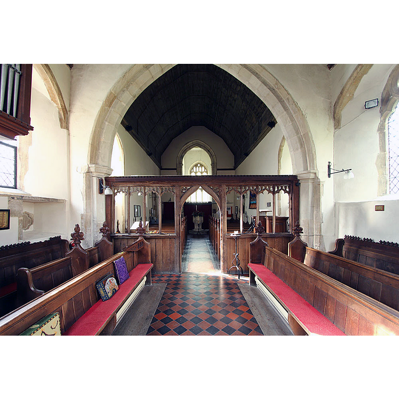
Scene Description: view west through the chancel screen; the baptismal font is visible at the far end in the centre aisle
Copyright Statement: Image copyright © John Salmon, 2014
Image Source: digital photograph taken 14 October 2014 by John Salmon [www.geograph.org.uk/photo/4231830] [accessed 1 January 2020]
Copyright Instructions: CC-BY-SA-2.0
view of church interior - looking east
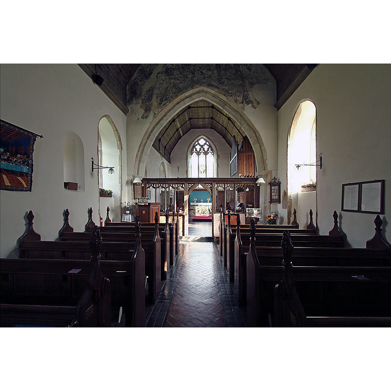
Scene Description: remains of a 15thC(?) mural painting on the west side of the chancel arch
Copyright Statement: Image copyright © John Salmon, 2014
Image Source: digital photograph taken 14 October 2014 by John Salmon [www.geograph.org.uk/photo/4231817] [accessed 1 January 2020]
Copyright Instructions: CC-BY-SA-2.0
design element - patterns - tracery - window tracery
Scene Description: [cf. Font notes]
Copyright Statement: Image copyright © John Salmon, 2014
Image Source: digital photograph taken 14 October 2014 by John Salmon [www.geograph.org.uk/photo/4231845] [accessed 1 January 2020]
Copyright Instructions: CC-BY-SA-2.0
design element - motifs - moulding
Scene Description: [cf. Font notes]
Copyright Statement: Image copyright © John Salmon, 2014
Image Source: digital photograph taken 14 October 2014 by John Salmon [www.geograph.org.uk/photo/4231845] [accessed 1 January 2020]
Copyright Instructions: CC-BY-SA-2.0
INFORMATION
Font ID: 14768STA
Object Type: Baptismal Font1
Font Century and Period/Style: 15th century, Perpendicular
Workshop/Group/Artisan: heraldic font
Church / Chapel Name: Parish Church of St. Nicholas
Font Location in Church: Inside the church
Church Patron Saint(s): St. Nicholas of Myra
Church Address: Church Rd, Stanningfield, Bury Saint Edmunds IP29 4RE, UK -- Tel.: +44 1284 846166
Site Location: Suffolk, East Anglia, England, United Kingdom
Directions to Site: Located off (W) the A134, near Bradfield Combust, 8 km SE of Bury St Edmunds, 8 km NW of Lavenham, 16 km N of Sudbury
Ecclesiastic Region: Diocese of St. Edmundsbury & Ipswich
Historical Region: Hundred of Thedwastre
Font Notes:
Click to view
There are three entries for Stanningfield [variant spellings] in the Domesday survey [https://opendomesday.org/place/TL8756/stanningfield/] [accessed 1 January 2020], one of which reports "1 church. 0.13 church lands" in it. Parker (1855) mentions no font in this church. It is listed in Cautley (1982) in a group of 15th-century heraldic fonts in Suffolk. Noted and illustrated in Knott (2008]: "The splendid 15th century font carries familiar tracery patterns, but also the shield of the Rookwoods on the east side"
Credit and Acknowledgements: We are grateful to Simon Knott, of Suffolk Churches, for his photograph of this font
COORDINATES
UTM: 31U 345747 5782736
Latitude & Longitude (Decimal): 52.17351, 0.7442
Latitude & Longitude (DMS): 52° 10′ 25″ N, 0° 44′ 39″ E
MEDIUM AND MEASUREMENTS
Material: stone
Font Shape: octagonal, mounted
Basin Interior Shape: round
Basin Exterior Shape: octagonal
Drainage Notes: lead-lined
LID INFORMATION
Date: modern
Material: wood, oak
Apparatus: no
Notes: octagonal and flat, with metal decoration; there are two metal staples at opposite ends of the upper rim of the basin
REFERENCES
- Cautley, Henry Munro, Suffolk churches and their treasures, Woodbridge: The Boydell Press, 1982, p. 67
- Knott, Simon, The Suffolk Churches Site, Simon Knott, 1999-. [standing permission to reproduce images received from Simon [February 2005]. URL: www.suffolkchurches.co.uk.