West Bradley
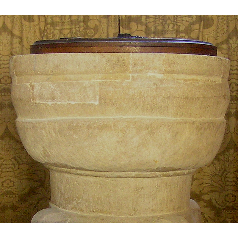
Image copyright © Tony Ethridge, 2009
Standing permission
Results: 4 records
view of font and cover
Copyright Statement: Image copyright © Tony Ethridge, 2009
Image Source: digital photograph taken 2 December 2008 by Tony Ethridge
Copyright Instructions: Standing permission
design element - motifs - moulding
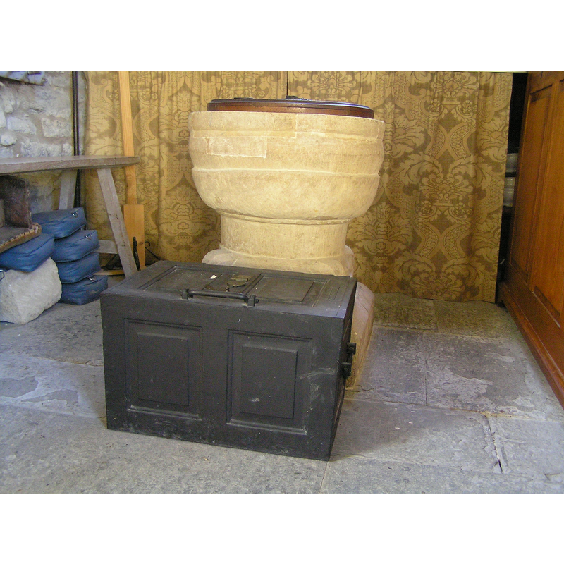
Copyright Statement: Image copyright © Tony Ethridge, 2009
Image Source: digital photograph taken 2 December 2008 by Tony Ethridge
Copyright Instructions: Standing permission
view of church exterior - southwest view
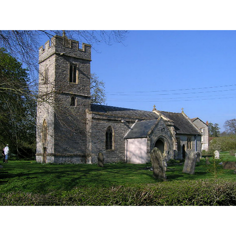
Copyright Statement: Image copyright © ChurchCrawler, 2005
Image Source: digital photograph taken 2 April 2005 by ChurchCrawler [www.geograph.org.uk/photo/66487] [accessed 8 May 2018]
Copyright Instructions: CC-BY-SA-2.0
view of church interior - nave - looking west
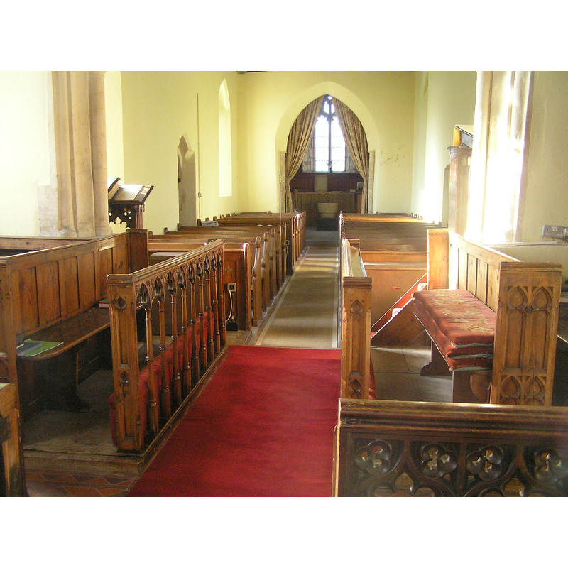
Scene Description: the font at the end, beneath the tower
Copyright Statement: Image copyright © Tony Ethridge, 2009
Image Source: digital photograph taken 2 December 2008 by Tony Ethridge
Copyright Instructions: Standing permission
INFORMATION
Font ID: 14667BRA
Object Type: Baptismal Font1
Font Date: ca. 1168?
Font Century and Period/Style: 12th century, Late Norman
Church / Chapel Name: Parish Church of St. Andrew
Font Location in Church: Inside the church, at the W end, beneath the tower
Church Patron Saint(s): St. Andrew [without dedication until 20thC]
Church Address: West Bradley BA6 8LT , UK -- Tel.: 01458 850248
Site Location: Somerset, South West, England, United Kingdom
Directions to Site: Located off (S) the A361, 6 km SE of Glastonbury
Ecclesiastic Region: Diocese of Bath & Wells
Historical Region: Hundred of Glastonbury Twelve Hides
Additional Comments: damaged font / repaired font
Font Notes:
Click to view
No entry for West Bradley found in the Domesday survey. Not mentioned in Pevsner (1958). The entry for this church in Historic England [Listing NGR: ST5578636874 ] reports a Norman tub font located beneath the tower of this church. The entry for this parish in the Victoria County History (Somerset, vol. 9, 2006) notes: "West Bradley was until 1875 [...] a chapelry of East Pennard and its church had the status of a dependent chapel. A chapel was first recorded in 1168 [...] The church, dedicated to St. Andrew only since the late 20th century and probably before then having no dedication, may well until restoration have had a piscina and corbels in the chancel which dated to the 13th century [...] the nave, perhaps 12th century in origin [...] All the windows and furnishings, apart from the plain tub font, are of the 19th century." [NB: although West Bradley remained a chapelry until the 19th century it must have had baptismal rights from its very beginning]. The basin consists of an irregular basin with bulges, rather than mouldings; it has repairs of new stone on the sides; raised on a cylindrical base, a moulded lower base, round at the top and square at the bottom. The wooden font cover is round and flat, with metal decoration and ring handle; appears modern.
Credit and Acknowledgements: We are grateful to Tony Ethridge, of Somerset Villages, for the photograph of this font
COORDINATES
UTM: 30U 525657 5664284
Latitude & Longitude (Decimal): 51.129444, -2.633333
Latitude & Longitude (DMS): 51° 7′ 46″ N, 2° 38′ 0″ W
MEDIUM AND MEASUREMENTS
Material: stone
Font Shape: cauldron-shaped, mounted
Basin Interior Shape: round
Basin Exterior Shape: round
LID INFORMATION
Date: modern?
Material: wood
Apparatus: no
Notes: [cf. FontNotes]
REFERENCES
- Victoria County History [online], University of London, 1993-. URL: https://www.british-history.ac.uk.