Wootton nr. Newport / Odetone / Woditon / Wootton Bridge
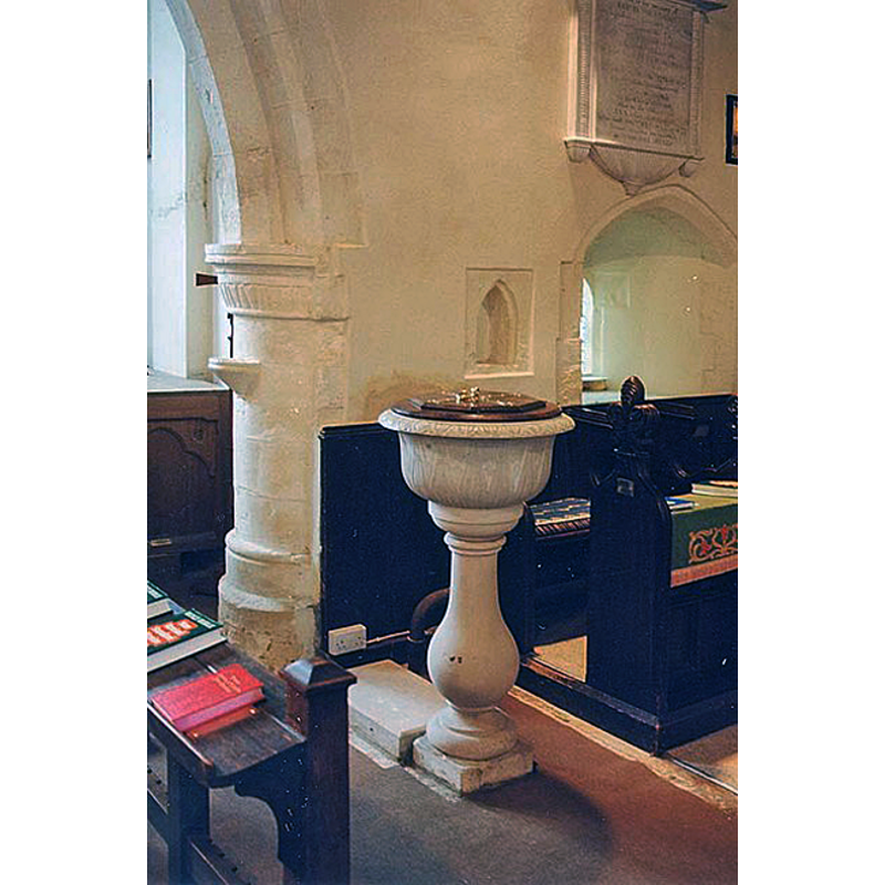
Image copyright © John Salmon, 2009
CC-BY-SA-2.0
Results: 4 records
view of font and cover
Scene Description: the later font [c f. FontNotes]
Copyright Statement: Image copyright © John Salmon, 2009
Image Source: digital image of a photograph taken 8 August 1999 by John Salmon [www.geograph.org.uk/photo/1153356] [accessed 8 September 2011]
Copyright Instructions: CC-BY-SA-2.0
design element - motifs - foliage
Copyright Statement: Image copyright © John Salmon, 2009
Image Source: digital image of a photograph taken 8 August 1999 by John Salmon [www.geograph.org.uk/photo/1153356] [accessed 8 September 2011]
Copyright Instructions: CC-BY-SA-2.0
view of church exterior - southeast view
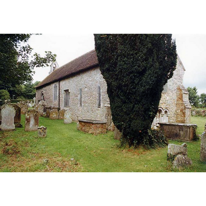
Copyright Statement: Image copyright © John Salmon, 2009
Image Source: digital image of a photograph taken 8 August 1999 by John Salmon [www.geograph.org.uk/photo/1153352] [accessed 8 September 2011]
Copyright Instructions: CC-BY-SA-2.0
view of church interior - nave - looking east
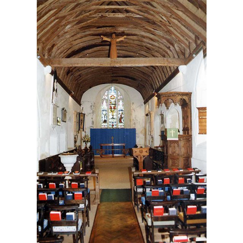
Scene Description: the later font is visible on the north sides of the nave, across from the pulpit
Copyright Statement: Image copyright © John Salmon, 2009
Image Source: digital image of a photograph taken 8 August 1999 by John Salmon [www.geograph.org.uk/photo/1153364] [accessed 8 September 2011]
Copyright Instructions: CC-BY-SA-2.0
INFORMATION
Font ID: 14629WOO
Object Type: Baptismal Font1
Font Century and Period/Style: 17th - 18th century
Church / Chapel Name: Parish Church of St. Edmund
Font Location in Church: Inside the church
Church Patron Saint(s): St. Edmund the Martyr [aka Edmund of East Anglia]
Church Address: 70-64 Church Rd, Wootton Bridge, Ryde PO33 4AA, UK
Site Location: Isle of Wight, South East, England, United Kingdom
Directions to Site: Located off (N) the A3054 [aka High St], SE of East Cowes, NE of Newport, on the NE side of the island
Ecclesiastic Region: Diocese of Portsmouth
Historical Region: Hundred of East Medine / Hundred of Bowcombe [ in Domesday] -- formerly Hampshire
Additional Comments: disappeared font? (the medieval font?)
Font Notes:
Click to view
No individual entry for this Wootton found in the Domesday survey. The Victoria County History (Hampshire, vol. 5, 1912) notes: "The church of St. Edmund is one of the smaller or manorial chapels of the Island, consisting of an aisleless nave and chancel, built in the 12th century, to which period the north and south doors belong"; there is no font mentioned in the VCH entry. Lloyd & Pevsner (2006) note: "Unusual font, C17 or C18. Concave bowl with pattern of leaves pointed upwards in flat relief, and rim with leaf pattern, on baluster-shaped stem which broadens boldly." [NB: we have no information on the earlier font(s) of this church]. The present font is of the small, roughly hemispherical basin raised on a baluster pedestal base. Wooden cover of two flat layers: round at the bottom, octagonal on top. [NB: the other parish church, St. Mark's, is modern, of ca. 1910]
COORDINATES
UTM: 30U 624600 5621380
Latitude & Longitude (Decimal): 50.730833, -1.234444
Latitude & Longitude (DMS): 50° 43′ 51″ N, 1° 14′ 4″ W
MEDIUM AND MEASUREMENTS
Material: stone
Font Shape: hemispheric, mounted
Basin Interior Shape: round
Basin Exterior Shape: round
LID INFORMATION
Date: modern
Material: wood, oak?
Apparatus: no
Notes: [cf. FontNotes]
REFERENCES
- Victoria County History [online], University of London, 1993-. URL: https://www.british-history.ac.uk.
- Lloyd, David W., The Isle of Wight, New Haven: Yale University Press, 2006, p. 302