Northwood / Northewode
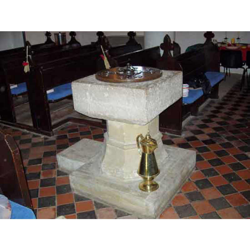
Image copyright © Northwood Village, 2009
CC-BY-SA-2.0
Results: 3 records
view of font and cover in context
Scene Description: the modern font
Copyright Statement: Image copyright © Northwood Village, 2009
Image Source: digital photograph [http://www.northwoodvillage.org.uk/church/churchimages/137.aspx] [accessed 11 May 2009]
Copyright Instructions: CC-BY-SA-2.0
view of font - upper view
![the old font [cf. Font notes]](/static-50478a99ec6f36a15d6234548c59f63da52304e5/compressed/1090512004_compressed.png)
Scene Description: the old font [cf. Font notes]
Copyright Statement: Image copyright © Northwood Village, 2009
Image Source: digital photograph [http://www.northwoodvillage.org.uk/church/churchimages/138.aspx] [accessed 11 May 2009]
Copyright Instructions: CC-BY-SA-2.0
view of church exterior - southwest view
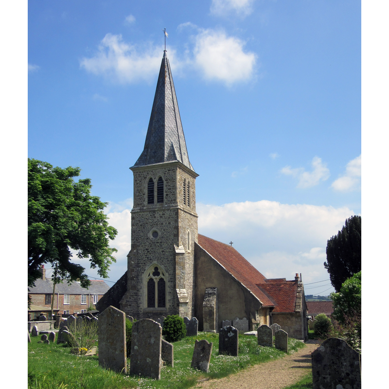
Copyright Statement: Image copyright © [in the public domain]
Image Source: digital photograph taken 15 May 2016 by Hassocks5489 [https://commons.wikimedia.org/wiki/File:St_John_the_Baptist's_Church,_Chawton_Lane,_Northwood_(May_2016)_(3).JPG] [accessed 19 February 2020]
Copyright Instructions: CC-Zero
INFORMATION
Font ID: 14627NOR
Object Type: Baptismal Font1, fragment
Font Century and Period/Style: 12th century, Norman
Church / Chapel Name: Parish Church of St. John the Baptist
Font Location in Church: [cf. FontNotes]
Church Patron Saint(s): St. John the Baptist
Church Address: Church Ln, Northwood, Cowes PO31 8QT, UK
Site Location: Isle of Wight, South East, England, United Kingdom
Directions to Site: Located off (W) the A3020 [aka Cowes Rd / Newport Rd], S of Cowes
Ecclesiastic Region: Diocese of Portsmouth
Historical Region: Hundred of West Medine -- formerly Hampshire
Additional Comments: damaged font / disused font
Font Notes:
Click to view
No individual entry found for Northwood in the Domesday survey. The Victoria County History (Hampshire, vol. 5, 1912) notes: "The church of St. John the Baptist lies to the east of the road from Newport to Cowes. It was built as a chapel for the northern portion of the parish of Carisbrooke in the middle of the 12th century"; there is no mention of a font in the VCH entry. The village web site [http://www.northwoodvillage.org.uk/church/churchimages/default.aspx] [accessed 11 May 2009] notes and illustrates the old font: "This is all that remains of the original 12th century font which can be found in the south porch at the entrance to the church. It had been dumped in the churchyard for many years but was rescued from that undignified position in 1954, and placed once again within its rightful home." What remains of the old font is the lower part of the round basin and the circular pedestal, all badly eroded. The present-day font in use consists of a plain square basin raised on an octagonal splaying stem and a quadrangular plinth, all modern.
COORDINATES
UTM: 30U 619848 5621639
Latitude & Longitude (Decimal): 50.734167, -1.301667
Latitude & Longitude (DMS): 50° 44′ 3″ N, 1° 18′ 6″ W
MEDIUM AND MEASUREMENTS
Material: stone
Font Shape: round, mounted
Basin Interior Shape: round
Basin Exterior Shape: round
REFERENCES
- Victoria County History [online], University of London, 1993-. URL: https://www.british-history.ac.uk.