Thorley nr. Yarmouth / Torlei
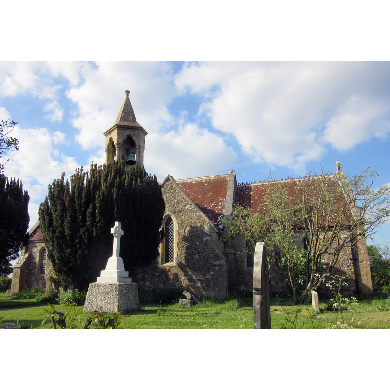
Image copyright © [in the public domain]
CC-Zero
Results: 5 records
view of church exterior - south view
Scene Description: the modern church of 1871
Copyright Statement: Image copyright © [in the public domain]
Image Source: digital photograph taken 16 May 2016 by Hassocks5489 [https://commons.wikimedia.org/wiki/File:St_Swithun's_Church,_Thorley_Road,_Thorley_(May_2016)_(11).JPG] [accesed 20 February 2020]
Copyright Instructions: CC-Zero
view of church exterior - northwest view
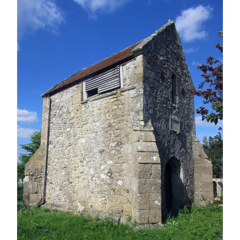
Scene Description: Old St Swithun's
Copyright Statement: Image copyright © [in the public domain]
Image Source: digital photograph taken 16 May 2016 by Hassocks5489 [https://commons.wikimedia.org/wiki/File:Ruins_of_Old_St_Swithun's_Church,_Thorley_Road,_Thorley_(May_2016)_(5).JPG] [accesed 20 February 2020]
Copyright Instructions: CC-Zero
view of church exterior - southeast view
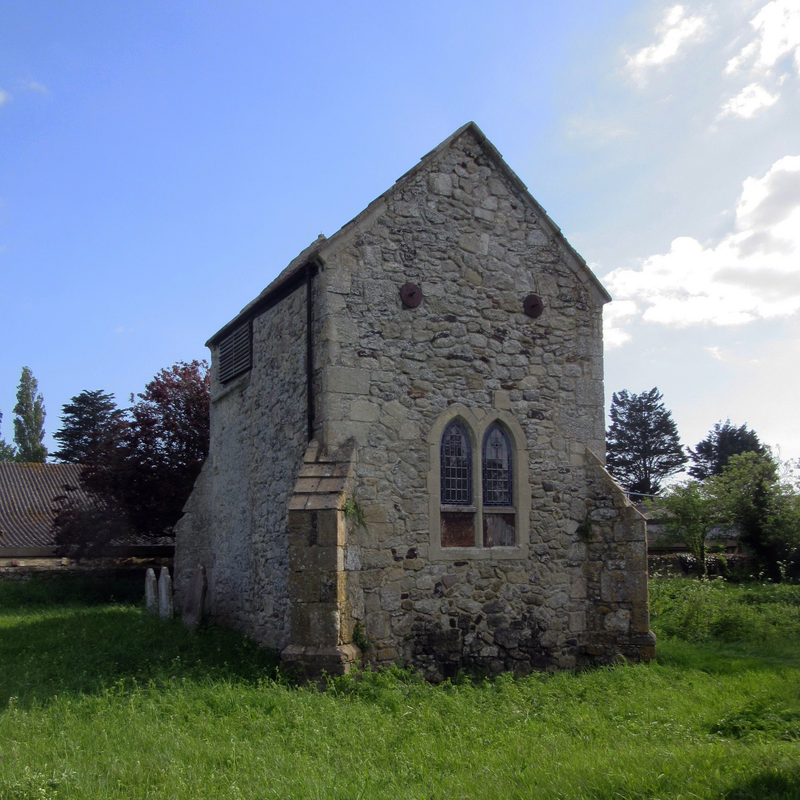
Scene Description: Old St Swithun's
Copyright Statement: Image copyright © [in the public domain]
Image Source: digital photograph taken 16 May 2016 by Hassocks5489 [https://commons.wikimedia.org/wiki/File:Ruins_of_Old_St_Swithun's_Church,_Thorley_Road,_Thorley_(May_2016)_(8).JPG] [accesed 20 February 2020]
Copyright Instructions: CC-Zero
view of church exterior - southwest view
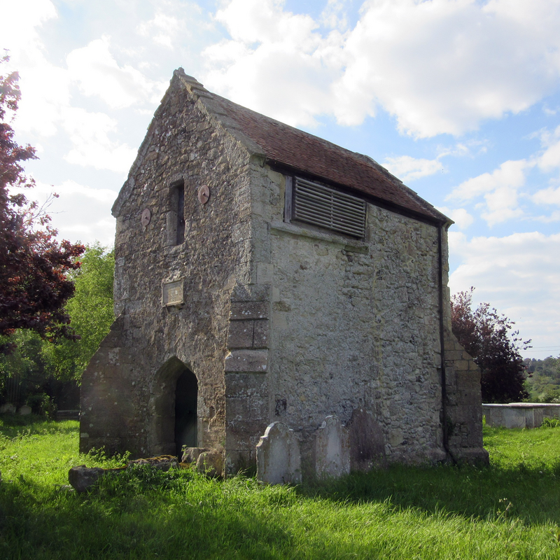
Scene Description: Old St Swithun's
Copyright Statement: Image copyright © [in the public domain]
Image Source: digital photograph taken 16 May 2016 by Hassocks5489 [https://commons.wikimedia.org/wiki/File:Ruins_of_Old_St_Swithun's_Church,_Thorley_Road,_Thorley_(May_2016)_(8).JPG] [accesed 20 February 2020]
Copyright Instructions: CC-Zero
view of church exterior - churchyard, cemetery
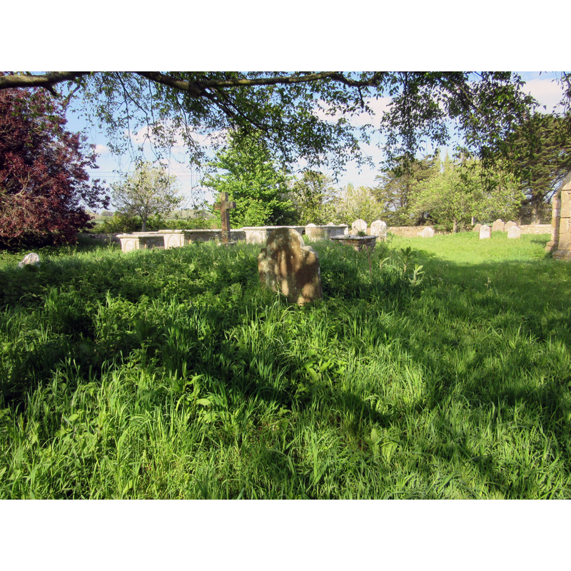
Scene Description: Source caption: "Part of the churchyard at the old St Swithun's Church, Thorley Road, Thorley, Isle of Wight, England. The original parish church Thorley, built in the 13th century and demolished in 1871 when a new church with the same dedication was built nearby. The remaining part serves as a mortuary chapel."
Copyright Statement: Image copyright © [in the public domain]
Image Source: digital photograph taken 16 May 2016 by Hassocks5489 [https://commons.wikimedia.org/wiki/File:Ruins_of_Old_St_Swithun's_Church,_Thorley_Road,_Thorley_(May_2016)_(Churchyard)_(1).JPG] [accesed 20 February 2020]
Copyright Instructions: CC-Zero
INFORMATION
Font ID: 14625THO
Object Type: Baptismal Font1
Font Century and Period/Style: 13th century [later base] [composite font], Medieval [composite]
Church / Chapel Name: Parish Church of St. Swithin [aka St. Swithun's]
Font Location in Church: Inside the new church
Church Patron Saint(s): St. Swithun [aka Swithin]
Church Notes: church here ca. 1100; re-built 13thC; demolished 1871; present church built 1871
Church Address: Seven Sisters Rd / Thorley Rd, Thorley, Yarmouth PO41 0SS, UK [church coordinates are for the old church]
Site Location: Isle of Wight, South East, England, United Kingdom
Directions to Site: Located off the B3401 [aka Main Rd], 2 km ESE of Yarmouth, 15 km W of Newport
Ecclesiastic Region: Diocese of Portsmouth
Historical Region: Hundred of West Medine / Hundred of Bowcombe [in Domesday] -- formerly Hampshire
Additional Comments: re-cycled font / altered font -- disappeared font? (the one from the ca. 1100 church here)
Font Notes:
Click to view
There is an entry for this Thorley [variant spelling] in the Domesday survey [https://opendomesday.org/place/SZ3689/thorley/] [accessed 20 February 2020] but it mentions neither cleric nor church in it. Cox (1911) notes: "The neglected church of this parish, about a mile to the south-east of Yarmouth, was pulled down in 1871 […] The old font, with plain octagonal bowl and circular shaft, probably 13th century, with a later battlemented base, was moved to the new church." The Victoria County History (Hampshire, vol. 5, 1912) notes: "The church of Thorley was granted by Richard de Redvers [+1107] to the priory of Christchurch Twyneham [...] Of the ancient church of St. Swithun the only portion remaining is the porch and belfry standing within a small disused graveyard adjoining the manor farm. [...] The present church [...] was erected by subscription on a site further to the north, and consecrated 9 December 1871."
COORDINATES
UTM: 30U 624318 5605386
Latitude & Longitude (Decimal): 50.58713, -1.24381
Latitude & Longitude (DMS): 50° 35′ 13.67″ N, 1° 14′ 37.72″ W
MEDIUM AND MEASUREMENTS
Material: stone
Font Shape: octagonal, mounted
Basin Interior Shape: round
Basin Exterior Shape: octagonal
REFERENCES
- Victoria County History [online], University of London, 1993-. URL: https://www.british-history.ac.uk.
- Cox, John Charles, Isle of Wight: its churches and religious houses, London: G. Allen & Sons, 1911, p. 156 / [www.archive.org/stream/isleofwightitsch00coxjuoft/isleofwightitsch00coxjuoft_djvu.txt] [accessed 11 May 2009]