Godshill
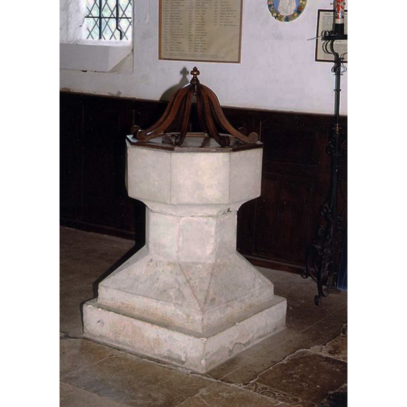
Image copyright © John Salmon, 2009
CC-BY-SA-2.0
Results: 3 records
view of font and cover
Scene Description: [cf. FontNotes]
Copyright Statement: Image copyright © John Salmon, 2009
Image Source: digital image of a photograph taken 8 August 1999 by John Salmon [www.geograph.org.uk/photo/1153483] [accessed 7 September 2011]
Copyright Instructions: CC-BY-SA-2.0
view of church exterior - southeast view
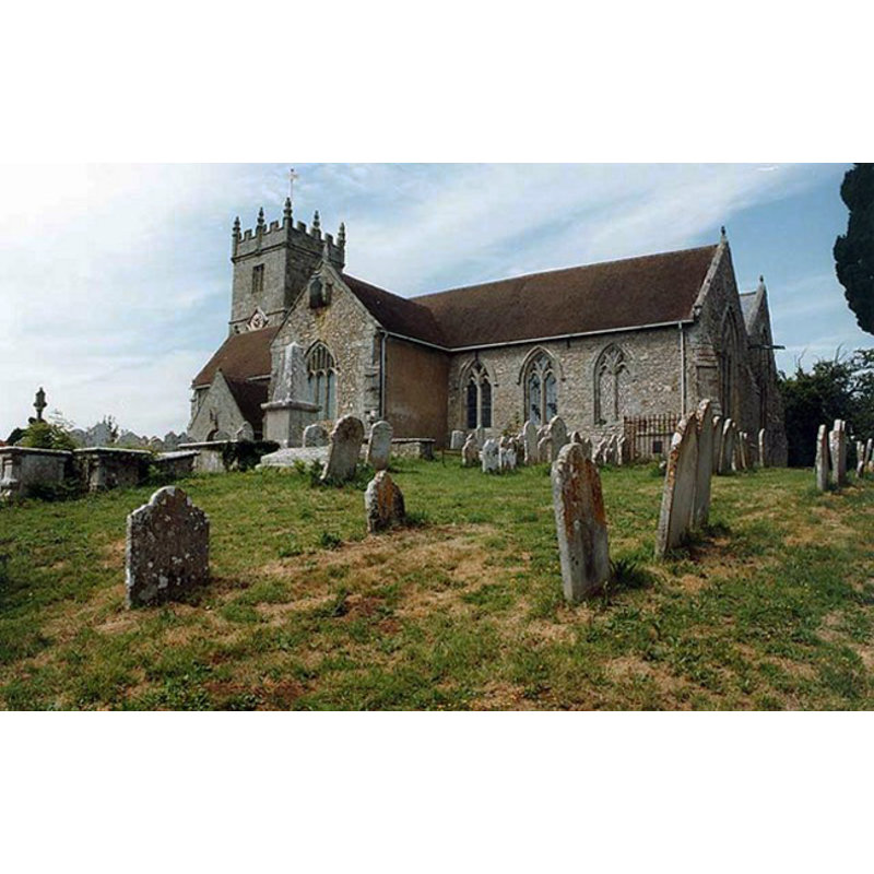
Copyright Statement: Image copyright © John Salmon, 2009
Image Source: digital image of a photograph taken 8 August 1999 by John Salmon [www.geograph.org.uk/photo/1153487] [accessed 7 September 2011]
Copyright Instructions: CC-BY-SA-2.0
view of church interior - nave - looking east
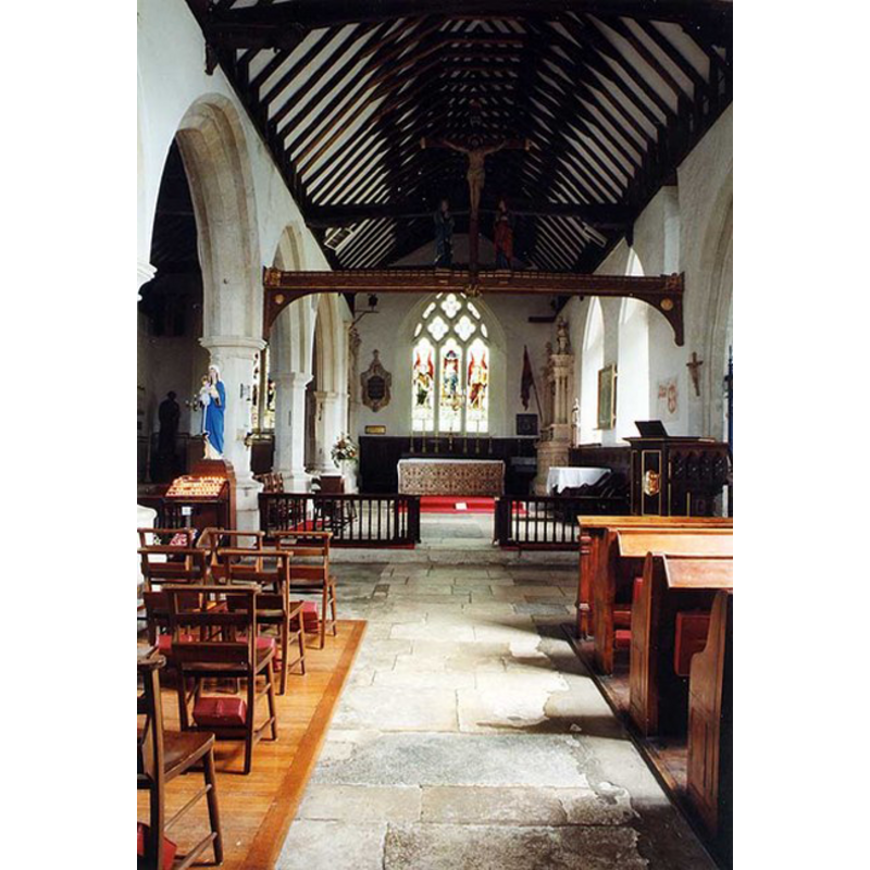
Copyright Statement: Image copyright © John Salmon, 2009
Image Source: digital image of a photograph taken 8 August 1999 by John Salmon [www.geograph.org.uk/photo/1153483] [accessed 7 September 2011]
Copyright Instructions: CC-BY-SA-2.0
INFORMATION
Font ID: 14614GOD
Object Type: Baptismal Font1
Font Century and Period/Style: 15th century (early?) / 19th century, Perpendicular? / Victorian?
Church / Chapel Name: Parish Church of All Saints
Font Location in Church: Inside the church
Church Patron Saint(s): All Saints
Church Address: Church Hill, Godshill, Isle of Wight, PO38 3HY
Site Location: Isle of Wight, South East, England, United Kingdom
Directions to Site: Located on the A3020, about halfway between Newport and Ventnor
Ecclesiastic Region: Diocese of Portsmouth
Historical Region: Hundred of East Medine -- formerly Hampshire [Not to be confused with Godshill in New Forest, also in Hants]
Additional Comments: disappeared font? (the medieval one)
Font Notes:
Click to view
No individual entry for Godshill found in the Domesday survey. The Victoria County History (Hampshire, vol. 5, 1912) notes: "Of the early church of All Saints —beyond the western portion of the north wall—not a vestige remains, [...] the whole of the present structure, dating from the early part of the 15th century, being the work of the Sheen monks. [...] The registers date from 1678"; there is no mention of a font in the VCH entry. The entry for this church in Historic England [Listing NGR: SZ5272481822] notes: "Parish church. Lower part of west tower, chancel east window, south chapel windows and transepts early C14. [...] To the right of the south door is a mediaeval stoup restored in 1918;" no font mentioned. A local source [Project Team Isle of Wight Living Churchyard, December 2004] notes that the only remains of the church built in the reign of King Edward the Confessor (1042-1066) are the font and the piscina located near the altar. The present font consists of an octagonal basin with plain sides and underbowl chamfer, raised on a octagonal stem and an octagonal-to-square lower base, on a square plinth; this present font, if it is ancient and had been re-tooled, could go back to the 15th-century re-building of the church, not to the earlier church; it might otherwise be 19th-century]
COORDINATES
UTM: 30U 623365 5610534
Latitude & Longitude (Decimal): 50.633611, -1.255556
Latitude & Longitude (DMS): 50° 38′ 1″ N, 1° 15′ 20″ W
MEDIUM AND MEASUREMENTS
Material: stone
Font Shape: octagonal, mounted
Basin Interior Shape: round
Basin Exterior Shape: octagonal
LID INFORMATION
Date: modern
Material: wood, oak?
Apparatus: no
Notes: flat octagonal base with eight vertical scroll ribs meeting at small knob finial
REFERENCES
- Victoria County History [online], University of London, 1993-. URL: https://www.british-history.ac.uk.