Brook / Broc / Brok / Brooke / La Brouke
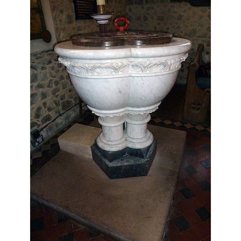
Image copyright © Basher Eyre, 2012
CC-BY-SA-2.0
Results: 3 records
view of font and cover - southeast view
Copyright Statement: Image copyright © Basher Eyre, 2012
Image Source: digital photograph taken 24 July 2012 by Basher Eyre [www.geograph.org.uk/photo/3148218] [accessed 18 February 2020]
Copyright Instructions: CC-BY-SA-2.0
view of font and cover - east side
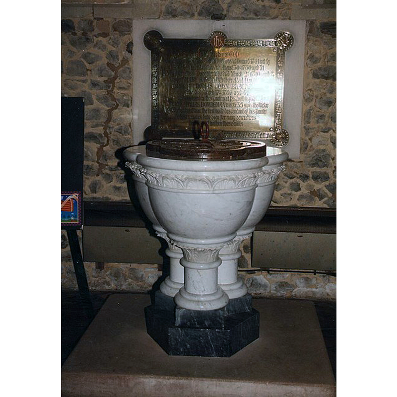
Scene Description: the modern font
Copyright Statement: Image copyright © John Salmon, 2009
Image Source: digital image of a photograph taken 12 August 1999 by John Salmon [www.geograph.org.uk/photo/1174067] [accessed 18 February 2020]
Copyright Instructions: CC-BY-SA-2.0
view of church exterior - southeast view
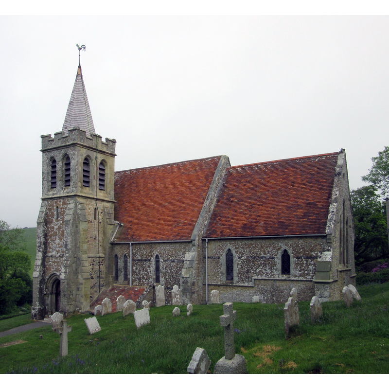
Copyright Statement: Image copyright © [in the public domain]
Image Source: digital photograph taken 20 May 2016 by Hassocks5489 [https://commons.wikimedia.org/wiki/File:St_Mary_the_Virgin's_Church,_Brook,_Isle_of_Wight_(May_2016)_(14).JPG] [accessed 18 February 2020]
Copyright Instructions: CC-Zero
INFORMATION
Font ID: 14610BRO
Object Type: Baptismal Font1?
Font Century and Period/Style: 13th century, Medieval
Church / Chapel Name: Parish Church of St. Mary the Virgin
Church Patron Saint(s): St. Mary the Virgin
Church Address: Brook, Brighstone, Newport PO30 4EP, UK
Site Location: Isle of Wight, South East, England, United Kingdom
Directions to Site: Located off the B3399, near Brighstone, 15 km WSW of Newport, on the Isle of Wight
Ecclesiastic Region: Diocese of Portsmouth
Historical Region: Hundred of West Menise / Hundred of Browcombe [in Domesday] -- formerly Hampshire
Additional Comments: disappeared font? / destroyed font?
Font Notes:
Click to view
There is an entry for Brook in the Domesday survey [https://opendomesday.org/place/SZ3883/brook/] [accessed 18 February 2020] but it mentions neither cleric nor church in it. White (1878) notes a font of marble in this church. White (ibid.) reports that St. Mary's was destroyed -only the tower was saved- by a fire on 9 December 1862, the replacement building being erected a year later. The Victoria County History (Hampshire, vol. 5, 1912) notes: "The church of St. Mary [...] possesses little of antiquarian interest. Completely gutted by fire in 1863, [...] it was practically rebuilt the following year [...] Of the original 13th-century church the only evidence is the arch [...] in the south wall opening to the tower, which must have originally opened into a side chapel, [...] and a carved stone representing a seated lion." There is no font mentioned in the VCH entry. The modern font is noted in Lloyd & Pevsner (2006): "Bowl of trefoil shape in white marble with carved band under the rim; shorth stem of three clustered columns. By Farmer" [Thomas Farmer?]. [NB: we have no information on the earlier font, probably destroyed in the fire]
COORDINATES
UTM: 30U 610088 5612958
Latitude & Longitude (Decimal): 50.658056, -1.4425
Latitude & Longitude (DMS): 50° 39′ 29″ N, 1° 26′ 33″ W
REFERENCES
- Victoria County History [online], University of London, 1993-. URL: https://www.british-history.ac.uk.
- Lloyd, David W., The Isle of Wight, New Haven: Yale University Press, 2006, p. 100
- White, William, History, gazetteer and directory of the County of Hampshire including the Isle of Wight, and [...], Sheffield: William White, 1878, p. 177