Binstead / Binsted nr. Ryde / Benestede
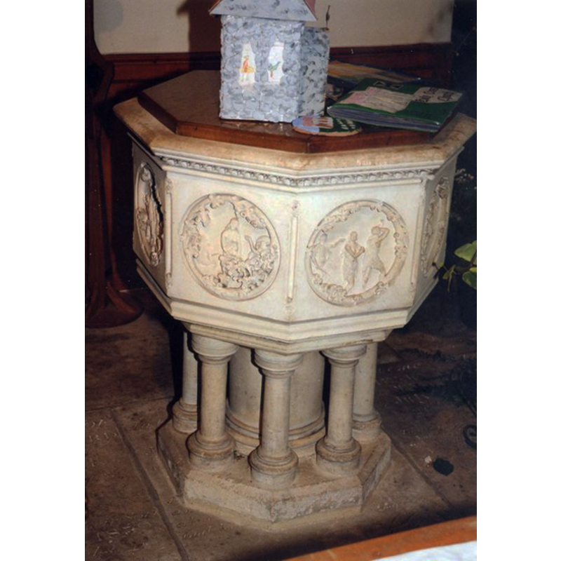
Image copyright © John Salmon, 2009
CC-BY-SA-2.0
Results: 3 records
view of font and cover
Scene Description: the modern font
Copyright Statement: Image copyright © John Salmon, 2009
Image Source: digital image of a photograph taken 12 August 1999 by John Salmon [www.geograph.org.uk/photo/1174118] [accessed 7 September 2011]
Copyright Instructions: CC-BY-SA-2.0
view of church exterior - southeast view
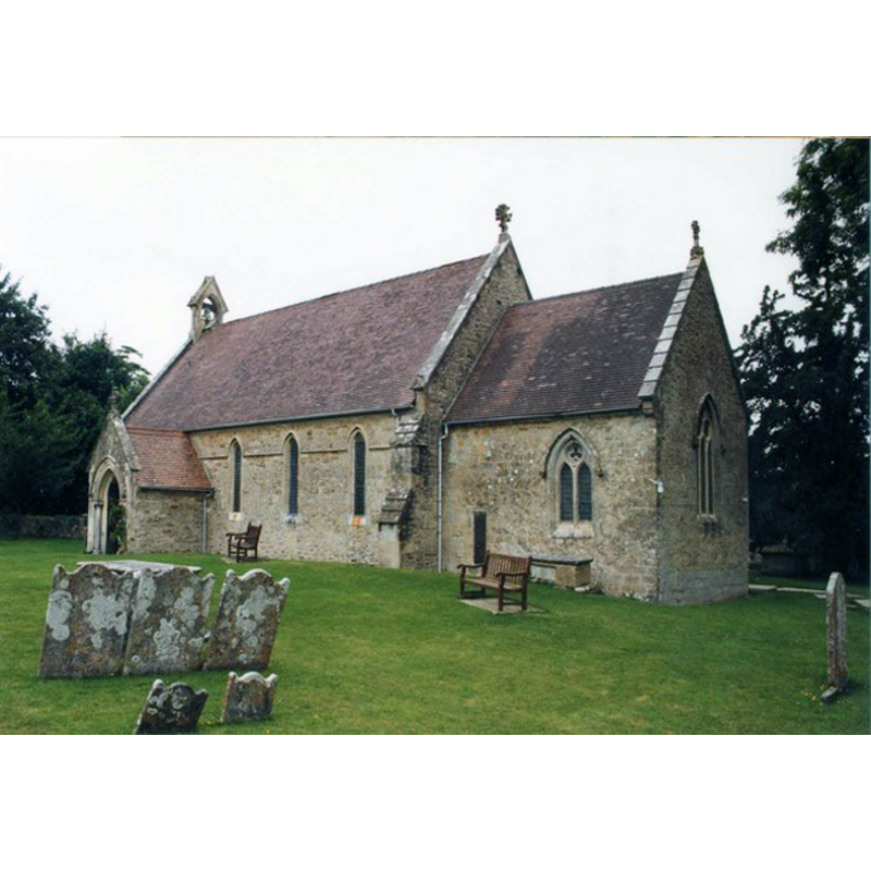
Copyright Statement: Image copyright © John Salmon, 2009
Image Source: digital image of a photograph taken 12 August 1999 by John Salmon [www.geograph.org.uk/photo/1174110] [accessed 7 September 2011]
Copyright Instructions: CC-BY-SA-2.0
view of church interior - nave - looking east
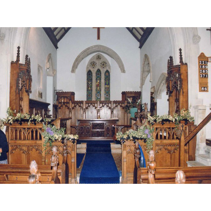
Copyright Statement: Image copyright © John Salmon, 2009
Image Source: digital image of a photograph taken 12 August 1999 by John Salmon [www.geograph.org.uk/photo/1174113] [accessed 7 September 2011]
Copyright Instructions: CC-BY-SA-2.0
INFORMATION
Font ID: 14607BIN
Object Type: Baptismal Font1?
Font Date: ca. 1150?
Font Century and Period/Style: 12th century (mid?), Late Norman
Church / Chapel Name: Parish Church of the Holy Cross
Church Patron Saint(s): The Holy Cross
Church Address: Church Rd, Binstead, Isle of Wight, PO33 3SY
Site Location: Isle of Wight, South East, England, United Kingdom
Directions to Site: Located on the A3054, 2 km W of Ryde (dir. Newport). Isle of Wight
Ecclesiastic Region: Diocese of Portsmouth
Historical Region: Hundred of East Medine / Hundred of Droxforth [in Domesday -- formerly Hampshire
Additional Comments: disappeared font? It may have been discarded(?) when the new one was introduced in 1844 [cf. FontNotes]
Font Notes:
Click to view
There is a multiple-place entry for Binstead [variant spelling] in the Domesday survey [https://opendomesday.org/place/SU6015/binstead/] [accessed 13 February 2020]; it reports a church in it. The Victoria County History (Hampshire, vol. 5, 1912) notes: "The church of the Holy Cross [...] was probably erected for the use of the workers in the quarries, c. 1150 [...] in 1844 the nave was pulled down bodily and rebuilt"; there is no mention of a font in the VCH entry. Lloyd & Pevsner (2006) write: "Font, 1844. Octagonal with richly carved roundels of biblical scenes, ringed with stylized foliage. Designed by the Ho. Henry Graves, 1844 (church guide)." [NB: we have no information on the original font of the medieval church]. On the nearby Quarr Abbey and its original church the VCH (ibid.) notes: "The Cistercian house of our Lady at Quarr was founded in 1131, by Baldwin de Redvers, as a colony from Savigny, and was consecrated 1 June 1150. [...] The abbey was dissolved in 1537. [...] The church was of the usual Cistercian type, consisting of a presbytery, quire and nave [...] The church was completely demolished at the Dissolution." [NB: we have no information whether a font existed in the abbey church or not].
COORDINATES
UTM: 30U 627846 5620964
Latitude & Longitude (Decimal): 50.726389, -1.188611
Latitude & Longitude (DMS): 50° 43′ 35″ N, 1° 11′ 19″ W
REFERENCES
- Victoria County History [online], University of London, 1993-. URL: https://www.british-history.ac.uk.
- Lloyd, David W., The Isle of Wight, New Haven: Yale University Press, 2006, p. 85