Chipstable / Cipestaple
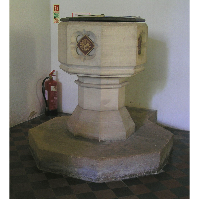
Image copyright © Tony Ethridge, 2009
Standing permission
Results: 3 records
view of font and cover
Scene Description: the modern font
Copyright Statement: Image copyright © Tony Ethridge, 2009
Image Source: digital photograph by Tony Ethridge [http://www.worldisround.com/articles/333820/index.html] [accessed 7 May 2009]
Copyright Instructions: Standing permission
view of church exterior - northeast view
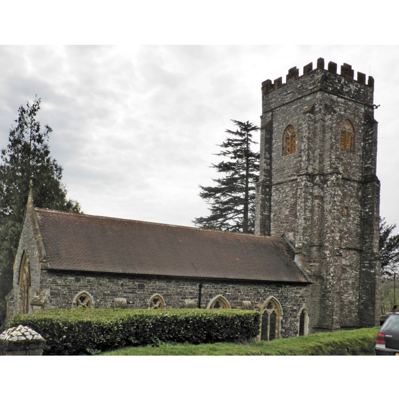
Copyright Statement: Image copyright © Roger Cornfoot, 2014
Image Source: digital photograph taken 29 March 2014 by Roger Cornfoot [www.geograph.org.uk/photo/3907027] [accessed 29 March 2014]
Copyright Instructions: CC-BY-SA-2.0
view of church exterior - southeast view
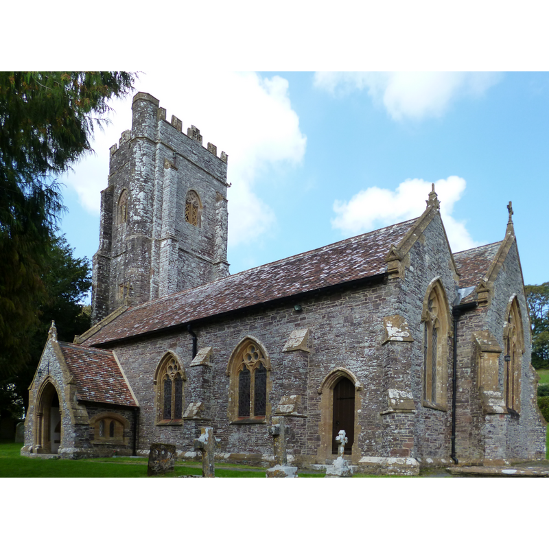
Copyright Statement: Image copyright © Dave Kelly, 2014
Image Source: digital photograph taken 10 September 2014 by Dave Kelly [www.geograph.org.uk/photo/4160000] [accessed 5 March 2018]
Copyright Instructions: CC-BY-SA-2.0
INFORMATION
Font ID: 14605CHI
Object Type: Baptismal Font1?
Font Century and Period/Style: 14th - 15th century, Medieval
Church / Chapel Name: Parish Church of All Saints
Church Patron Saint(s): All Saints
Church Address: Chipstable, Taunton TA4 2PZ, UK
Site Location: Somerset, South West, England, United Kingdom
Directions to Site: Located off (N) the B3227, 4 km W of Wiveliscombe, 16 km W of Taunton
Ecclesiastic Region: Diocese of Bath & Wells
Historical Region: Hundred of Williton
Additional Comments: disappeared font?
Font Notes:
Click to view
There is an entry for Chipstable [variant spelling] in the Domesday survey [http://opendomesday.org/place/ST0427/chipstable/] [accessed 5 March 2018], but it mentions neither cleric nor church in it. The entry for this parisch in the Victoria County History (Somerset, vol. 5, 1985) notes: "Ownership of the church of Chipstable was confirmed to the monks of Muchelney in 1239 [...] The medieval building, comprising chancel, nave with south aisle and south porch, and west tower, with windows of the 15th and early 16th centuries, [...] was demolished except for the tower in 1869, and was replaced by a building in the Geometrical style by Benjamin Ferrey"; there is no mention of a font in the VCH entry. The present baptismal in this church is a 19th-century replacement of the original 15th-century font. The modern font consists of an octagonal basin with alternate plain and carved sides and a pronouned moulding all around the lower side; raised on an octagonal stem and splaying lower base. Octagonal plinth with kneeling extension. The wooden cover is octagonal and flat; modern. [NB: we have no information on the late-medieval font of this church]
Credit and Acknowledgements: We are grateful to Tony Etheridge, of Somerset Villages, for his photograph of the modern font
COORDINATES
UTM: 30U 474289 5653848
Latitude & Longitude (Decimal): 51.0356, -3.3667
Latitude & Longitude (DMS): 51° 2′ 8.16″ N, 3° 22′ 0.12″ W
LID INFORMATION
Date: modern
Material: wood
Apparatus: no
Notes: [cf. FontNotes]
REFERENCES
- Victoria County History [online], University of London, 1993-. URL: https://www.british-history.ac.uk.