Thurning nr. Holt / Thirning / Tirninga / Turninga / Tyrninga
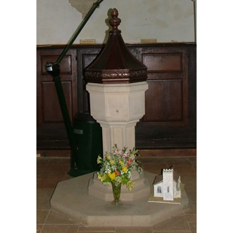
Image copyright © Simon Knott, 2009
Standing permission
Results: 5 records
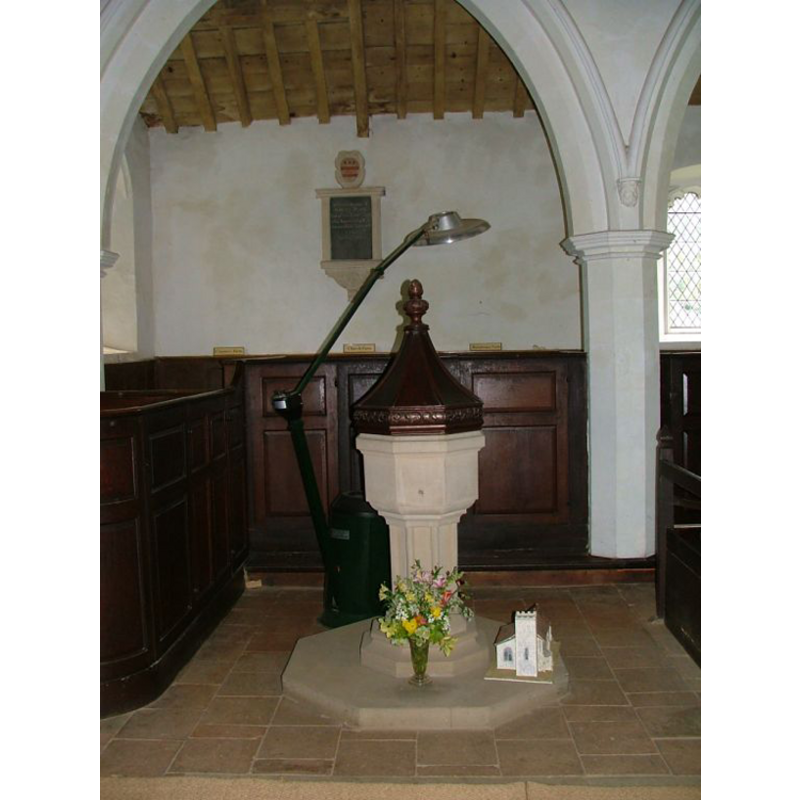
view of font and cover
Scene Description: the modern font
Copyright Statement: Image copyright © Simon Knott, 2009
Image Source: detail of a digital photograph by Simon Knott in Norfolk Churches [www.norfolkchurches.co.uk/thurning/thurning.htm] [accessed 5 May 2009]
Copyright Instructions: Standing permission
view of church exterior - southeast view
![Photo caption: "The chancel has been in ruins for many years. The east window was transferred to the east end of the nave together with the priest's doorway"
INT N AISLE W B&W photograph taken 27 July 1950 by George Plunkett [ww.georgeplunkett.co.uk/Norfolk/T/Thurning St Andrew's church interior view W [3946] 1950-07-27.jpg] [accessed 31 October 2013] Caption: "High box pews in north aisle. 14c arcade"](/static-50478a99ec6f36a15d6234548c59f63da52304e5/compressed/1131103058_compressed.png)
Scene Description: Photo caption: "The chancel has been in ruins for many years. The east window was transferred to the east end of the nave together with the priest's doorway"
INT N AISLE W B&W photograph taken 27 July 1950 by George Plunkett [ww.georgeplunkett.co.uk/Norfolk/T/Thurning St Andrew's church interior view W [3946] 1950-07-27.jpg] [accessed 31 October 2013] Caption: "High box pews in north aisle. 14c arcade"
Copyright Statement: Image copyright © George Plunkett, 2013
Image Source: B&W photograph taken 24 September 1995 by George Plunkett [www.georgeplunkett.co.uk/Norfolk/T/Thurning St Andrew's church from SE [7253] 1995-09-24.jpg] [accessed 31 October 2013]
Copyright Instructions: Standing permission by Jonathan Plunkett
view of church interior - nave - looking northwest
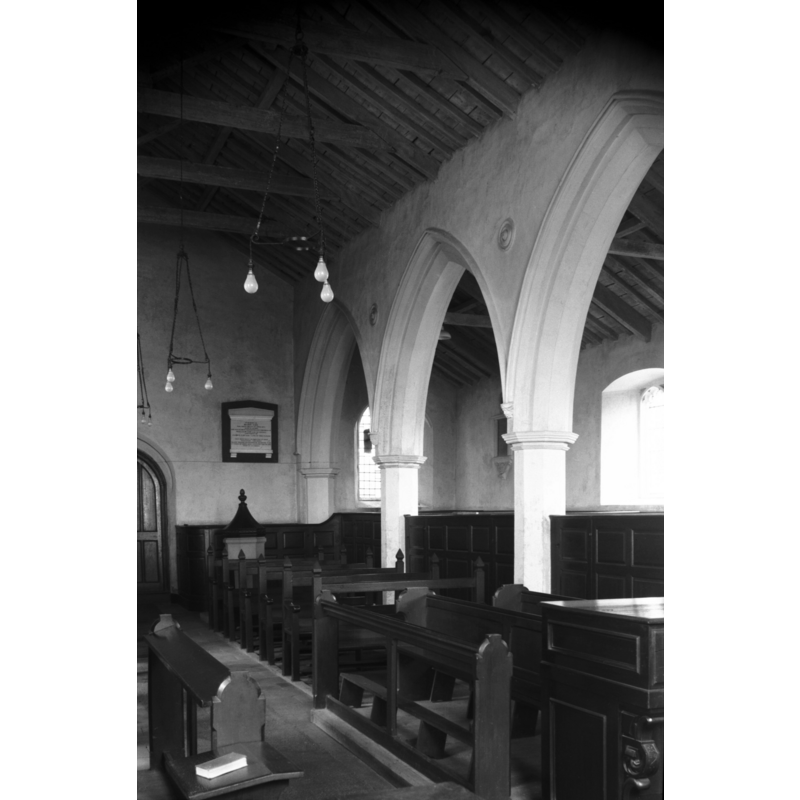
Scene Description: across the north arcade into the north aisle -- the font and cover are visible in the nave, to the right (north) of the tower door
Copyright Statement: Image copyright © George Plunkett, 2013
Image Source: W B&W photograph taken 27 July 1950 by George Plunkett [ww.georgeplunkett.co.uk/Norfolk/T/Thurning St Andrew's church interior view W [3946] 1950-07-27.jpg] [accessed 31 October 2013]
Copyright Instructions: Standing permission by Jonathan Plunkett
view of church interior - nave - looking east
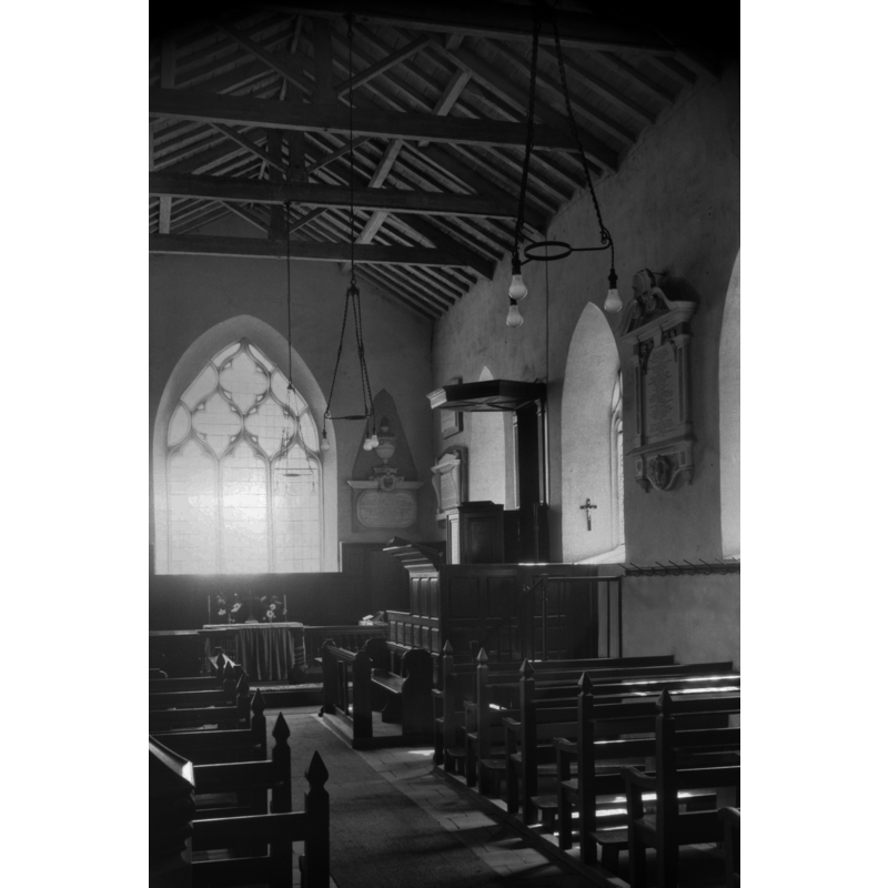
Copyright Statement: Image copyright © George Plunkett, 2013
Image Source: B&W photograph taken 27 July 1950 by George Plunkett [www.georgeplunkett.co.uk/Norfolk/T/Thurning St Andrew's church interior view E [3947] 1950-07-27.jpg] [accessed 31 October 2013]
Copyright Instructions: Standing permission by Jonathan Plunkett
view of font and cover in context
Scene Description: the modern font
Copyright Statement: Image copyright © Simon Knott, 2009
Image Source: digital photograph by Simon Knott in Norfolk Churches [www.norfolkchurches.co.uk/thurning/thurning.htm] [accessed 5 May 2009]
Copyright Instructions: Standing permission
INFORMATION
Font ID: 14586THU
Object Type: Baptismal Font1?
Font Century and Period/Style: 13th century, Medieval
Church / Chapel Name: Parish Church of St. Andrew
Church Patron Saint(s): St. Andrew
Church Address: Reepham Road, Thurning, Norfolk NR20 5QY
Site Location: Norfolk, East Anglia, England, United Kingdom
Directions to Site: Located near Corpusty, 11 km S of Holt
Ecclesiastic Region: Diocese of Norwich
Historical Region: Hundred of Eynford
Additional Comments: disappeared font? (the one of the 12thC church here)
Font Notes:
Click to view
The entries for "Tirninga", "Turninga" and "Tyrninga" make no mention of church or cleric in it. Blomefield (1805-1810) notes that "In the 9th year the King [...] purchased of William, the prior of Norwich, 50 acres of land, with 27s. and 7d. rent, and the advowson of this church, by fine"; the king was Edward I, therefore a church here is documented by 1291, the 9th year of Edward's reign. The present font here is illustrated in Knot (2006) It is a 19th-century replacement of its former medieval one; it consisits of a small octagonal moulded basin on a tall and slender octagonal pedestal stem and a moulded base; octagonla plinth, also modern. The wooden cover is an octagonal pyramid with carved sides and finial; modern. [NB: we have no information on the original font of the medieval church]
Credit and Acknowledgements: We are grateful to Simon Knott, of Norfolk Churches [www.norfolkchurches.co.uk], for his photographs of the modern font; we are also grateful to Jonathan Plunkett for the photographas of this church taken by his father, George Plunkett, in 1950 and 1995
COORDINATES
UTM: 31U 371052 5854211
Latitude & Longitude (Decimal): 52.82223, 1.086319
Latitude & Longitude (DMS): 52° 49′ 20.03″ N, 1° 5′ 10.75″ E
LID INFORMATION
Date: modern
Material: wood
Apparatus: no
Notes: [cf. FontNotes]
REFERENCES
- Blomefield, Francis, An essay towards a topographical history of Norfolk, 1805-1810, vol. 8: 279-282 / [www.british-history.ac.uk/report.aspx?compid=78466] [accessed 31 October 2013]
- Knott, Simon, The Norfolk Churches Site, Simon Knott, 2004. [standing permission to reproduce images received from Simon (February 2005]. URL: www.norfolkchurches.co.uk.