Sudborough / Silburk / Subbure / Suburg / Sutburg / Suthburg
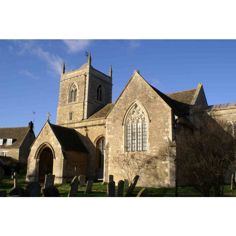
Image copyright © Chris Stafford, 2007
CC-BY-SA-3.0
Results: 3 records
UB01: design element - motifs - moulding

Copyright Statement: Image copyright © Dragontree, 2010
Image Source: digital photograph taken in 2010 by Dragontree [http://img.groundspeak.com/waymarking/1882a1fa-f18a-407b-ac75-10adaac2db65.JPG] [accessed 24 May 2012]
Copyright Instructions: PERMISSION NOT AVAILABLE -- IMAGE NOT FOR PUBLIC USE
view of church exterior - southeast view
Copyright Statement: Image copyright © Chris Stafford, 2007
Image Source: digital photograph taken 24 January 2007 by Chris Stafford [www.geograph.org.uk/photo/319916] [accessed 24 May 2012]
Copyright Instructions: CC-BY-SA-3.0
view of font and cover
Copyright Statement: Image copyright © Dragontree, 2010
Image Source: digital photograph taken in 2010 by Dragontree [http://img.groundspeak.com/waymarking/1882a1fa-f18a-407b-ac75-10adaac2db65.JPG] [accessed 24 May 2012]
Copyright Instructions: PERMISSION NOT AVAILABLE -- IMAGE NOT FOR PUBLIC USE
INFORMATION
Font ID: 14540SUD
Object Type: Baptismal Font1
Font Century and Period/Style: 13th - 14th century, Medieval
Church / Chapel Name: Parish Church of All Saints
Font Location in Church: Inside the church
Church Patron Saint(s): All Saints
Church Address: Main Street, Sudborough, Northamptonshire, NN14 3BX
Site Location: Northamptonshire, East Midlands, England, United Kingdom
Directions to Site: Located between Thrapston and Market Harborough
Ecclesiastic Region: Diocese of Peterborough
Historical Region: Hundred of Huxloe
Additional Comments: disappeared font? (there may have been a church here since pre-Conquest times)
Font Notes:
Click to view
The Victoria County History (Northampton, vol. 3, 1930) notes: "The font is a plain octagonal bowl with octagonal pedestal and a 17th-century cover." The only decoration is a moulding on the pedestal base. The basin has had repairs made with new stone inserts. [NB: the VCH reports "two stones were found under the north-east pier, which together formed part of a pre-Conquest cross", but we have no information on the earlier font(s) of this church].
COORDINATES
UTM: 30U 664664 5811429
Latitude & Longitude (Decimal): 52.428237, -0.578061
Latitude & Longitude (DMS): 52° 25′ 41.65″ N, 0° 34′ 41.02″ W
MEDIUM AND MEASUREMENTS
Material: stone
Font Shape: octagonal, mounted
Basin Interior Shape: round
Basin Exterior Shape: octagonal
LID INFORMATION
Date: 17th-century?
Material: wood
Notes: panelled wooden cover [cf. FontNotes]
REFERENCES
- Victoria County History [online], University of London, 1993-. URL: https://www.british-history.ac.uk.