Preston Deanery / Preston by Pedyngton / Preston iuxta Northampton / Preston-juxta-Northampton
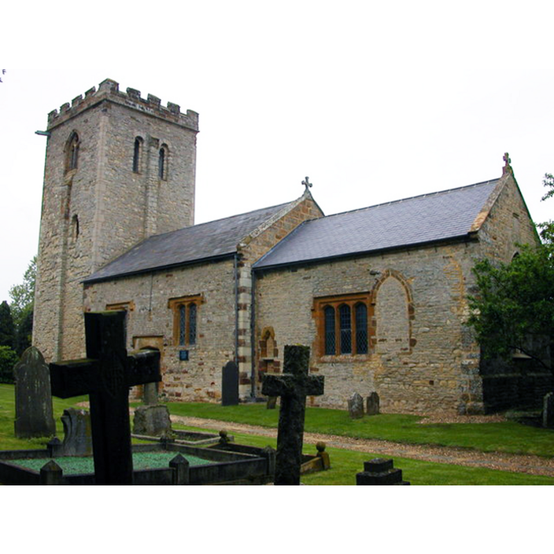
Image copyright © Ian Rob, 2007
CC-BY-SA-3.0
Results: 1 records
view of church exterior - southeast view
Copyright Statement: Image copyright © Ian Rob, 2007
Image Source: digital photograph taken 16 May 2007 by Ian Rob [www.geograph.org.uk/photo/880384] [accessed 5 June 2012]
Copyright Instructions: CC-BY-SA-3.0
INFORMATION
Font ID: 14523PRE
Object Type: Baptismal Font1?
Font Century and Period/Style: 12th century, Late Norman
Church / Chapel Name: Parish Church of St. Peter and St. Paul [redundant]
Church Patron Saint(s): St. Peter & St. Paul
Church Notes: original church 12thC; partly demolished 16thC; repaired early 17th, 19th and 20thC; redundant 1972; from 1976 in the care of The Churches Conservation Trust
Church Address: Preston Deanery, Hackleton, Northampton, Northamptonshire, NN7 2DX
Site Location: Northamptonshire, East Midlands, England, United Kingdom
Directions to Site: Located off the M1and B526, 6 km S of Northampton town centre
Ecclesiastic Region: Diocese of Peterborough [formerly in the diocese of Lincoln]
Historical Region: Hundred of Wymersley
Additional Comments: disappeared font? (the one from the 12thC church here)
Font Notes:
Click to view
The Victoria County History (Northampton, vol. 4, 1937) notes: "The building is substantially of 12th-century date, the tower, the walls of the nave, and the west part of the chancel being of that period. […] The font stands against the west wall of the nave; it has an octagonal cup-shaped bowl and is apparently of 18th-century date." This later 'font', or large stoup, is actually half-embedded into the west wall, just north of the tower arch opening. The Churches Conservation Trust entry [www.visitchurches.org.uk/Ourchurches/Completelistofchurches/Church-of-St-Peter-St-Paul-Preston-Deanery-Northamptonshire/] [accessed 5 June 2012] notes: "In the 16th-century the church was partly demolished and converted to secular use - the chancel became a dog kennel and the rugged Norman tower a pigeon house! It was restored in 1620." [NB: we have no information on the original font of the 12th-century church]
COORDINATES
UTM: 30U 647082 5784765
Latitude & Longitude (Decimal): 52.1937, -0.8481
Latitude & Longitude (DMS): 52° 11′ 37.32″ N, 0° 50′ 53.16″ W
REFERENCES
- Victoria County History [online], University of London, 1993-. URL: https://www.british-history.ac.uk.