Pilton / Piltona / Piltoun / Polton / Pulton / Pylton
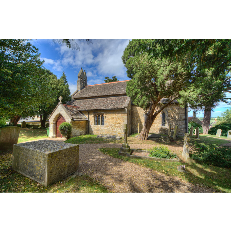
Image copyright © Christopher Jones, 2015
Standing permission
Results: 2 records
view of church exterior - southeast view
Copyright Statement: Image copyright © Christopher Jones, 2015
Image Source: digital photograph taken by Christopher Jones [www.leicestershirechurches.co.uk/pilton-st-nicholas/] [accessed 21 July 2015]
Copyright Instructions: Standing permission
view of church interior - nave - looking southwest
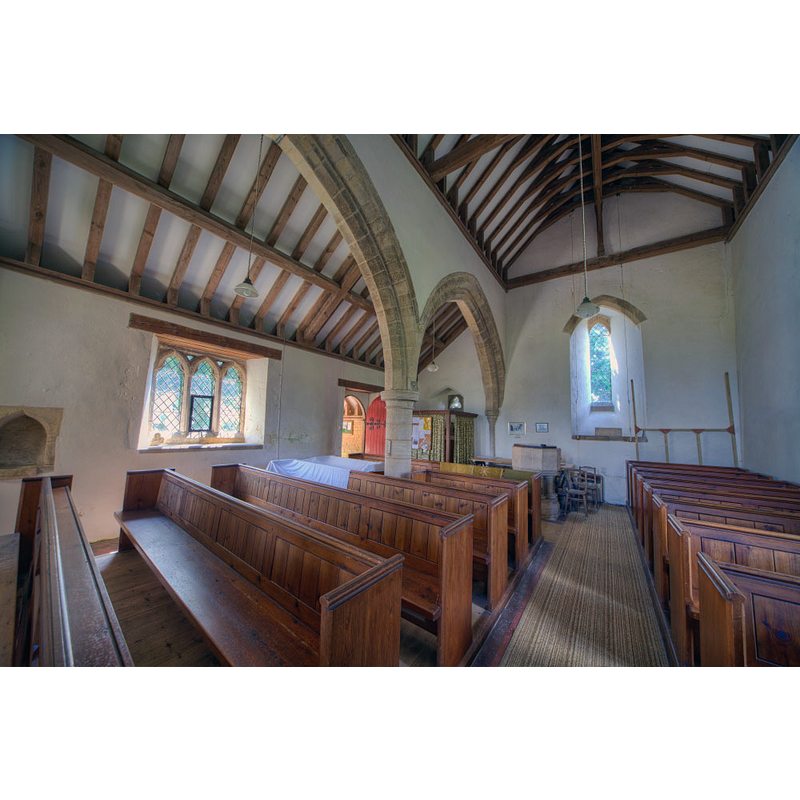
Scene Description: the restored font and its modern cover are visible at the far end of the nave, oposite the south entranceway
Copyright Statement: Image copyright © Christopher Jones, 2015
Image Source: digital photograph taken by Christopher Jones [www.leicestershirechurches.co.uk/pilton-st-nicholas/] [accessed 21 July 2015]
Copyright Instructions: Standing permission
INFORMATION
Font ID: 14522PIL
Object Type: Baptismal Font1
Font Date: ca. 1210?
Font Century and Period/Style: 13th century (early?) [restored], Early English [altered]
Church / Chapel Name: Parish Church of St. Nicholas
Font Location in Church: Inside the church, at the W end of the nave
Church Patron Saint(s): St. Nicholas of Myra
Church Address: Lyndon Road, Pilton, Rutland. LE15 9NT
Site Location: Rutland, East Midlands, England, United Kingdom
Directions to Site: Located between Lyndon and Morcott
Ecclesiastic Region: Diocese of Peterborough
Historical Region: Hundred of Wrandike
Additional Comments: altered font? (the present one; restored) -- disappeared font? (the one from the 12thC church here)
Font Notes:
Click to view
No entry found for this Pilton in the Domesday survey. The Victoria County History (Rutland, vol. 2, 1935) notes: "The whole building may have been erected originally at the beginning of the 13th century, but it is not unlikely that the nave represents an aisleless 12th-century church to which, about 1200–10, an aisle was added, the south wall being pierced by the existing arcade of two bays. [...] The font is probably contemporary with the nave arcade, and consists of a plain octagonal bowl on a large cylindrical stem and eight surrounding shafts with moulded capitals and bases, all very much restored".
Credit and Acknowledgements: We are grateful to Christopher Jones, of Leicestershire Churches [www.leicestershirechurches.co.uk], for his photographs of this church and font
COORDINATES
UTM: 30U 659100 5831767
Latitude & Longitude (Decimal): 52.612578, -0.650081
Latitude & Longitude (DMS): 52° 36′ 45.28″ N, 0° 39′ 0.29″ W
MEDIUM AND MEASUREMENTS
Material: stone
Font Shape: octagonal, mounted
Basin Interior Shape: round
Basin Exterior Shape: octagonal
LID INFORMATION
Date: modern
Material: wood, oak?
Apparatus: mo
Notes: octagonal, flat and plain; modern
REFERENCES
- Victoria County History [online], University of London, 1993-. URL: https://www.british-history.ac.uk.