Wigginton nr. Hook Norton / Wigentone
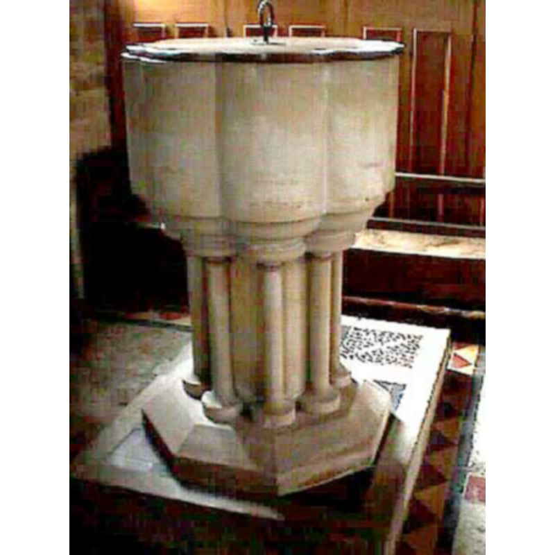
Image copyright © John Wilkes, 2006
Standing permission
Results: 4 records
view of font and cover
Scene Description: the modern font
Copyright Statement: Image copyright © John Wilkes, 2006
Image Source: digital photograph taken June 2006 by John Wilkes [www.allthecotaswols.com]
Copyright Instructions: Standing permission
view of font and cover
![[NB: is the cover upside down? Compare it with the other image of the full font taken about the same date] -- the modern font --](/static-50478a99ec6f36a15d6234548c59f63da52304e5/compressed/1060708010_compressed.png)
Scene Description: [NB: is the cover upside down? Compare it with the other image of the full font taken about the same date] -- the modern font --
Copyright Statement: Image copyright © John Wilkes, 2006
Image Source: digital photograph taken June 2006 by John Wilkes [www.allthecotaswols.com]
Copyright Instructions: Standing permission
view of church exterior - southeast view
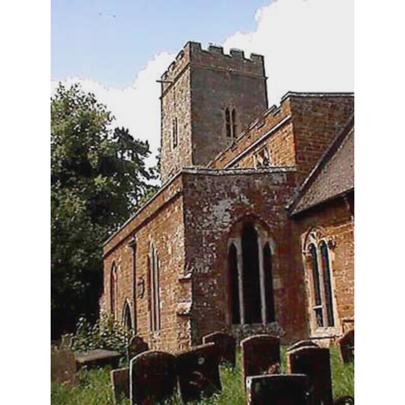
Copyright Statement: Image copyright © John Wilkes, 2006
Image Source: digital photograph taken June 2006 by John Wilkes [www.allthecotaswols.com]
Copyright Instructions: Standing permission
view of church exterior - northwest end
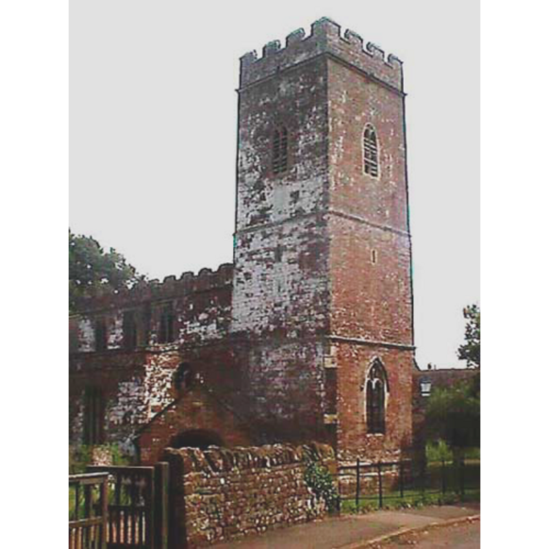
Copyright Statement: Image copyright © John Wilkes, 2006
Image Source: digital photograph taken June 2006 by John Wilkes [www.allthecotaswols.com]
Copyright Instructions: Standing permission
INFORMATION
Font ID: 14511WIG
Object Type: Baptismal Font1?
Font Century and Period/Style: 12th - 13th century, Medieval
Church / Chapel Name: Parish Church of St. Giles
Church Patron Saint(s): St. Giles [aka Aegidus, Egidus, Gilles]
Church Address: Wiggington Road, Wigginton, Oxfordshire, OX15 4JU, UK
Site Location: Oxfordshire, South East, England, United Kingdom
Directions to Site: Located off (W) the A361, just SE of Hook Norton
Ecclesiastic Region: Diocese of Oxford
Historical Region: Hundred of Bloxham
Additional Comments: disappeared font? (the one from the 12th-13thC church here)
Font Notes:
Click to view
There is an entry for this Wigginton [variant spelling] in the Domesday survey [http://opendomesday.org/place/SP3833/wigginton/] [accessed 7 November 2017], but it mentions neither priest nor church in it. The Victoria County History (Oxford, vol. 9, 1969) notes: "The earliest documentary reference to the church is c. 1210 [...] About 1130, however, the canons of the church of St. George, Oxford, were in possession of part of the demesne tithes [...] and this may mean that some tithes were reserved for the incumbent of Wigginton [...] The only surviving feature earlier than the 13th century is a Romanesque capital reused as a corbel [...] in 1811 a new font was purchased." The new font is poly-lobed, with plain basin sides, the only decoration being the round mouldings at the top and bottom of the colonnettes that make up the stem of the base.
Credit and Acknowledgements: We are grateful to John Wilkes, of www.allthecotswolds.com, for the photographs of this church and font.
COORDINATES
UTM: 30U 607654 5761840
Latitude & Longitude (Decimal): 51.996775, -1.431915
Latitude & Longitude (DMS): 51° 59′ 48.39″ N, 1° 25′ 54.89″ W
LID INFORMATION
Date: modern
Material: wood
Apparatus: no
Notes: poly-lobed, plain and flat, with ring handle
REFERENCES
- Victoria County History [online], University of London, 1993-. URL: https://www.british-history.ac.uk.