Passenham
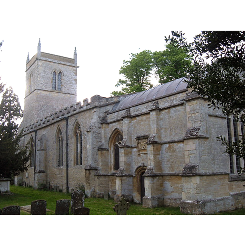
Image copyright © Mr Biz, 2009
CC-BY-SA-3.0
Results: 3 records
view of church exterior - southeast view
Copyright Statement: Image copyright © Mr Biz, 2009
Image Source: digital photograph taken 9 May 2009 by Mr Biz [www.geograph.org.uk/photo/1295451] [accessed 11 June 2012]
Copyright Instructions: CC-BY-SA-3.0
view of font
![the wooden font [cf. FontNotes]](/static-50478a99ec6f36a15d6234548c59f63da52304e5/others/permission_not_available.jpg)
Scene Description: the wooden font [cf. FontNotes]
Copyright Statement: Image copyright © WDAHS, 2012
Image Source: digital photograph in [www.mkheritage.co.uk/wdahs/pass/docs/churchtour/ch6.html] [accessed 11 June 2012]
Copyright Instructions: PERMISSION NOT AVAILABLE -- IMAGE NOT FOR PUBLIC USE
view of font and cover
Scene Description: the modern font of 1976 [cf. FontNotes]
Copyright Statement: Image copyright © WDAHS, 2012
Image Source: digital photograph in [www.mkheritage.co.uk/wdahs/pass/docs/churchtour/ch6.html] [accessed 11 June 2012]
Copyright Instructions: PERMISSION NOT AVAILABLE -- IMAGE NOT FOR PUBLIC USE
INFORMATION
Font ID: 14508PAS
Object Type: Baptismal Font1?
Font Century and Period/Style: 13th century (late?), Decorated
Church / Chapel Name: Parish Church of St. Guthlac
Church Patron Saint(s): St. Guthlac [aka Guthlake]
Church Address: Passenham, Old Stratford, Northamptonshire MK19 6DH
Site Location: Northamptonshire, East Midlands, England, United Kingdom
Directions to Site: Located 2 km SW of Stony Stratford
Ecclesiastic Region: Diocese of Peterborough
Historical Region: Hundred of Cleley
Additional Comments: disappeared font? (the one from the late-13thC church)
Font Notes:
Click to view
The Victoria County History notes (Northampton, vol. 5, 2002): "Although there is no reference to a church in Passenham in Domesday Book, the royal estate there had soke over part of Cosgrove. [...] This, and the dedication to the 8th-century Mercian saint Guthlac, suggest that the church at Passenham had once been the centre of a larger Anglo-Saxon parochia. [...] The church was valued at £10 in 1291 [...] The lower part of the tower and the nave are of the later 13th century. [...] A new font was given by the rector, Loraine Loraine-Smith, in 1834 […] A plan in 1938 to form a baptistry at the west end of the south side of the nave, including the replacement of the font, was turned down by the diocesan advisory committee […] and presumably abandoned after the outbreak of war." The MK Heritage entry [www.mkheritage.co.uk/wdahs/pass/docs/churchtour/ch6.html] [accessed 11 June 2012] notes and illustrates two baptismal fonts in this church: an old wooden cylindrical font, and a "modern Font was donated in 1976 by A. D. A. Lawson in memory of his wife", both of them outside the scope of this Index. [NB: we have no information on the earlier font of this church].
COORDINATES
UTM: 30U 646472 5768476
Latitude & Longitude (Decimal): 52.047514, -0.864034
Latitude & Longitude (DMS): 52° 2′ 51.05″ N, 0° 51′ 50.52″ W
REFERENCES
- Victoria County History [online], University of London, 1993-. URL: https://www.british-history.ac.uk.