Weston-on-the-Green / Weston on the Green / Westone
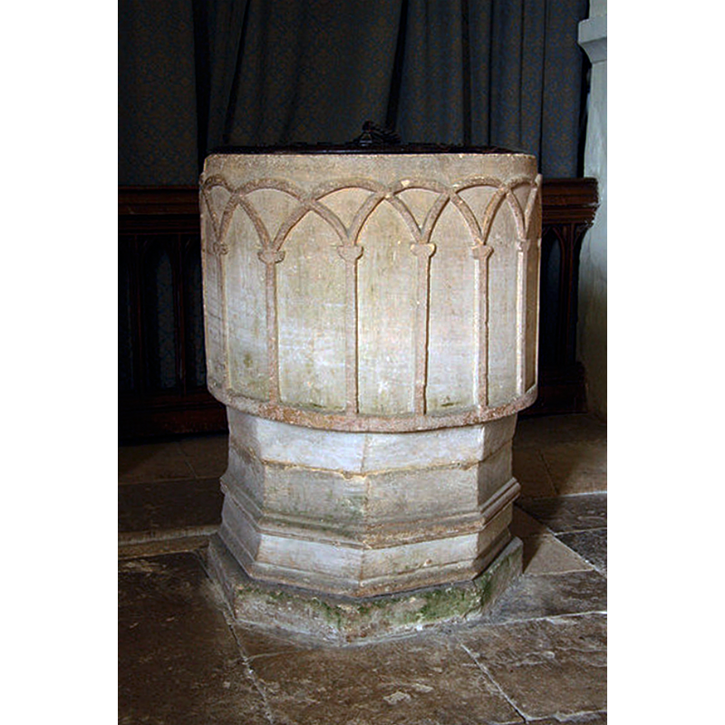
Image copyright © Richard Croft, 2010
CC-BY-SA-2.0
Results: 6 records
view of font and cover
Scene Description: Source caption: "12th century tub font with arcaded sides in St.Mary's church".
Copyright Statement: Image copyright © Richard Croft, 2010
Image Source: digital photograph taken 27 July 2010 by Richard Croft [www.geograph.org.uk/photo/1997311] [accessed 25 October 2017]
Copyright Instructions: CC-BY-SA-2.0
design element - architectural - arcade - blind - round arches - intersecting arches - columns with capitals
Scene Description: plain and simple capitals
Copyright Statement: Image copyright © Richard Croft, 2010
Image Source: digital photograph taken 27 July 2010 by Richard Croft [www.geograph.org.uk/photo/1997311] [accessed 25 October 2017]
Copyright Instructions: CC-BY-SA-2.0
view of church exterior - southeast view
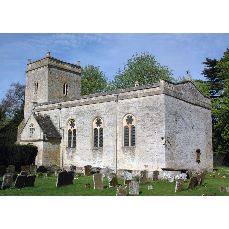
Copyright Statement: Image copyright © Motacilla, 2011
Image Source: digital photograph taken 6 April 2011 by Motacilla [https://commons.wikimedia.org/wiki/File:Weston_BlessedVirginMary_southeast.JPG] [accessed 25 October 2017]
Copyright Instructions: CC-BY-SA-3.0
view of church interior - nave - looking east
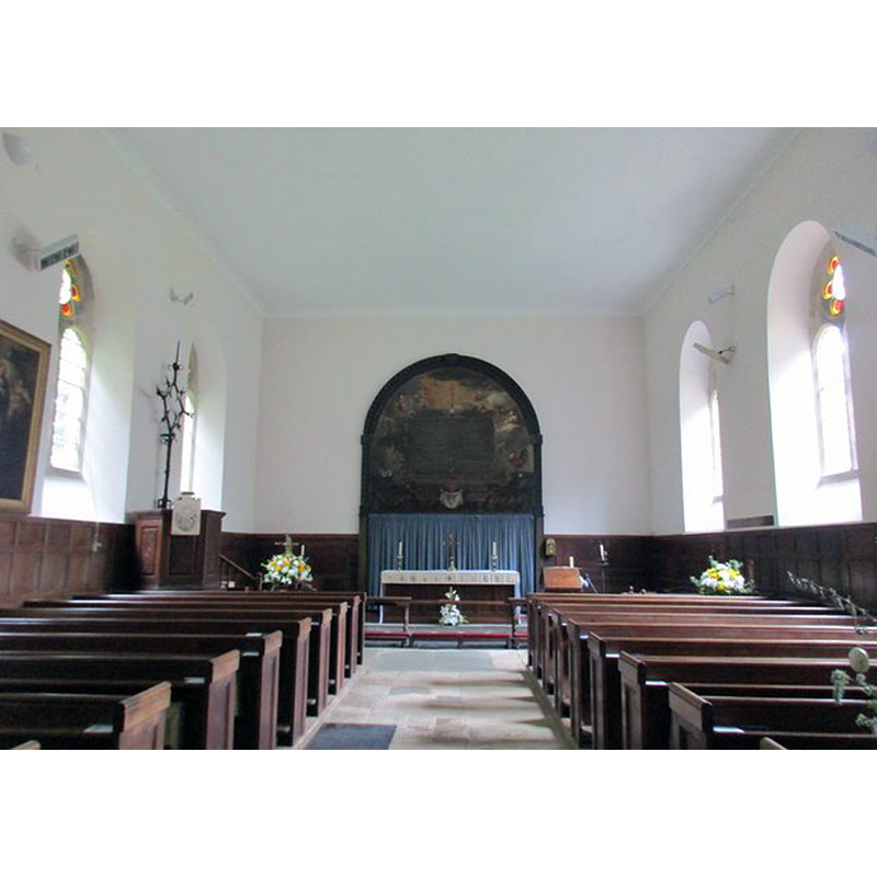
Scene Description: Source caption: "The body of the church dates from 1743 though the windows were gothicised in 1885".
Copyright Statement: Image copyright © Jonathan Thacker, 2017
Image Source: digital photograph taken 21 April 2017 by Jonathan Thacker [www.geograph.org.uk/photo/5365716] [accessed 25 October 2017]
Copyright Instructions: CC-BY-SA-2.0
view of font and cover in context
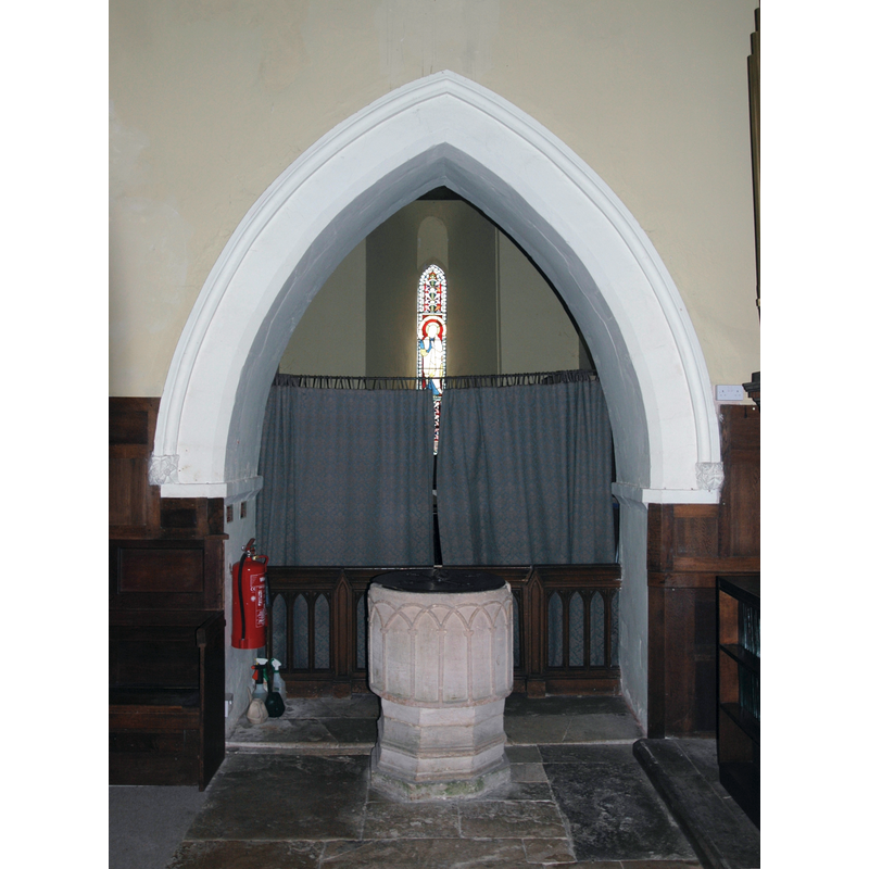
Scene Description: Source caption: "Font and tower arch of Church of England parish church of the Blessed Virgin Mary, Weston-on-the-Green, Oxfordshire".
Copyright Statement: Image copyright © Motacilla, 2011
Image Source: digital photograph taken 6 April 2011 by Motacilla [https://commons.wikimedia.org/wiki/File:Weston_BlessedVirginMary_TowerArch.JPG] [accessed 25 October 2017]
Copyright Instructions: CC-BY-SA-3.0
design element - motifs - moulding
Copyright Statement: Image copyright © Richard Croft, 2010
Image Source: digital photograph taken 27 July 2010 by Richard Croft [www.geograph.org.uk/photo/1997311] [accessed 25 October 2017]
Copyright Instructions: CC-BY-SA-2.0
INFORMATION
Font ID: 14485WES
Object Type: Baptismal Font1
Font Century and Period/Style: 12th century [basin only] [composite font], Medieval / composite
Church / Chapel Name: Parish Church of St. Mary
Font Location in Church: Inside the church, at the W end
Church Patron Saint(s): St. Mary the Virgin
Church Address: Church Lane, Weston-on-the-Green, Oxfordshire, OX25 3QS
Site Location: Oxfordshire, South East, England, United Kingdom
Directions to Site: Located 9-10 km SW of Bicester, 14 km NNE of Oxford
Ecclesiastic Region: Diocese of Oxford
Historical Region: Hundred of Ploughley -- Hundred of Kirtlington [in Domesday]
Additional Comments: composite font / altered font [later base]
Font Notes:
Click to view
There is an entry for Weston [-on-the-Green] [variant spelling] in the Domesday survey [http://opendomesday.org/place/SP5318/weston-on-the-green/] [accessed 25 October 2017], but it mentions neither priest nor church in it. Dunkin (1823) writes: "At the western end, within an highly ornamented semicircular recess, is the ancient font, sufficiently capacious to admit the immersion of the infant, as enjoined by the rubric; the outside is decorated by interesting arches." The Victoria County History (Oxford, vol. 6, 1959) remarks that "There was probably an 11th-century church at Weston [...] The present church is a plain rectangular building dating from the 18th century except for the western tower, which is probably 13th-century and belongs to an earlier medieval church [...] The 12th-century font is circular, with interlacing arcading on a moulded circular base of later date." Noted in Sherwood & Pevsner (1974): "Norman, tub-shaped, with intersecting blind arcading. The moulded octagonal base is later."
COORDINATES
UTM: 30U 621857 5747333
Latitude & Longitude (Decimal): 51.863463, -1.230284
Latitude & Longitude (DMS): 51° 51′ 48.47″ N, 1° 13′ 49.02″ W
MEDIUM AND MEASUREMENTS
Material: stone
Font Shape: round, mounted
Basin Interior Shape: round
Basin Exterior Shape: round
REFERENCES
- Victoria County History [online], University of London, 1993-. URL: https://www.british-history.ac.uk.
- Dunkin, John, Oxfordshire. The history and antiquities of the hundreds of Bullington and Ploughley, London: Harding, Mavor & Lepard, 1823, vol. 2: 200
- Pevsner, Nikolaus, Oxfordshire, Harmondsworth: Penguin Books, 1974, p. 833