Whitwell-on-the-Hill / Whitwell on the Hill / Witeuella / Witevella
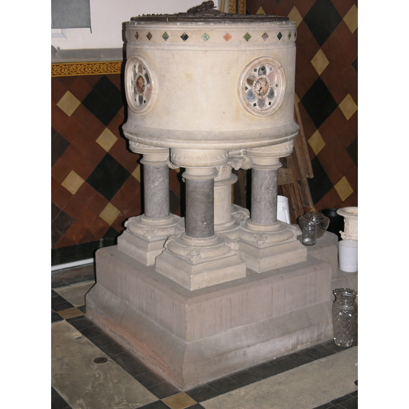
Image copyright © Colin Hinson, 2009
Standing permission
Results: 4 records
view of font and cover
Scene Description: the modern font
Copyright Statement: Image copyright © Colin Hinson, 2009
Image Source: digital photograph taken 12 April 2009 by Colin Hinson [www.yorkshireCDbooks.com]
Copyright Instructions: Standing permission
view of basin - interior
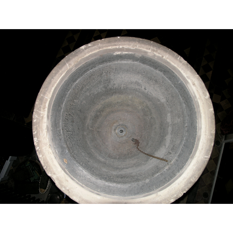
Scene Description: the modern font
Copyright Statement: Image copyright © Colin Hinson, 2009
Image Source: digital photograph taken 12 April 2009 by Colin Hinson [www.yorkshireCDbooks.com]
Copyright Instructions: Standing permission
view of church exterior - north view
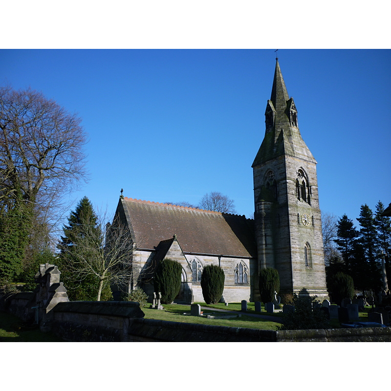
Scene Description: the modern church
Copyright Statement: Image copyright © Ian S, 2011
Image Source: digital photograph taken 8 February 2011 by Ian S [www.geograph.org.uk/photo/2262321] [accessed 12 May 2016]
Copyright Instructions: CC-BY-SA-2.0
view of font and cover in context
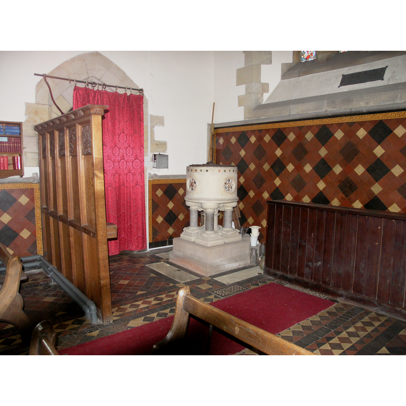
Scene Description: the modern font in the modern church
Copyright Statement: Image copyright © Colin Hinson, 2009
Image Source: digital photograph taken 12 April 2009 by Colin Hinson [www.yorkshireCDbooks.com]
Copyright Instructions: Standing permission
INFORMATION
Font ID: 14474WHI
Object Type: Baptismal Font1
Font Date: ca. 1858?
Font Century and Period/Style: 19th century (mid?), Victorian
Church / Chapel Name: Parish Church of St. John the Evangelist
Font Location in Church: Inside the church, at the W end of the nave, by the S entrance
Church Patron Saint(s): St. John the Evangelist
Church Notes: present church si mid-19thC by G.E. Street
Church Address: Whitwell-on-the-Hill, North Yorkshire YO60 7JJ
Site Location: North Yorkshire, Yorkshire and the Humber, England, United Kingdom
Directions to Site: Located on the A64, 1-2 km NW of Crambe, 10 km SW of Malton
Historical Region: Hundred of Bulford [in Domesday] -- formerly in the North Riding of Yorkshire
Font Notes:
Click to view
There is an entry for Whitwell [on the Hill] [variant spelling] in the Domesday survey [http://opendomesday.org/place/SE7265/whitwell-on-the-hill/] [accessed 12 May 2016], but it mentions neither cleric nor church in it. Whellan (1859) informs of a new church being built at the time at Whitwell "at the sole expense of Lady Lechmere [...] The building is of Gothic design, from the pencil of G. E. Street, Esq., architect [...] the pulpit and font will be of stone". The font is indeed of stone, a cylindrical basin with a row of lively coloured stone lozenges on a moulding around the upper basin side, four hexafoil-in-a-circle windows at 90-degree angles, also of coloured stones, on the sides; raised on five supports -centre shaft and four angle colonnettes- with capitals and bases, on a square lower base. The wooden cover is round and flat, with metal decoration and ring handle. Both font and cover probably of the date of the church itself, ca. 1858. [NB: we found no record of an earlier church here].
Credit and Acknowledgements: We are grateful to Colin Hinson, of www.yorkshireCDbooks.com, for his photographs of church and font
COORDINATES
UTM: 30U 637711 5994810
Latitude & Longitude (Decimal): 54.083036, -0.894793
Latitude & Longitude (DMS): 54° 4′ 58.93″ N, 0° 53′ 41.26″ W
MEDIUM AND MEASUREMENTS
Material: stone
Font Shape: cylindrical, mounted
Basin Interior Shape: round
Basin Exterior Shape: round
Drainage System: centre hole in basin
Drainage Notes: lead-lined
LID INFORMATION
Date: 19th-century
Material: wood
Apparatus: no
Notes: [cf. FontNotes]
REFERENCES
- Whellan & Co., T., History and topography of the city of York and the North Riding of Yorkshire, embracing a […], Beverley: printed for the publishers by John Green, Market Place, 1859, vol. 2: 599