Hemington nr. Frome / Hamitone
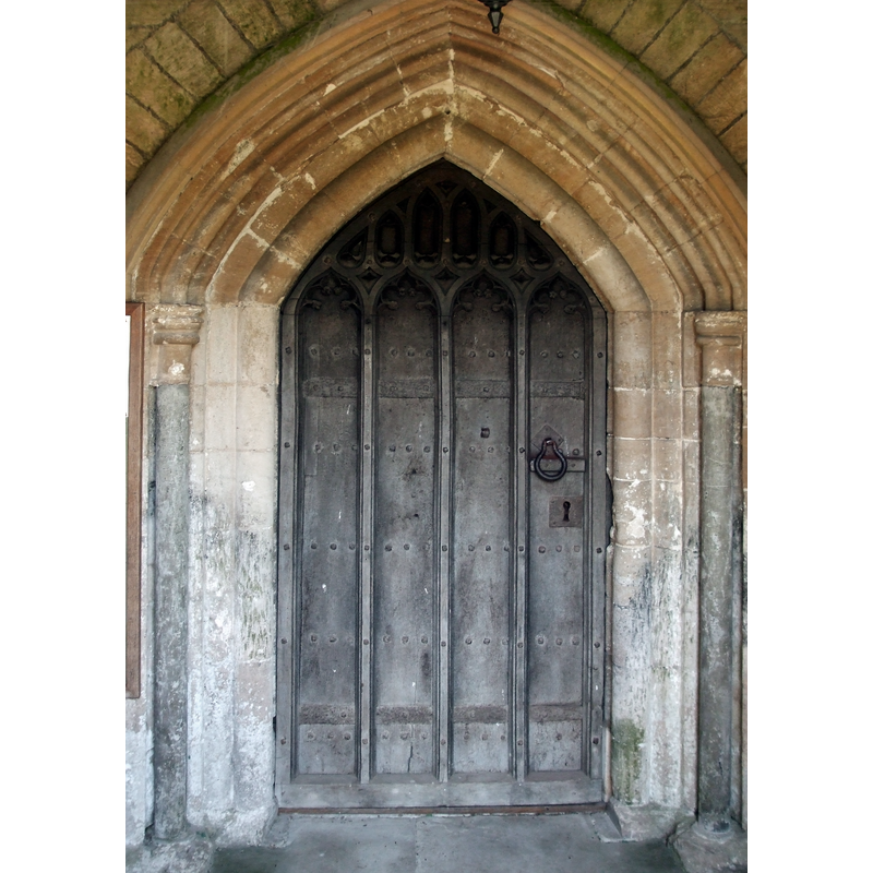
Image copyright © Neil Owen, 2019
CC-BY-SA-2.0
Results: 8 records
view of church exterior - south portal
Scene Description: Source caption: "South door of Hemington's church. A suitably heavy wood and iron door."
Copyright Statement: Image copyright © Neil Owen, 2019
Image Source: digital photograph taken 4 July 2019 by Neil Owen [www.geograph.org.uk/photo/6202420] [accessed 11 October 2019]
Copyright Instructions: CC-BY-SA-2.0
view of church exterior - south porch - archivolt
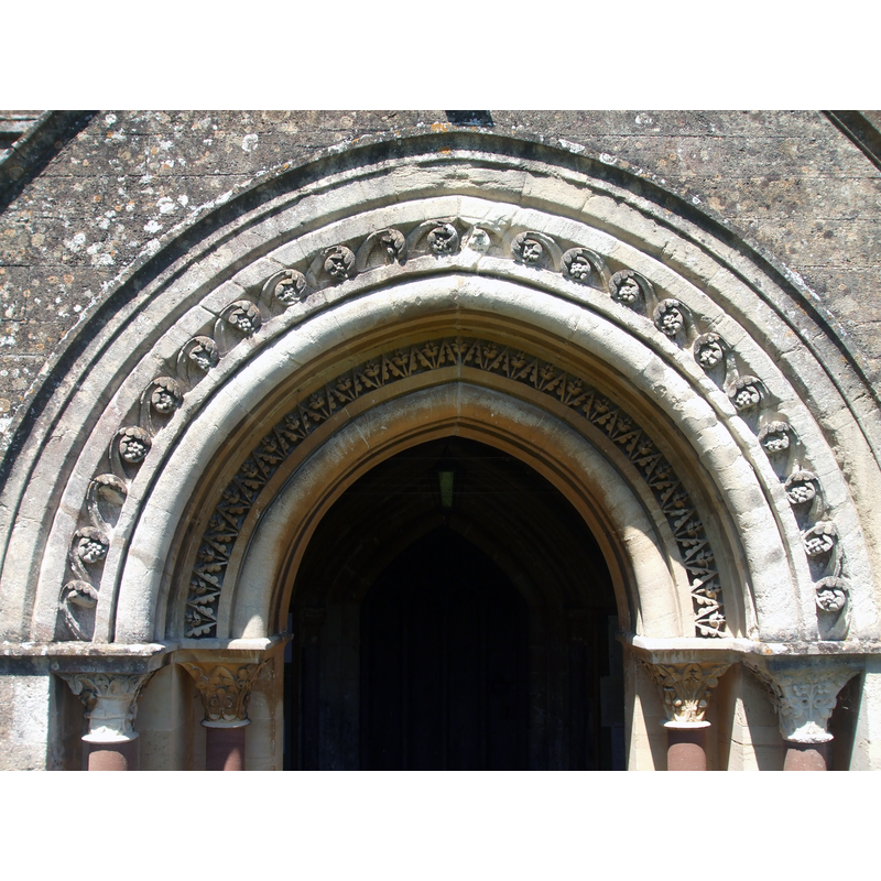
Scene Description: Source: "South porch detail. Although based on a Norman style, the porch is actually Victorian (1856) and believed to have been produced by the office of Sir Gilbert Scott."
Copyright Statement: Image copyright © Neil Owen, 2019
Image Source: digital photograph taken 4 July 2019 by Neil Owen [www.geograph.org.uk/photo/6202392] [accessed 11 October 2019]
Copyright Instructions: CC-BY-SA-2.0
view of church exterior - detail - south porch
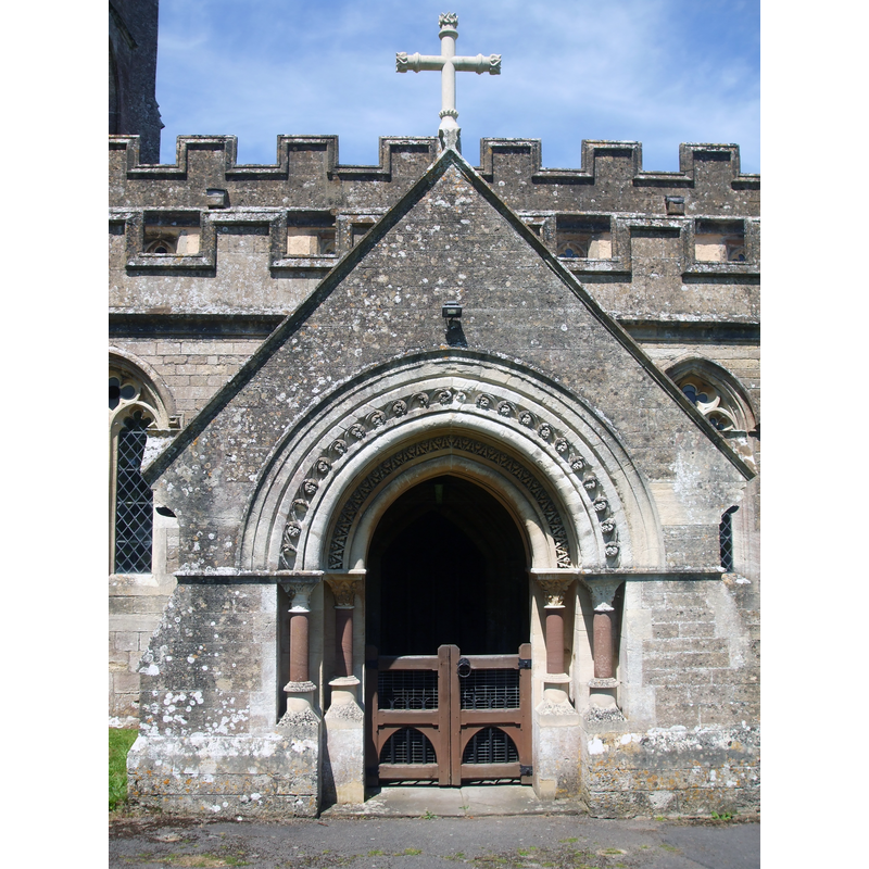
Copyright Statement: Image copyright © Neil Owen, 2019
Image Source: digital photograph taken 4 July 2019 by Neil Owen [www.geograph.org.uk/photo/6202389] [accessed 11 October 2019]
Copyright Instructions: CC-BY-SA-2.0
view of church exterior - north view
Copyright Statement: Image copyright © Neil Owen, 2019
Image Source: digital photograph taken 4 July 2019 by Neil Owen [www.geograph.org.uk/photo/6202364] [accessed 11 October 2019]
Copyright Instructions: CC-BY-SA-2.0
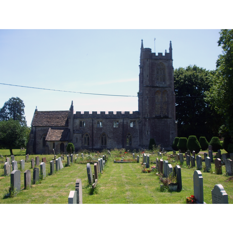
view of church exterior - southeast view
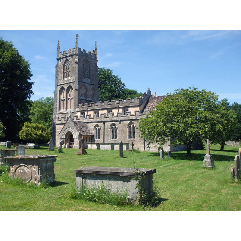
Copyright Statement: Image copyright © Neil Owen, 2019
Image Source: digital photograph taken 4 July 2019 by Neil Owen [www.geograph.org.uk/photo/6200760] [accessed 11 October 2019]
Copyright Instructions: CC-BY-SA-2.0
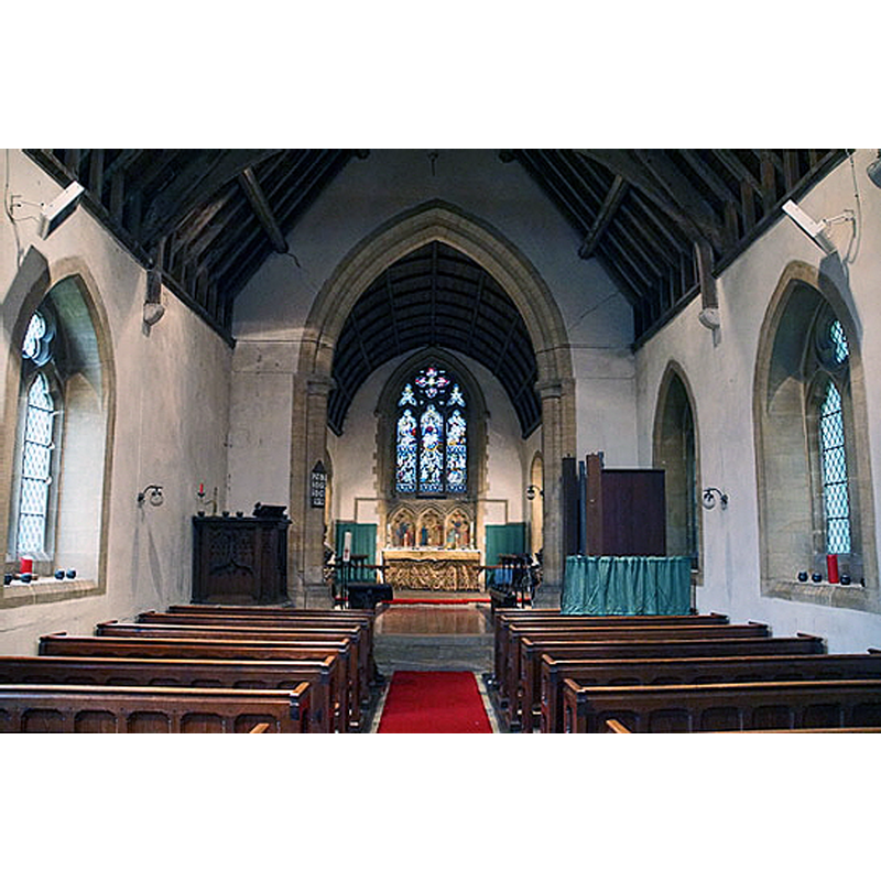
view of church interior - looking southeast
Scene Description: Source caption: "Inside St Mary's, Hemington. The church has roots in the thirteenth century, with additions in the fourteenth, fifteenth, seventeenth and nineteenth. The pews are sixteenth century."
Copyright Statement: Image copyright © Neil Owen, 2019
Image Source: digital photograph taken 4 July 2019 by Neil Owen [www.geograph.org.uk/photo/6202413] [accessed 11 October 2019]
Copyright Instructions: CC-BY-SA-2.0
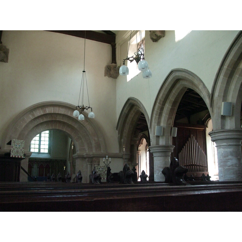
view of church interior - looking west
Scene Description: the old font is partially visible at the far end, by the south entranceway
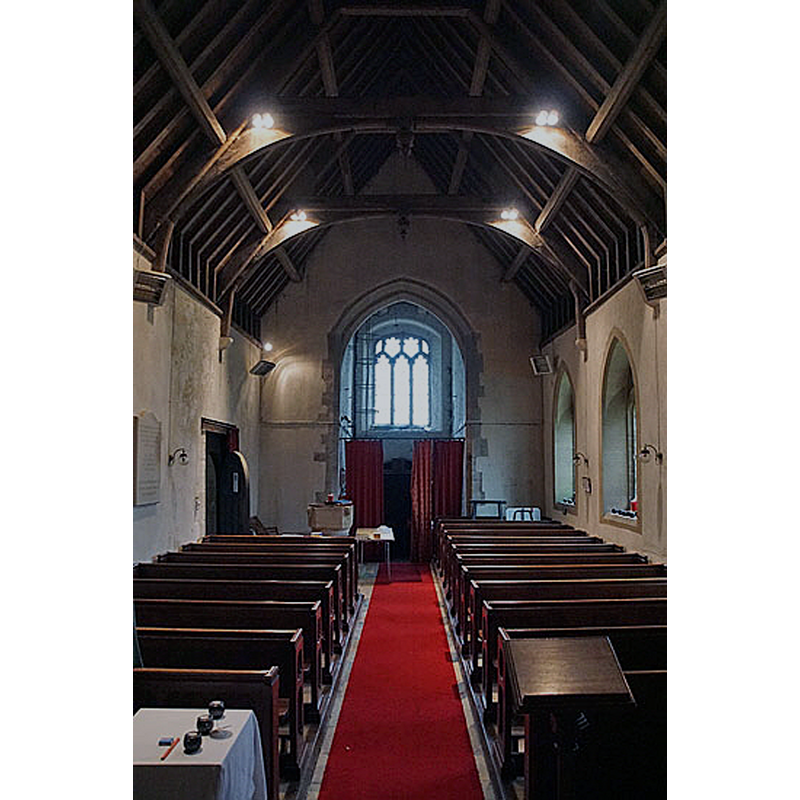
view of church interior - looking east
INFORMATION
Font ID: 14464HEM
Object Type: Baptismal Font1
Font Century and Period/Style: 12th century, Late Norman
Church / Chapel Name: Parish Church of St. Mary
Font Location in Church: Inside the church, near in the chancel, S aisle, near the E wall
Church Patron Saint(s): St. Mary the Virgin
Church Notes: present church Perpendicular; modified mi-17thC; modified late-19thC
Church Address: Southfield Hill, Hemington, Somerset, BA3 5XX, UK
Site Location: Somerset, South West, England, United Kingdom
Directions to Site: Located odd (NE) the A362, near Faulkland, 8-9 km NW of Frome
Historical Region: Hundred of Kilmersdon
Font Notes:
Click to view
There is an entry for this Hemington [variant spelling] in the Domesday survey [https://opendomesday.org/place/ST7253/hemington/] [accessed 11 October 2019] but it mentions neither cleric nor church in it. Pevsner (1958) describes the font: "Plain, circular, Norman, with two friezes of lobes." The entry for this church in Historic England [Listing NGR: ST7273453026] reports a "Norman tub font" in it. Described in the Hardington Vale Group of Churches [www.hardingtonvale.org.uk/Hist_Hemington.html] [accessed 13 April 2009]: "circular font decorated with a double ring of scallops" and dated to the Norman period, as is the church itself. The entry for this church in the CRSBI (2019) notes: "Putative Saxon remains have also been discovered nearby [...] Font. Unusually placed near the E wall, in the S aisle of the chancel, level with the steps of the high altar, with plenty of ambient space since there are no pews here. In the usual white local limestone, it is in quite good condition. It seems all of a piece and date, its design nicely balanced and eschewing all but the boldest decoration. Without plinth below, the base is a variation on the conventional chamfered ring, with a shallow roll between the bottom-most ring and chamfer as well as a lighter roll above the chamfer. Some renewal appears to have been effected at the present WNW. The relatively shallow stem is rather ostentatiously marked off top and bottom by astragals of different profile (round below, flat-sided above); it also carries a large roll round its middle. The bowl is almost straight-sided except for the incurved bottom. A roll runs round the bottom, above the lowest element, a straight-sided ring. The top of the bowl has a prominent chamfer. The bowl has been finished in such a way as to leave large bold scallops hanging from the top chamfer and rising from the bottom roll. Close inspection of the upper row of scallops, especially at the present SW (where there is evident damage), might lead one to deduce that the top chamfer is not an original feature and that the two rows of scallops were originally better matched in size. Lead lining (in fair condition) is brought up and across the whole of the rim. There are still lock-fittings visible at the present E and SW."
COORDINATES
UTM: 30U 542150 5681133
Latitude & Longitude (Decimal): 51.27997, -2.39566
Latitude & Longitude (DMS): 51° 16′ 47.89″ N, 2° 23′ 44.38″ W
MEDIUM AND MEASUREMENTS
Material: stone
Font Shape: tub-shaped, mounted
Basin Interior Shape: round
Basin Exterior Shape: round
Drainage Notes: lead-lined
Rim Thickness: 5 cm [calculated]
Diameter (inside rim): 57 cm*
Diameter (includes rim): 67 cm*
Basin Depth: 26 cm*
Basin Total Height: 40 cm*
Font Height (less Plinth): 94.5 cm*
REFERENCES
- Corpus of Romanesque Sculpture in Britain and Ireland, The Corpus of Romanesque Sculpture in Britain and Ireland, The Corpus of Romanesque Sculpture in Britain and Ireland. URL: http://www.crsbi.ac.uk.