Aston Sandford / Astun Samford / Estone
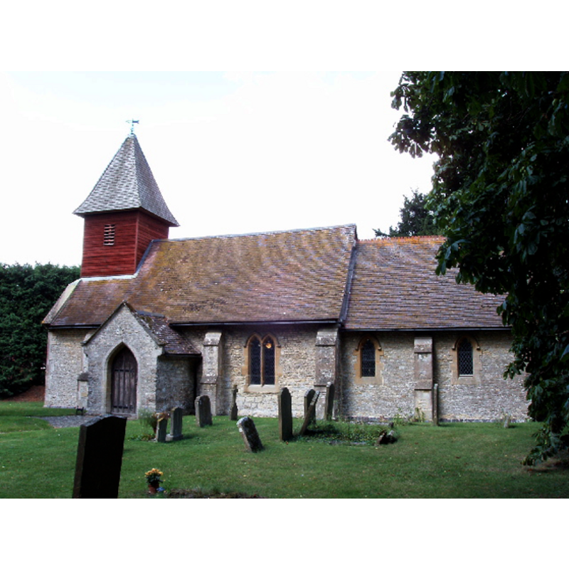
Image copyright © David Hawgood, 2005
CC-BY-SA-2.0
Results: 2 records
view of church exterior - south view
Copyright Statement: Image copyright © David Hawgood, 2005
Image Source: digital photograph taken 26 August 2005 by David Hawgood [www.geograph.org.uk/photo/43431] [accessed 11 January 2012]
Copyright Instructions: CC-BY-SA-2.0
view of font
![the modern font [cf. FontNotes]](/static-50478a99ec6f36a15d6234548c59f63da52304e5/others/permission_not_available.jpg)
Scene Description: the modern font [cf. FontNotes]
Copyright Statement: Image copyright © Rex Harris, 2014
Image Source: digital photograph taken 4 July 2014 by Rex Harris [www.flickr.com/photos/sheepdog_rex/14556801616] [accessed 2 December 2015]
Copyright Instructions: PERMISSION NOT AVAILABLE -- IMAGE NOT FOR PUBLIC USE
INFORMATION
Font ID: 14448AST
Object Type: Baptismal Font1?
Font Century and Period/Style: 12th century, Norman
Church / Chapel Name: Parish Church of St. Michael and All Angels
Church Patron Saint(s): St. Michael & All Angels
Church Address: Aston Sandford, Buckinghamshire, HP17 8JB
Site Location: Buckinghamshire, South East, England, United Kingdom
Directions to Site: Located 5 km ENE of Thame
Ecclesiastic Region: Diocese of Oxford
Historical Region: Hundred of Ashendon
Additional Comments: disappeared font? (the one from the 12thC church here)
Font Notes:
Click to view
There are three entries for Aston Sandford [variant spelling] in the Domesday survey [http://opendomesday.org/place/SP7507/aston-sandford/] [accessed 2 December 2015], none of which mention cleric or church in it. Parker (1850) reports a modern font in this church. Parker (1850) and Sheahan (1862) report a modern font in this re-built church. The Victoria County History (Buckingham, vol. 4, 1927) notes: "The building was so considerably restored in 1878, its details being retooled and reset, that it is now difficult to assign accurate dates to its parts. The nave probably dates from the 12th century, the chancel from the 13th century [...]" but does not mention an early font. The present font consists of a tapering polygonal basin raised on a very Victorian base that includes a colour marble stem; if it is from the 1878 restoration of this church it would mean that Parker and Sheahan [cf. supra] saw anothern modern font here. [NB: the fabric of the building goes back to the 12th century [the nave] and the 13th century [the chancel], but we have no information on the earlier font(s) of this church].
COORDINATES
UTM: 30U 644606 5736842
Latitude & Longitude (Decimal): 51.76377, -0.9045
Latitude & Longitude (DMS): 51° 45′ 49.57″ N, 0° 54′ 16.2″ W
REFERENCES
- Victoria County History [online], University of London, 1993-. URL: https://www.british-history.ac.uk.
- Parker, John Henry, The Ecclesiastical and architectural topography of England: Oxfordshire, Oxford, London: Published under the sanction of the Central Commitee of the Archaeological Institute of Great Britain and Ireland [by] John Henry Parker, 1850, [entry no.] 147
- Sheahan, James Joseph, History and topography of Buckinghamshire, comprising a general survey of the county, preceded by an epitome of the early history of Great Britain, London; Pontefract: Longman, Green, Longman, and Roberts; William Edward Bonas [...], 1862, p. 331