Ickford / Hicford / Hitford / Ickeforde / Iforde / Ikeford / Ycford
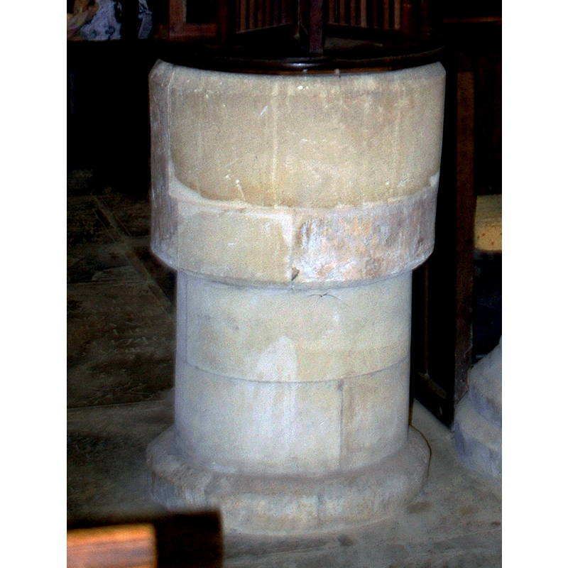
Image copyright © Motacilla, 2011
CC-BY-SA-2.0
Results: 5 records
view of font
Scene Description: the drastically re-tooled 13thC font
Copyright Statement: Image copyright © Motacilla, 2011
Image Source: edited detail of a digital photograph taken 6 March 2011 by Motacilla [https://commons.wikimedia.org/wiki/File:Ickford_StNicholas_font.jpg] [accessed 3 December 2015]
Copyright Instructions: CC-BY-SA-2.0
view of church exterior - northwest view
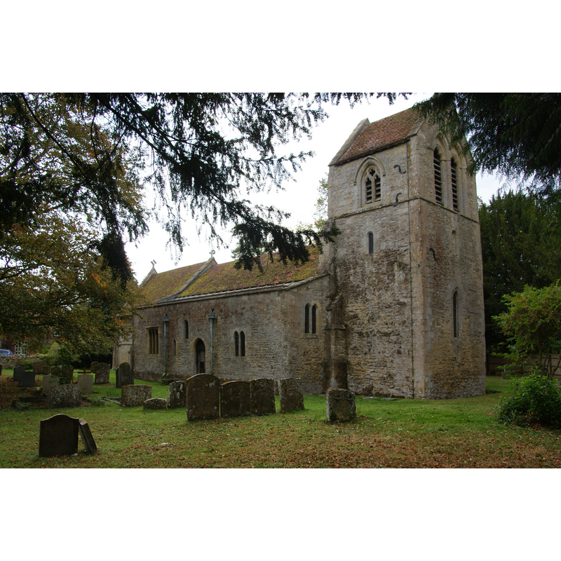
Copyright Statement: Image copyright © Bill Boaden, 2011
Image Source: digital photograph tane 23 October 2011 by Bill Boaden [www.geograph.org.uk/photo/2671512] [accessed 3 December 2015]
Copyright Instructions: CC-BY-SA-2.0
view of church exterior - south view
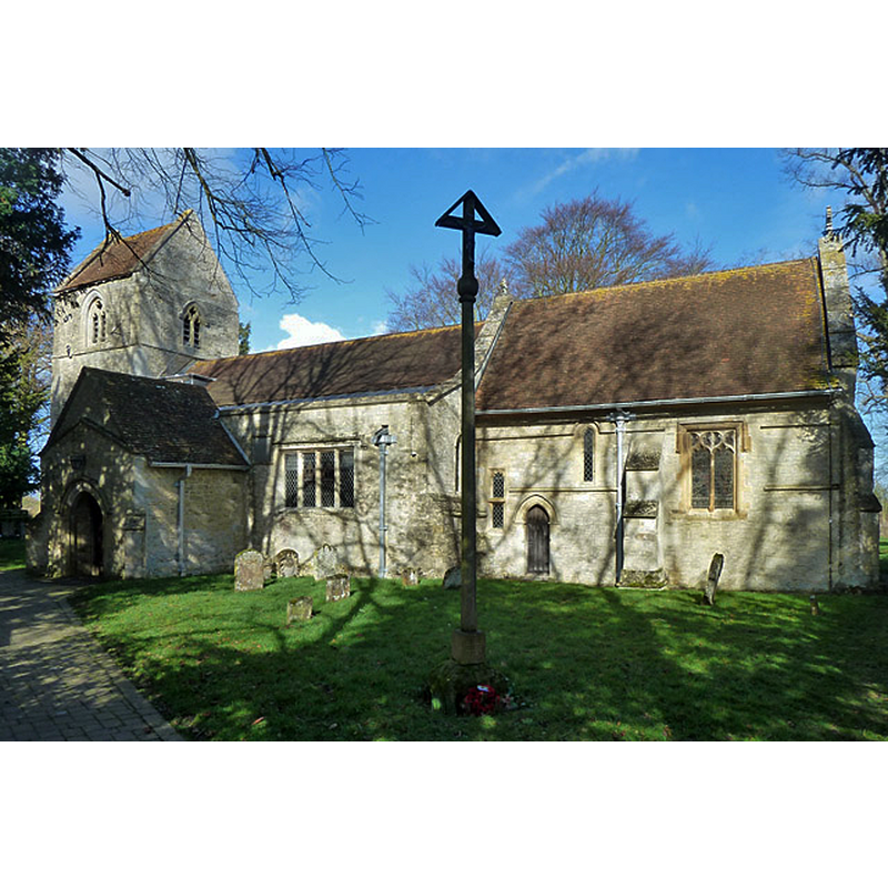
Copyright Statement: Image copyright © Robin Webster, 2014
Image Source: digital photograph taken 22 February 2014 by Robin Webster [www.geograph.org.uk/photo/3857495] [accessed 3 December 2015]
Copyright Instructions: CC-BY-SA-2.0
view of font and cover in context
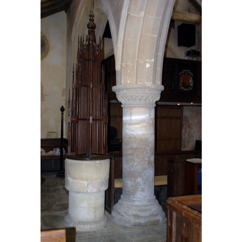
Scene Description: the cover is 20thC
Copyright Statement: Image copyright © Motacilla, 2011
Image Source: digital photograph taken 6 March 2011 by Motacilla [https://commons.wikimedia.org/wiki/File:Ickford_StNicholas_font.jpg] [accessed 3 December 2015]
Copyright Instructions: CC-BY-SA-2.0
view of church interior - nave - looking east
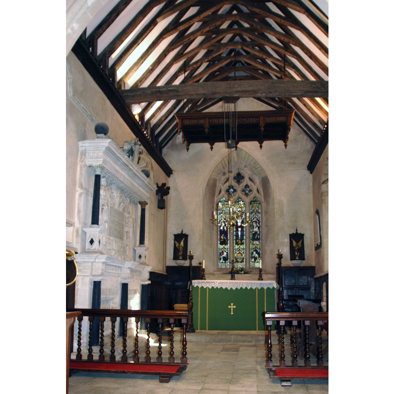
Scene Description: view of the chancel from the nave
Copyright Statement: Image copyright © Motacilla, 2011
Image Source: digital photograph taken 6 March 2011 by Motacilla [https://commons.wikimedia.org/wiki/File:Ickford_StNicholas_Chancel_interior.jpg] [accessed 3 December 2015]
Copyright Instructions: CC-BY-SA-2.0
INFORMATION
Font ID: 14447ICK
Object Type: Baptismal Font1
Font Century and Period/Style: 13th century, Early English
Church / Chapel Name: Parish Church of St. Nicholas
Font Location in Church: Inside the church, in the W end of the S aisle, just W of the S door
Church Patron Saint(s): St. Nicholas of Myra
Church Address: Church Road, Ickford, Buckinghamshire, HP18 9HZ
Site Location: Buckinghamshire, South East, England, United Kingdom
Directions to Site: Located off (E) the M40, 3 km N of the junction with the A40, 6 km NW of Thame,14 km E of Oxford, 21 km WSW of Aylesbury, by the border with Oxon.
Ecclesiastic Region: Diocese of Oxford
Historical Region: Hundred of Ixhill [in Domesday] -- Hundred of Ashendon
Additional Comments: altered font: drastically re-tooled -- disappeared font? (the one from the late-12thC church here)
Font Notes:
Click to view
There are two entries for Ickford [variant spelling] in the Domesday survey [http://opendomesday.org/place/SP6407/ickford/] [accessed 3 December 2015], neither of which mentions cleric or church in it. Parker (1850) writes: "The font is plain, round, on a solid base, probably E[arly] E[nglish]." Lipscomb (1831- ) describes it as "large and ancient". In Sheahan (1862) as "large, plain, and circular". The Victoria County History (Buckingham, vol. 4, 1927) notes: "Reference to Ickford Church occurs first in 1194–5 [...] The present building dates in the main from about 1210 [...] The font has a plain round bowl and may be of the 13th century." The web site of the Friends of Ickford Church [www.ickfordchurchfriends.com/history/] [accessed 11 April 2009] notes: "the greater part of the fittings are the handiwork of Canon Vernon Stanley, Rector 1911-1933. The elaborate font-cover, the tester above the altar, standard candlesticks altar rails, lectern, stools and benches were all made by Stanley in his workshop at the Rectory", but does not mention the font itself. Described and illustrated in the CRSBI (2015): "The work recorded here, including the plain font, probably comes from a single campaign at the end of the 12thc or the beginning of the 13thc. [...] In the S aisle, alongside pier 2. The font has an almost cylindrical bowl, very slightly wider at the top that the bottom, with chamfered upper and lower rims. It stands on a cylindrical stem made of ashlar blocks, and this on a plain chamfered base. The bowl has been extensively restored, but is substantially medieval. It is lead lined and has rim repairs at W and N, and a large inserted repair at the E. The W section of the bowl is best preserved. The stem is modern, but the base appears original."
COORDINATES
UTM: 30U 633501 5736290
Latitude & Longitude (Decimal): 51.761568, -1.065532
Latitude & Longitude (DMS): 51° 45′ 41.65″ N, 1° 3′ 55.91″ W
MEDIUM AND MEASUREMENTS
Material: stone
Font Shape: cylindrical, mounted
Basin Interior Shape: round
Basin Exterior Shape: round
Drainage Notes: lead-lined
Rim Thickness: 10.25 cm [calculated]
Diameter (inside rim): 49 cm*
Diameter (includes rim): 70 cm*
Basin Total Height: 47 cm*
Font Height (less Plinth): 100 cm*
Notes on Measurements: * CRSBI (2015)
LID INFORMATION
Date: 20th-century (early)
Material: wood, oak?
Notes: [cf. FontNotes]
REFERENCES
- Victoria County History [online], University of London, 1993-. URL: https://www.british-history.ac.uk.
- Corpus of Romanesque Sculpture in Britain and Ireland, The Corpus of Romanesque Sculpture in Britain and Ireland, The Corpus of Romanesque Sculpture in Britain and Ireland. URL: http://www.crsbi.ac.uk.
- Lipscomb, George, The History and Antiquities of the County of Buckingham, London: J.B. Nichols, 1831-1843, vol. 1: 285
- Parker, John Henry, The Ecclesiastical and architectural topography of England: Oxfordshire, Oxford, London: Published under the sanction of the Central Commitee of the Archaeological Institute of Great Britain and Ireland [by] John Henry Parker, 1850, [entry no.] 158
- Sheahan, James Joseph, History and topography of Buckinghamshire, comprising a general survey of the county, preceded by an epitome of the early history of Great Britain, London; Pontefract: Longman, Green, Longman, and Roberts; William Edward Bonas [...], 1862, p. 391