Shabbington / Shobbington / Shobindon / Shobington / Sobinton / Sobintone
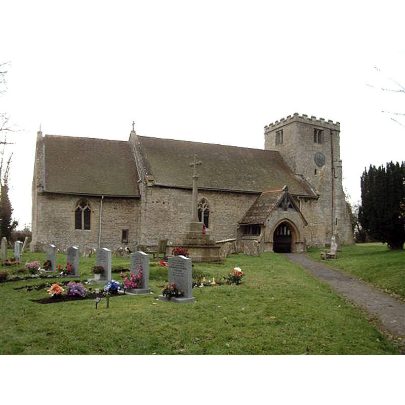
Image copyright © Colin Bates, 2005
CC-BY-SA-2.0
Results: 3 records
view of church exterior - north view
Copyright Statement: Image copyright © Colin Bates, 2005
Image Source: digital photograph taken 13 December 2005 by Colin Bates [www.geograph.org.uk/photo/90783] [accessed 4 January 2016]
Copyright Instructions: CC-BY-SA-2.0
view of church exterior - southeast view
![EXT SE digital photograph taken 23 October 2011 by Bill Boaden [www.geograph.org.uk/photo/2674042] [accessed 4 January 2016]
EXT NE digital photograph taken 13 December 2005 by Colin Bates [www.geograph.org.uk/photo/90783] [accessed 4 January 2016]
INT W digital photograph taken 31 July 2009 by Gerald Massey [www.geograph.org.uk/photo/1484768] [accessed 4 January 2016]](/static-50478a99ec6f36a15d6234548c59f63da52304e5/compressed/1160104003_compressed.png)
Scene Description: EXT SE digital photograph taken 23 October 2011 by Bill Boaden [www.geograph.org.uk/photo/2674042] [accessed 4 January 2016]
EXT NE digital photograph taken 13 December 2005 by Colin Bates [www.geograph.org.uk/photo/90783] [accessed 4 January 2016]
INT W digital photograph taken 31 July 2009 by Gerald Massey [www.geograph.org.uk/photo/1484768] [accessed 4 January 2016]
Copyright Statement: Image copyright © Bill Boaden, 2011
Image Source: digital photograph taken 23 October 2011 by Bill Boaden [www.geograph.org.uk/photo/2674042] [accessed 4 January 2016]
Copyright Instructions: CC-BY-SA-2.0
view of church interior - nave - looking west
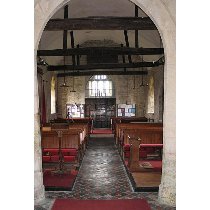
Copyright Statement: Image copyright © Gerald Massey, 2009
Image Source: digital photograph taken 31 July 2009 by Gerald Massey [www.geograph.org.uk/photo/1484768] [accessed 4 January 2016]
Copyright Instructions: CC-BY-SA-2.0
INFORMATION
Font ID: 14443SHA
Object Type: Baptismal Font1
Font Century and Period/Style: 12th - 14th century [re-tooled], Medieval [altered]
Church / Chapel Name: Parish Church of St. Mary Magdalene
Font Location in Church: Inside the church, at the W end of the nave
Church Patron Saint(s): St. Mary Magdalene
Church Address: Mill Rd, Shabbington, Buckinghamshire, HP18 9HQ
Site Location: Buckinghamshire, South East, England, United Kingdom
Directions to Site: Located off (N) the A418, 4 km WNW of Thame, 11 WSW of Aylesbury, by the border with Oxon.
Ecclesiastic Region: Diocese of Oxford
Historical Region: Hundred of Ixhill [in Domesday] -- Hundred of Ashendon
Additional Comments: altered font / scraped / re-tooled? -- disappeared font? the one from the 11thC chcurch here?)
Font Notes:
Click to view
There is an entry for Shabbington [variant spelling] in thttp://opendomesday.org/place/SP6606/shabbington/he Domesday survey [http://opendomesday.org/place/SP6606/shabbington/] [accessed 4 January 2016], but it mentions neither cleric nor church in it. A font here is noted in Lipscomb (1831- ): "The font near the west end of the nave is large and octagonal, and its pedestal of correspondent form." The Victoria County History (Buckingham, vol. 4, 1927) notes: " A vicarage was ordained in Shabbington in 1221, the advowson and the rectory then belonging to Wallingford Priory [...] The walls of the nave and chancel, which are of rubble incorporating herring-bone work, are partly of late 11th-century date, but no contemporary detail survives [...] The church was restored in 1882 [...] The font is probably mediaeval, but has been so scraped that it is impossible to date it with certainty. The bowl is plain and octagonal, and stands upon a tapering stem."
COORDINATES
UTM: 30U 635550 5735668
Latitude & Longitude (Decimal): 51.755486, -1.036102
Latitude & Longitude (DMS): 51° 45′ 19.75″ N, 1° 2′ 9.97″ W
MEDIUM AND MEASUREMENTS
Material: stone
Font Shape: octagonal, mounted
Basin Interior Shape: round
Basin Exterior Shape: octagonal
LID INFORMATION
Date: modern
Material: wood
Apparatus: no
REFERENCES
- Victoria County History [online], University of London, 1993-. URL: https://www.british-history.ac.uk.
- Lipscomb, George, The History and Antiquities of the County of Buckingham, London: J.B. Nichols, 1831-1843, vol. 1: 453
- Parker, John Henry, The Ecclesiastical and architectural topography of England: Oxfordshire, Oxford, London: Published under the sanction of the Central Commitee of the Archaeological Institute of Great Britain and Ireland [by] John Henry Parker, 1850, [entry no.] 167
- Sheahan, James Joseph, History and topography of Buckinghamshire, comprising a general survey of the county, preceded by an epitome of the early history of Great Britain, London; Pontefract: Longman, Green, Longman, and Roberts; William Edward Bonas [...], 1862, p. 426