Stoke Talmage
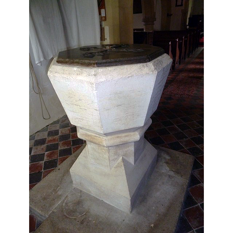
Image copyright © Basher Eyre, 2014
CC-BY-SA-2.0
Results: 4 records
view of font and cover
Scene Description: the modern font
Copyright Statement: Image copyright © Basher Eyre, 2014
Image Source: digital photograph taken 17 April 2014 by Basher Eyre [www.geograph.org.uk/photo/3980576] [accessed 1 November 2017]
Copyright Instructions: CC-BY-SA-2.0
view of church exterior - south view
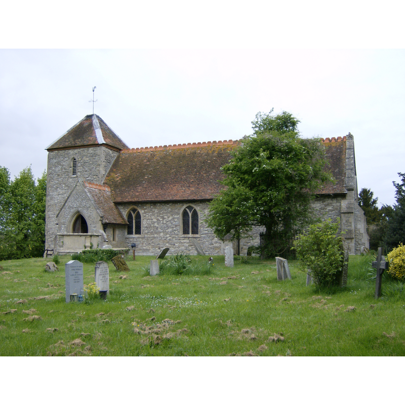
Copyright Statement: Image copyright © Sealman, 4 May 2009
Image Source: digital photograph taken 4 May 2009 by Sealman [https://commons.wikimedia.org/wiki/File:St_Mary_Magdalen_Church_Stoke_Talmage.JPG] [accessed 1 November 2017]
Copyright Instructions: GFDL / CC-BY-SA-3.0
view of font and cover in context
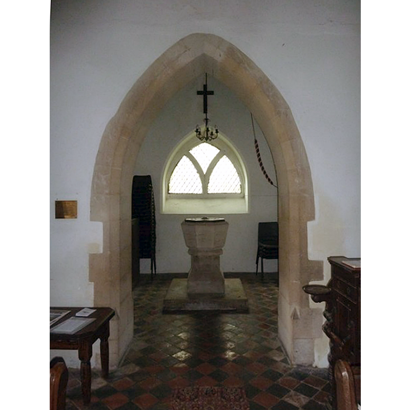
Scene Description: view of the tower arch, and of the modern font and cover beneath the tower
Copyright Statement: Image copyright © Basher Eyre, 2014
Image Source: digital photograph taken 17 April 2014 by Basher Eyre [www.geograph.org.uk/photo/3980604] [accessed 1 November 2017]
Copyright Instructions: CC-BY-SA-2.0
view of church interior - nave - looking east
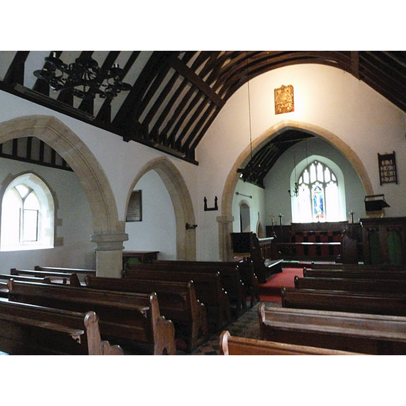
Copyright Statement: Image copyright © Basher Eyre, 2014
Image Source: digital photograph taken 17 April 2014 by Basher Eyre [www.geograph.org.uk/photo/3980610] [accessed 1 November 2017]
Copyright Instructions: CC-BY-SA-2.0
INFORMATION
Font ID: 14380STO
Object Type: Baptismal Font1
Font Century and Period/Style: 12th - 14th century, Medieval
Church / Chapel Name: Parish Church of St. Mary Magdalene
Font Location in Church: [cf. FontNotes]
Church Patron Saint(s): St. Mary Magdalene
Church Address: Stoke Talmage, Oxfordshire, OX9 7EV, UK
Site Location: Oxfordshire, South East, England, United Kingdom
Directions to Site: Located 3 km SSW of Tetsworth
Ecclesiastic Region: Diocese of Oxford
Historical Region: Hundred of Pyrton
Font Notes:
Click to view
No entry found for Stoke Talmage in the Domesday survey. The Victoria County History (Oxford, vol. 8, 1964) notes: "The early history of the church is confused. The first clear reference to it is in 1219, but the history of the advowson suggests an 11th-century origin at the latest [...] The medieval church was largely rebuilt in the 18th and 19th centuries; the tower is mainly 18th-century work, but the belfry windows may be older [...] There is a Victorian font", but a footnote informs of the earlier font: "For a sketch of the medieval font see MS. Top. Eccles. b 14 [i.e., the collection at the Bodleian Library][to be completed]
COORDINATES
UTM: 30U 636823 5728134
Latitude & Longitude (Decimal): 51.687473, -1.020622
Latitude & Longitude (DMS): 51° 41′ 14.9″ N, 1° 1′ 14.24″ W
REFERENCES
- Victoria County History [online], University of London, 1993-. URL: https://www.british-history.ac.uk.