Chesterton / Cestedone / Cestreton / Cestretone / Chesterton Green
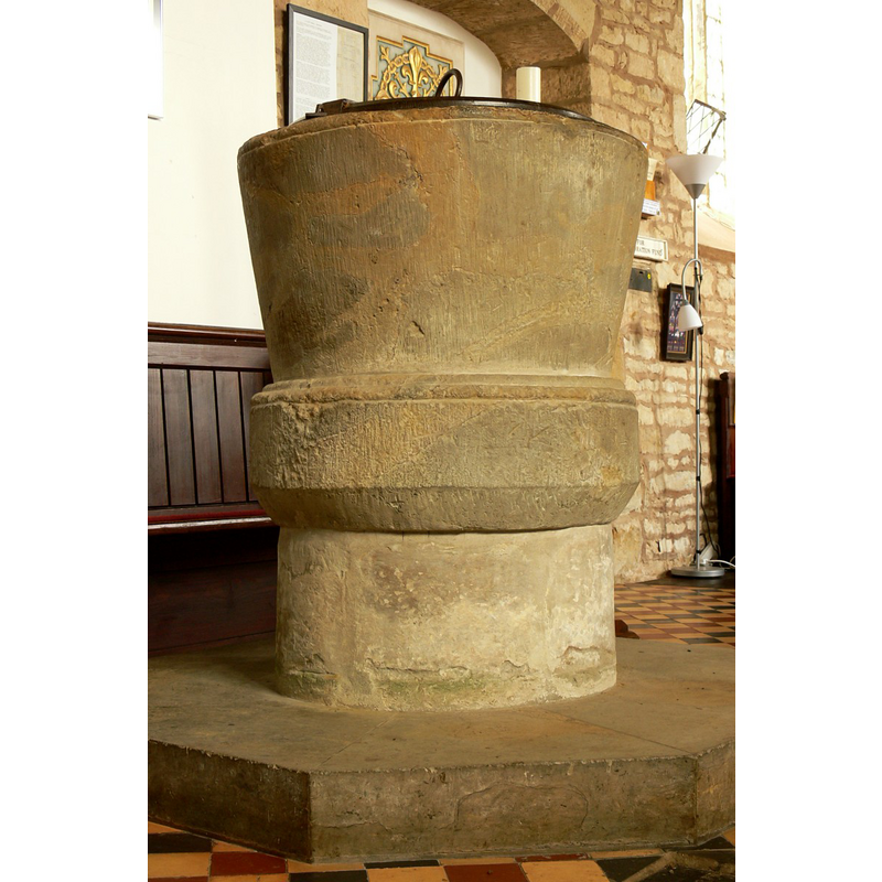
Image copyright © Walwyn, 2009
Standing permission + Creative Commons Licence [http://creativecommons.org/licenses/by-nc-sa/2.0/] [accessed 27 March 2009]
Results: 4 records
view of font
Copyright Statement: Image copyright © Walwyn, 2009
Image Source: digital photograph taken 28 February 2009 by Walwyn [www.flickr.com/photos/overton_cat] [accessed 27 March 2009]
Copyright Instructions: Standing permission + Creative Commons Licence [http://creativecommons.org/licenses/by-nc-sa/2.0/] [accessed 27 March 2009]
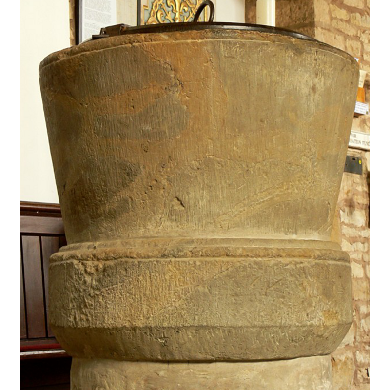
design element - motifs - moulding
Copyright Statement: Image copyright © Walwyn, 2009
Image Source: detail of a digital photograph taken 28 February 2009 by Walwyn [www.flickr.com/photos/overton_cat] [accessed 27 March 2009]
Copyright Instructions: Standing permission + Creative Commons Licence [http://creativecommons.org/licenses/by-nc-sa/2.0/] [accessed 27 March 2009]
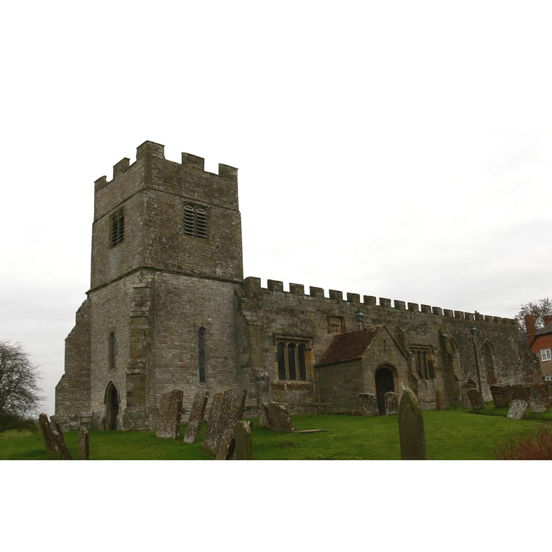
view of church exterior - southwest view
Copyright Statement: Image copyright © Walwyn, 2009
Image Source: digital photograph taken 28 February 2009 by Walwyn [www.flickr.com/photos/overton_cat] [accessed 27 March 2009]
Copyright Instructions: Standing permission + Creative Commons Licence [http://creativecommons.org/licenses/by-nc-sa/2.0/] [accessed 27 March 2009]
INFORMATION
Font ID: 14377CHE
Object Type: Baptismal Font1
Font Century and Period/Style: 13th century, Early English
Church / Chapel Name: Parish Church of St. Giles
Font Location in Church: Inside the church, in the W end of the nave, on th N side
Church Patron Saint(s): St. Giles [aka Aegidus, Egidus, Gilles]
Church Address: Chesterton, Warwickshire CV33 9LG
Site Location: Warwickshire, West Midlands, England, United Kingdom
Directions to Site: Located off (N) the M40, 10 km ESE of Leamington Spa [NB: the church is "in an isolated position on rising ground about 1½ miles south-east of the Fosse Way and 11/8 miles north-east of the Banbury-Warwick main road", according to the VCH entry].
Ecclesiastic Region: Diocese of Coventry
Historical Region: Hundred of Tremlowe [in Domesday] -- Hundred of Kington
Font Notes:
Click to view
There are five entries for this Chesterton [variant spelling] in the Domesday survey [http://domesdaymap.co.uk/place/SP3558/chesterton/] [accessed 5 January 2015], neither of which mentions cleric or church in it. The Victoria County History (Warwick, vol. 5, 1949) notes: "Richard the Forester, the Domesday tenant of the manor, founded the church and endowed it with land worth 2 marks; and his son-in-law William Croc gave it to the priory of Kenilworth [...] The earliest feature is the south doorway of the nave, c. 1310–20, but it is possible that the thick north wall incorporates some of the original 12th-century nave, although there are no details of that period. [...] The font has a 13th-century tapering round bowl with a moulded top edge, on a moulded base which has been raised on another stone and has had its lower edge chamfered. The two ancient staple-rings are still used with an iron cross-bar to lock down the modern flat cover if required." English Heritage [Listing NGR: SP3571158240] (1967) reports a "C13 tapering cylindrical font with moulded base and short stem" in this church.
Credit and Acknowledgements: We are grateful to Walwyn, of Midland Churches [http://professor-moriarty.com/moriarties/midland_churches], for his photographs of this church and font
COORDINATES
UTM: 30U 603811 5786692
Latitude & Longitude (Decimal): 52.220865, -1.480295
Latitude & Longitude (DMS): 52° 13′ 15.11″ N, 1° 28′ 49.06″ W
MEDIUM AND MEASUREMENTS
Material: stone
Font Shape: bucket-shaped, mounted
Basin Interior Shape: round
Basin Exterior Shape: round
LID INFORMATION
Material: wood
Apparatus: no
Notes: round and flat, with metal decoration and ring handle
REFERENCES
- Victoria County History [online], University of London, 1993-. URL: https://www.british-history.ac.uk.