Beeston St. Lawrence / Besetuna
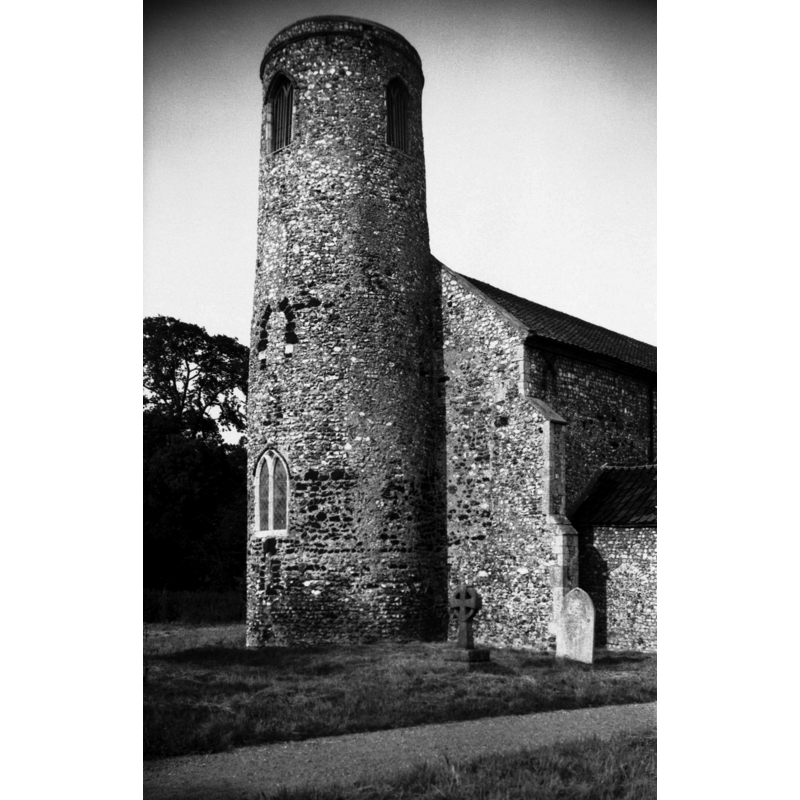
Image copyright © George Plunkett, 2014
Standing permission by Jonathan Plunkett
Results: 5 records
view of church exterior - west tower
Scene Description: Photo caption: "Probably pre-conquest"
Copyright Statement: Image copyright © George Plunkett, 2014
Image Source: B&W photograph taken 11 July 1976 by George Plunkett [www.georgeplunkett.co.uk/Norfolk/B/Beeston St Lawrence's church Saxon tower [5591] 1976-07-11.jpg] [accessed 31 January 2014]
Copyright Instructions: Standing permission by Jonathan Plunkett
view of church exterior - southeast view
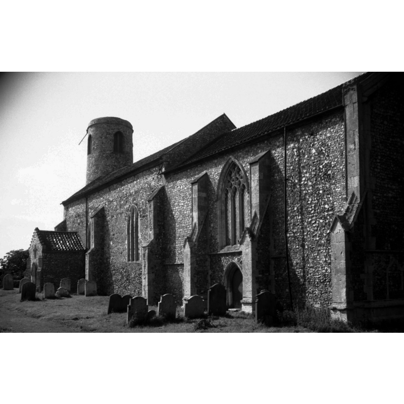
Scene Description: Photo caption: "14c buttresses to chancel with gablets at first set-off"
Copyright Statement: Image copyright © George Plunkett, 2014
Image Source: B&W photograph taken 29 July 1992 by George Plunkett [www.georgeplunkett.co.uk/Norfolk/B/Beeston St Lawrence's church from SE [6894] 1992-07-28.jpg] [accessed 31 January 2014]
Copyright Instructions: Standing permission by Jonathan Plunkett
view of church exterior - southwest view
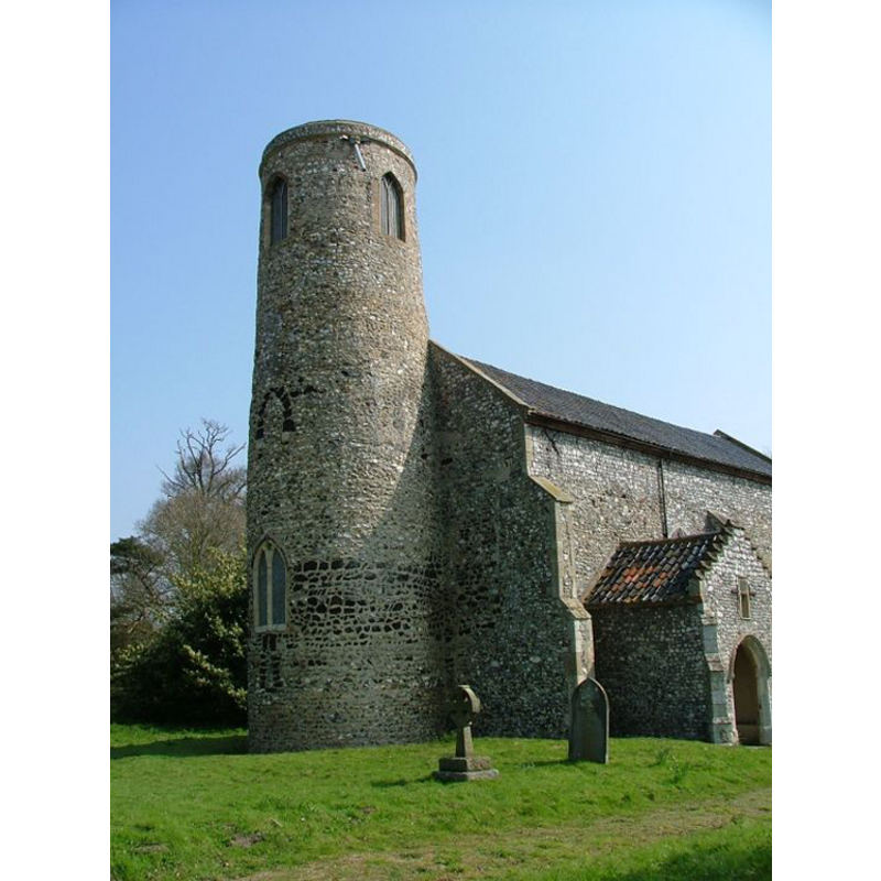
Copyright Statement: Image copyright © Simon Knott, 2005
Image Source: digital photograph [April 2005] by Simon Knott [http://www.norfolkchurches.co.uk/beestonstlawrence/beestonstlawrence.htm] [accessed 24 March 2009]
Copyright Instructions: Standing permission
view of font in context
Copyright Statement: Image copyright © Simon Knott, 2005
Image Source: detail of a digital photograph [April 2005] by Simon Knott [http://www.norfolkchurches.co.uk/beestonstlawrence/beestonstlawrence.htm] [accessed 24 March 2009]
Copyright Instructions: Standing permission
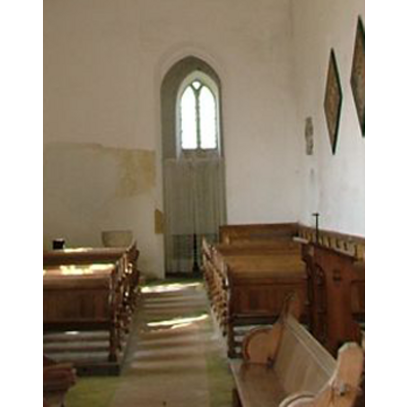
view of church interior - nave - looking west
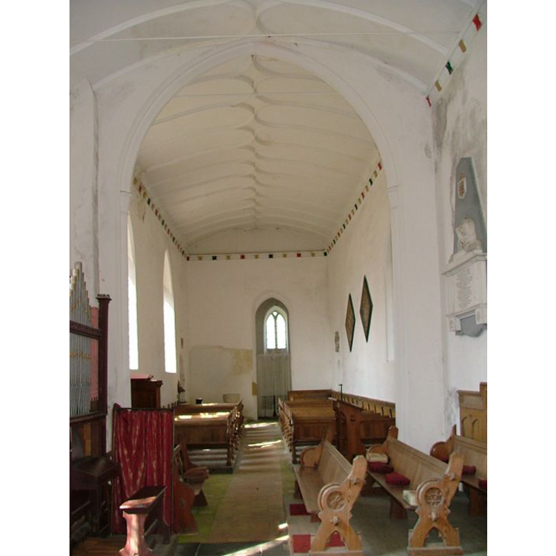
Scene Description: the top of the font is visible at the back, to the left (south) of the tower door (west)
Copyright Statement: Image copyright © Simon Knott, 2005
Image Source: digital photograph [April 2005] by Simon Knott [http://www.norfolkchurches.co.uk/beestonstlawrence/beestonstlawrence.htm] [accessed 24 March 2009]
Copyright Instructions: Standing permission
INFORMATION
Font ID: 14355BEE
Object Type: Baptismal Font1
Font Century and Period/Style: 12th century, Norman
Church / Chapel Name: Parish Church of St. Lawrence [aka St. Laurence]
Church Patron Saint(s): St. Lawrence [aka Laurence]
Church Notes: round-tower church
Church Address: Stalham Road, Beeston St Lawrence, Norfolk, NR12 8YS
Site Location: Norfolk, East Anglia, England, United Kingdom
Directions to Site: Located 8 km ENE of Coltishall
Ecclesiastic Region: Diocese of Norwich
Historical Region: Hundred of Tunsted
Additional Comments: disappeared font? (the one from the Norman (?) church here)
Font Notes:
Click to view
There is and entry for Beeston [St. Lawrence] [variant spelling]in the Domesday survey [http://domesdaymap.co.uk/place/TG3221/beeston-st-lawrence/] [accessed 24 April 2014], but it mentions neither church no cleric in it. Blomefield (1805-1810) writes: "The Church is a rectory dedicated to St. Laurence, valued at 5 marks in the reign of Edward I [i.e., 1272-1307] when William de Stalham was lord and patron; the rector had a manse, and 20 acres, the abbot of St. Bennet had a portion [...] The Church is a rectory dedicated to St. Laurence, valued at 5 marks in the reign of Edward I. when William de Stalham was lord and patron; the rector had a manse, and 20 acres, the abbot of St. Bennet had a portion". Although this is the earliest related date recorded in Blomefield (ibid.) for this church, the Norman round tower suggests an earlier date for its founding. There is a modern stone baptismal font, polygonal, decorated with tracery on the sides, raised on an octagonal pedestal base with a moulded lower base; on an octagonal plinth; at the west end of the nave; probably a late replacement [early-19th century?] for the original font of the of the Norman church here.
Credit and Acknowledgements: We are grateful to Simon Knott, of Norfolk Churches [www.norfolkchurches.co.uk], for his photographs of this church and modern font; we are also grateful to Jonathan Plunkett for the photographs of this church taken by his father, George Plunkett, in 1976 and 1992
COORDINATES
UTM: 31U 395224 5845074
Latitude & Longitude (Decimal): 52.745356, 1.447819
Latitude & Longitude (DMS): 52° 44′ 43.28″ N, 1° 26′ 52.15″ E
MEDIUM AND MEASUREMENTS
Basin Interior Shape: round
Basin Exterior Shape: round
REFERENCES
- Blomefield, Francis, An essay towards a topographical history of Norfolk, 1805-1810, vol. 11: 14-16 / [www.british-history.ac.uk/report.aspx?compid=78732] [accessed 24 April 2014]