Bayfield / Baiafleda
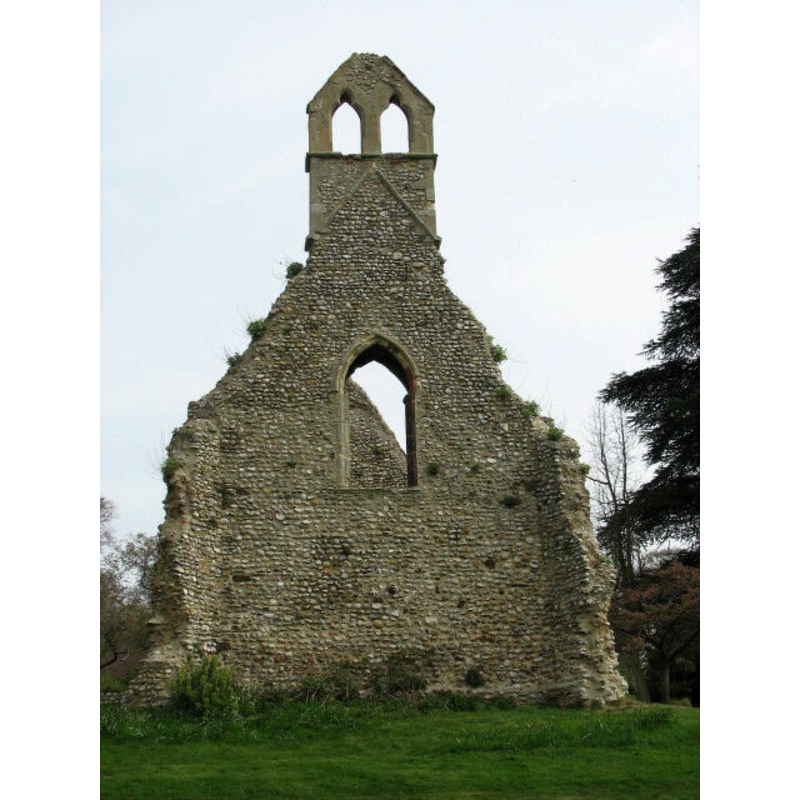
Image copyright © Evelyn Simak, 2007
CC-BY-SA-3.0
Results: 7 records
view of church exterior - west view
Copyright Statement: Image copyright © Evelyn Simak, 2007
Image Source: digital photograph taken 9 August 2007 by Evelyn Simak [www.geograph.org.uk/photo/519931] [accessed 20 January 2014]
Copyright Instructions: CC-BY-SA-3.0
view of church exterior - northwest view
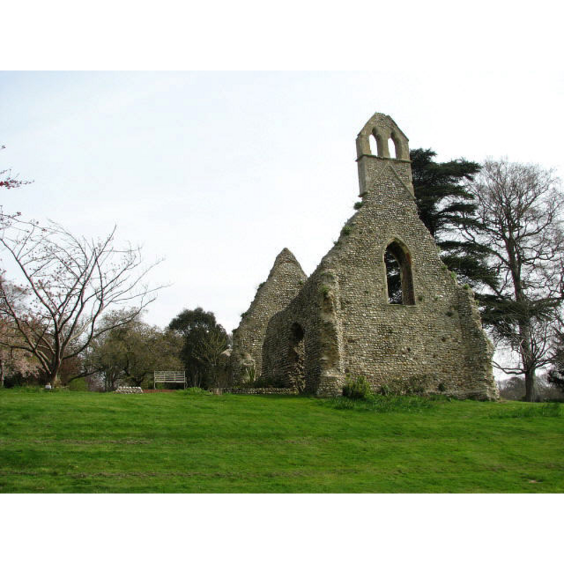
Copyright Statement: Image copyright © Evelyn Simak, 2007
Image Source: digital photograph taken 9 August 2007 by Evelyn Simak [www.geograph.org.uk/photo/519925] [accessed 20 January 2014]
Copyright Instructions: CC-BY-SA-3.0
view of church exterior - southwest view
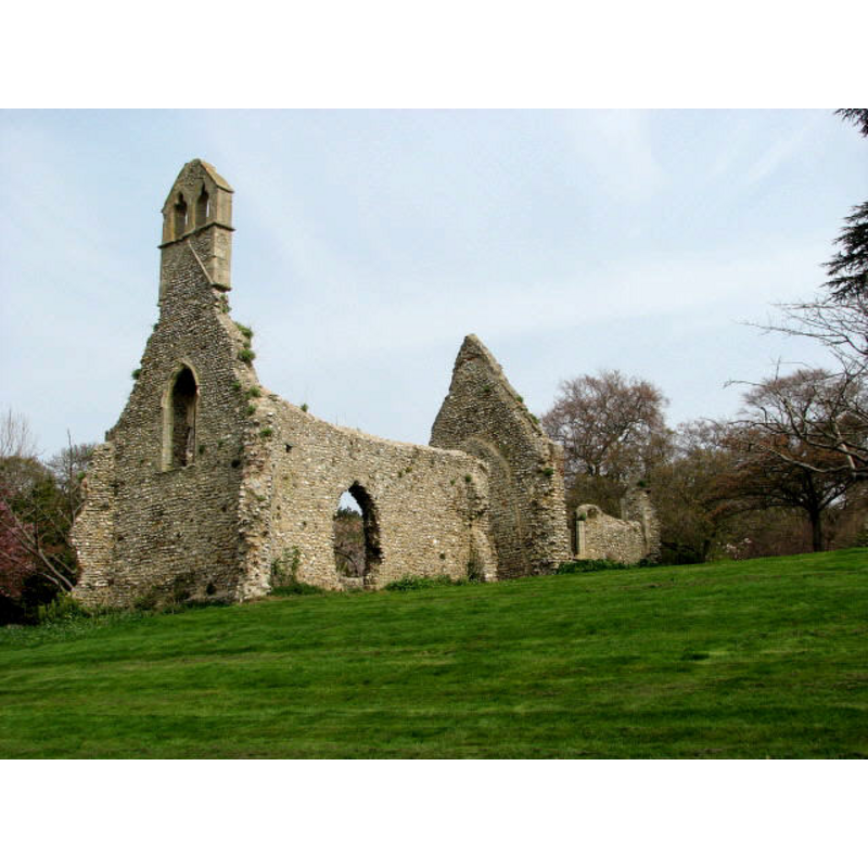
Copyright Statement: Image copyright © Evelyn Simak, 2007
Image Source: digital photograph taken 9 August 2007 by Evelyn Simak [www.geograph.org.uk/photo/519928] [accessed 20 January 2014]
Copyright Instructions: CC-BY-SA-3.0
view of church exterior - southwest view
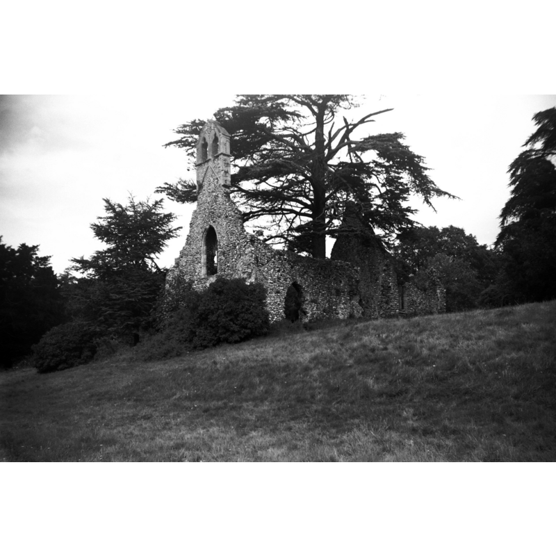
Scene Description: the ruins of the church in 1956
Copyright Statement: Image copyright © George Plunkett, 2014
Image Source: B&W photograph taken 25 August 1956 by Geroge Plunkett [www.georgeplunkett.co.uk/Norfolk/B/Bayfield St Margaret's church ruin from SW [4466] 1956-08-25.jpg] [accessed 20 January 2014]
Copyright Instructions: Standing permission by Jonathan Plunkett
view of church exterior - southeast view
![the ruins of the church in 1956 -- Photo caption: "In the grounds of Bayfield Hall"
EXT SW B&W photograph taken 25 August 1956 by Geroge Plunkett [www.georgeplunkett.co.uk/Norfolk/B/Bayfield St Margaret's church ruin from SW [4466] 1956-08-25.jpg] [accessed 20 January 2014]
EXT SW digital photograph taken 9 August 2007 by Evelyn Simak [www.geograph.org.uk/photo/519928] [accessed 20 January 2014]
EXT NW digital photograph taken 9 August 2007 by Evelyn Simak [www.geograph.org.uk/photo/519925] [accessed 20 January 2014]
EXT W digital photograph taken 9 August 2007 by Evelyn Simak [www.geograph.org.uk/photo/519931] [accessed 20 January 2014]
INT W digital photograph taken 9 August 2007 by Evelyn Simak [www.geograph.org.uk/photo/519932] [accessed 20 January 2014]](/static-50478a99ec6f36a15d6234548c59f63da52304e5/compressed/1140120001_compressed.png)
Scene Description: the ruins of the church in 1956 -- Photo caption: "In the grounds of Bayfield Hall"
EXT SW B&W photograph taken 25 August 1956 by Geroge Plunkett [www.georgeplunkett.co.uk/Norfolk/B/Bayfield St Margaret's church ruin from SW [4466] 1956-08-25.jpg] [accessed 20 January 2014]
EXT SW digital photograph taken 9 August 2007 by Evelyn Simak [www.geograph.org.uk/photo/519928] [accessed 20 January 2014]
EXT NW digital photograph taken 9 August 2007 by Evelyn Simak [www.geograph.org.uk/photo/519925] [accessed 20 January 2014]
EXT W digital photograph taken 9 August 2007 by Evelyn Simak [www.geograph.org.uk/photo/519931] [accessed 20 January 2014]
INT W digital photograph taken 9 August 2007 by Evelyn Simak [www.geograph.org.uk/photo/519932] [accessed 20 January 2014]
Copyright Statement: Image copyright © George Plunkett, 2014
Image Source: B&W photograph taken 25 August 1956 by Geroge Plunkett [www.georgeplunkett.co.uk/Norfolk/B/Bayfield St Margaret's church ruin from SE [4467] 1956-08-25.jpg] [accessed 20 January 2014]
Copyright Instructions: Standing permission by Jonathan Plunkett
view of church exterior - southwest view
![[cf. Font notes]](/static-50478a99ec6f36a15d6234548c59f63da52304e5/compressed/1090324008_compressed.png)
Scene Description: [cf. Font notes]
Copyright Statement: Image copyright © Simon Knott, 2004
Image Source: digital photograph taken November 2004 by Simon Knott [http://www.norfolkchurches.co.uk/bayfield/bayfield.htm] [accessed 24 March 2009]
Copyright Instructions: Standing permission
view of church interior - nave - looking east
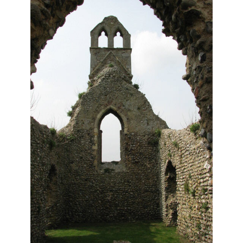
Copyright Statement: Image copyright © Evelyn Simak, 2007
Image Source: digital photograph taken 9 August 2007 by Evelyn Simak [www.geograph.org.uk/photo/519932] [accessed 20 January 2014]
Copyright Instructions: CC-BY-SA-3.0
INFORMATION
Font ID: 14354BAY
Object Type: Baptismal Font1?
Font Century and Period/Style: 13th century, Medieval
Church / Chapel Name: Parish Church of St. Margaret [in ruins]
Font Location in Church: [cf. FontNotes]
Church Patron Saint(s): St. Margaret of Antioch [aka Margaret the Virgin, Marina]
Church Notes: St. Margaret's church is in ruins now.
Church Address: Letheringsett, Norfolk NR25 7JN
Site Location: Norfolk, East Anglia, England, United Kingdom
Directions to Site: Located 1.5 km S of Glanford, 5 km NW of Holt [NB: the ruins of this church are located in the grounds of Bayfield Hall (private property), 50-60 yards E of the Hall]
Ecclesiastic Region: [Diocese of Norwich]
Historical Region: Hundred of Holt
Additional Comments: disappeared font? (the one from the 13thC (?) church here)
Font Notes:
Click to view
Bayfield [alternative spelling] has two entries in the Domesday survey [http://domesdaymap.co.uk/place/TG0540/bayfield/] [accessed 20 January 2014], but there is no mention of either church or cleric in them. Blomefield (1805-1810) writes: "The Church is dedicated to St. Margaret, and was formerly valued with a portion of Peter le Curson, at 5l. 10s. Peter-pence, 5d. The present valor 4l. and is at present demolished [...] In 1331, and 1320, William de Calthorp occurs rector." The earliest reference to the church in Blomefield (ibid.) is 1286, in relation to "the advowson of the church of St. Margaret of Bayfield". Pevsner & Wilson (1997) state that the church "was still in use in 1603 but in ruins by the end of the C18". [NB: we have no information on the font of the original church here].
Credit and Acknowledgements: We are grateful to Simon Knott, of Norfolk Churches, for his photograph of this church; we are also grateful to Jonathan Plunkett for the photographs of this church taken by his father, George Plunkett, in 1956
COORDINATES
UTM: 31U 368830 5865459
Latitude & Longitude (Decimal): 52.92275, 1.04883
Latitude & Longitude (DMS): 52° 55′ 21.9″ N, 1° 2′ 55.79″ E
REFERENCES
- Blomefield, Francis, An essay towards a topographical history of Norfolk, 1805-1810, vol. 9: 358-360 / [www.british-history.ac.uk/report.aspx?compid=78564] [accessed 20 January 2014]
- Pevsner, Nikolaus, Norfolk 1: Norwich and North-East [2nd ed.], Harmondsworth: Penguin Books, 1997, p. 382