Grateley / Gratele / Gratelee / Grateleghe / Grately / Gratley / Greetanlea / Greteleia / Grettelee
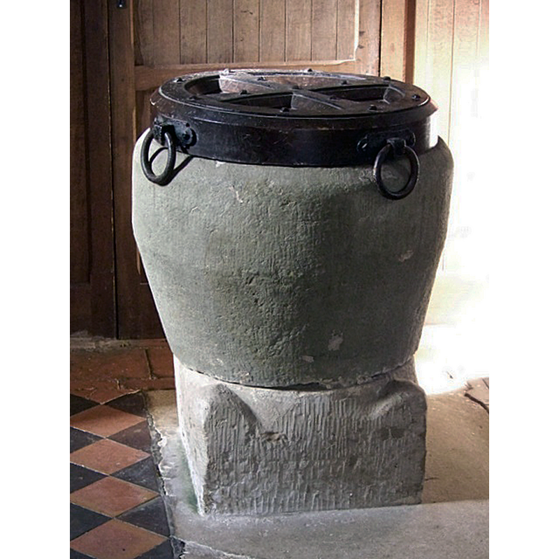
Image copyright © Maigheach-gheal, 2010
CC-BY-SA-2.0
Results: 3 records
view of font and cover
Scene Description: Source caption: "The font, traditionally placed near the door is Norman."
Copyright Statement: Image copyright © Maigheach-gheal, 2010
Image Source: digital photograph taken 19 February 2010 by Maigheach-gheal [www.geograph.org.uk/photo/1716151] [accessed 28 August 2018]
Copyright Instructions: CC-BY-SA-2.0
view of church exterior in context - southwest view
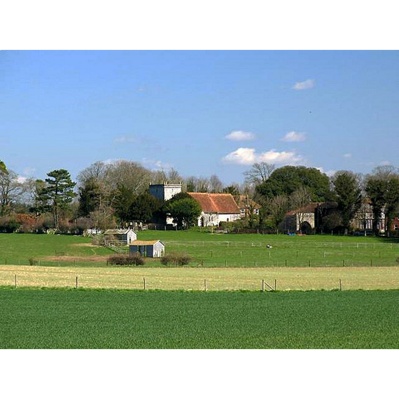
Scene Description: Source caption: "View of St Leonard's Church. It was probably during time of the Mauduit family that the final version of the Church of St. Leonard was built: the nave in the 12th century and chancel in the 13th C. There is some evidence that three previous church buildings were on the same site. Part of the work in the tower is Saxon and the three courses of bricks are said to be Roman."
Copyright Statement: Image copyright © Boyes-Hannington, 2006
Image Source: digital photograph taken 8 April 2006 by Boyes-Hannington [www.geograph.org.uk/photo/148454] [accessed 28 August 2018]
Copyright Instructions: CC-BY-SA-2.0
view of church interior - nave - looking east
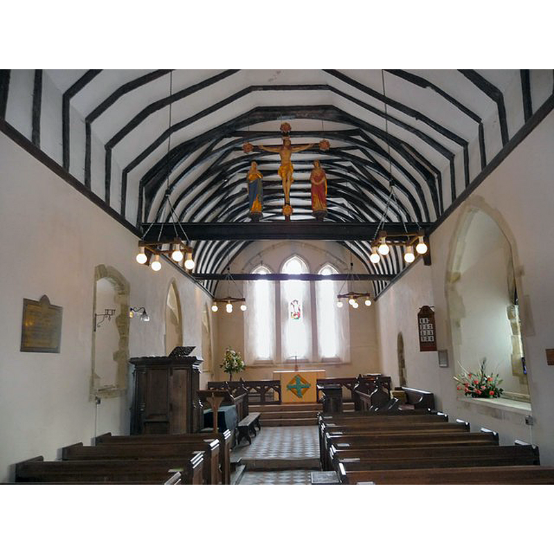
Copyright Statement: Image copyright © Chris Talbot, 2009
Image Source: digital photograph taken 3 February 2009 by Chris Talbot [www.geograph.org.uk/photo/1161941] [accessed 28 August 2018]
Copyright Instructions: CC-BY-SA-2.0
INFORMATION
Font ID: 14343GRA
Object Type: Baptismal Font1
Object Details: altar, Druidic
Font Century and Period/Style: 11th - 12th century [re-cut], Norman [altered]
Church / Chapel Name: Parish Church of St. Leonard
Font Location in Church: Inside the church, in the W end, by the entranceway
Church Patron Saint(s): St. Leonard
Church Address: 1 Manor Farm Cottages, Grateley, Andover SP11 8JZ, UK -- Tel.: +44 1264 335245
Site Location: Hampshire, South East, England, United Kingdom
Directions to Site: Located off (S) the A303, 11 km WSW of Andover
Ecclesiastic Region: Diocese of Winchester
Historical Region: Hundred of Andover
Additional Comments: latered font (re-cut font? -- composite font? Base said to have been a Druidic altar or the base of a cross)
Font Notes:
Click to view
No individual entry found for Grateley in the Domesday survey. White (1878) writes: "the font is placed upon a stone said to have been a Druidical altar". The Victoria County History (Hampshire, vol. 4, 1911) notes: "The first recorded presentation to Grately Church, early in the episcopacy of Bishop Pontoise, was made by the king [+1304] [...] This, however, was probably only during a wardship, for the advowson belonged from an early date to the lords of the manor, with whom it continued for a considerable period. [...] Of the 12th-century building only the nave now remains, and this only retains one of its original windows. [...] The font, which is placed at the west end of the nave, was found at the Manor Farm. It is circular, tapering towards the base, and has been recut. The base is an old stone, but does not appear to belong in this position; it seems to be the base of a cross." Noted and illustrated in the Parish web site : "The font is either Saxon or Norman."
COORDINATES
UTM: 30U 597372 5670352
Latitude & Longitude (Decimal): 51.17629, -1.607021
Latitude & Longitude (DMS): 51° 10′ 34.64″ N, 1° 36′ 25.28″ W
MEDIUM AND MEASUREMENTS
Material: stone
Font Shape: tub-shaped
Basin Interior Shape: round
Basin Exterior Shape: round
LID INFORMATION
Material: wood
Notes: round and flat, with metal handles on the sides; uncommon.
REFERENCES
- Victoria County History [online], University of London, 1993-. URL: https://www.british-history.ac.uk.
- White, William, History, gazetteer and directory of the County of Hampshire including the Isle of Wight, and [...], Sheffield: William White, 1878, p. 266