Pyrton / Peritone
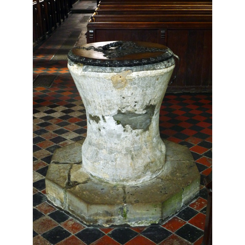
Image copyright © John Ward, 2009
Standing permission
Results: 2 records
view of font and cover
Copyright Statement: Image copyright © John Ward, 2009
Image Source: digital photograph taken 28 February 2009 [http://www.flickr.com/photos/oxfordshirechurches/3316336173/] [accessed 1 May 2009]
Copyright Instructions: Standing permission
view of church exterior - southeast view
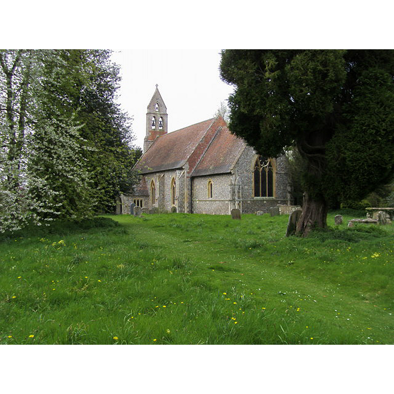
Copyright Statement: Image copyright © Shaun Ferguson, 2008
Image Source: digital photograph taken 3 May 2008 by Shaun Ferguson [www.geograph.org.uk/photo/815367] [accessed 1 November 2017]
Copyright Instructions: CC-BY-SA-2.0
INFORMATION
Font ID: 14319PYR
Object Type: Baptismal Font1
Font Century and Period/Style: 12th century [basin only], Medieval [composite]
Church / Chapel Name: Parish Church of St. Mary
Font Location in Church: Inside the church
Church Patron Saint(s): St. Mary the Virgin
Church Address: off B4009, Pyrton, Oxfordshire, OX49 5AW, UK
Site Location: Oxfordshire, South East, England, United Kingdom
Directions to Site: Located off (W) the B4009, 5 km SW of Lewknor
Ecclesiastic Region: Diocese of Oxford
Historical Region: Hundred of Pyrton
Additional Comments: altered font? (the base is modern)
Font Notes:
Click to view
There is an entry of Pyrton [variant spelling] in the Domesday survey [http://opendomesday.org/place/SU6895/pyrton/] [accessed 1 November 2017], but it mentions neither priest nor church in it. The Victoria County History (Oxford, vol. 8, 1964) notes: "the church still retains some of its earlier fittings. There is a medieval tub font, lead lined, standing on a modern base." This same source adds: "For a drawing see MS. Top. Oxon. a 68, no. 416; Bodl. MS. Top. Eccles. b 14." Noted in the National Monuments Record, English Heritage [http://www.imagesofengland.org.uk/details/default.aspx?pid=1&id=248980] [accessed 15 March 2009]: Tub font on a modern base. Victorian wooden cover.
Credit and Acknowledgements: We are grateful to John Ward, of Oxfordshire Churches [http://homepage.mac.com/john.ward/oxfordshirechurches], for his photograph of this font
COORDINATES
UTM: 30U 637930 5724650
Latitude & Longitude (Decimal): 51.6559, -1.006
Latitude & Longitude (DMS): 51° 39′ 21.24″ N, 1° 0′ 21.6″ W
MEDIUM AND MEASUREMENTS
Material: stone
Font Shape: tub-shaped
Basin Interior Shape: round
Basin Exterior Shape: round
Drainage System: centre hole in basin
Drainage Notes: lead-lined
LID INFORMATION
Date: 19th-century?
Material: wood
Apparatus: no
Notes: [cf. FontNotes]
REFERENCES
- Victoria County History [online], University of London, 1993-. URL: https://www.british-history.ac.uk.