Marsh Baldon / Baldedone / Balordone
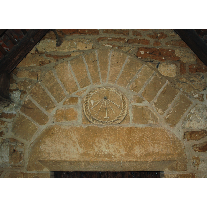
Image copyright © Motacilla, 2010
CC-BY-SA-3.0
Results: 2 records
view of church exterior - south portal - tympanum - sundial
Scene Description: not in its original location; the Anglo-Saxon sundial was moved from its earlier position on the south wall, to its present location over the south entranceway
Copyright Statement: Image copyright © Motacilla, 2010
Image Source: digital photograph taken 17 December 2010 by Motacilla [http://commons.wikimedia.org/wiki/File:MarshBaldon_StPeters_sundial.JPG] [accessed 12 June 2012]
Copyright Instructions: CC-BY-SA-3.0
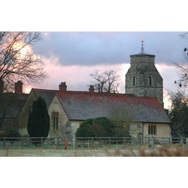
view of church exterior - northeast view
Copyright Statement: Image copyright © Motacilla, 2010
Image Source: digital photograph taken 17 December 2010 by Motacilla [http://commons.wikimedia.org/wiki/File:MarshBaldon_StPeters.JPG] [accessed 12 June 2012]
Copyright Instructions: CC-BY-SA-3.0
INFORMATION
Font ID: 14316MAR
Object Type: Baptismal Font1
Font Century and Period/Style: 11th century, Pre-Conquest? / Norman
Church / Chapel Name: Parish Church of St. Peter
Church Patron Saint(s): St. Peter
Church Address: Baldon Lane, The Baldons, Oxfordshire, OX44 9LS
Site Location: Oxfordshire, South East, England, United Kingdom
Directions to Site: Located off (E) the A4074, just S of Nuneham Courtenay, 8 km SE of Oxford
Ecclesiastic Region: Diocese of Oxford
Historical Region: Hundred of Headington [in Domesday] -- Hundred of Bullingdon
Additional Comments: disappeared font? (the one from the Anglo-Saxon church here)
Font Notes:
Click to view
There are two entries for [Marsh] Baldon [variant spelling] in the Domesday survey [http://opendomesday.org/place/SU5699/marsh-baldon/] [accessed 10 November 2016], neither of which mentions cleric or church in it. The Victoria County History (Oxford, vol. 5, 1957): "The early history of the church is obscure, but there can be little doubt that a chapel of St. Peter at Marsh Baldon was originally served by the secular priests of the Saxon church at Dorchester [...] The only trace of Saxon work remaining is a scratch dial with cabled border, once on the south wall but now over the south doorway. [...] The aisle was enlarged and rebuilt between 1888 and 1890 [...] A new octagonal font of stone was put in 1890" [this last phrase footnoted: "Bodl. MS. Top Eccles. E 4, f. 607", a reference to a drawing in a collection at the Bodleian Library, Oxford]. [NB: the church itself goes back to the 14th century]
COORDINATES
UTM: 30U 625524 5728121
Latitude & Longitude (Decimal): 51.69, -1.184
Latitude & Longitude (DMS): 51° 41′ 24″ N, 1° 11′ 2.4″ W
REFERENCES
- Victoria County History [online], University of London, 1993-. URL: https://www.british-history.ac.uk.