Hardwick nr. Bicester / Hardewich
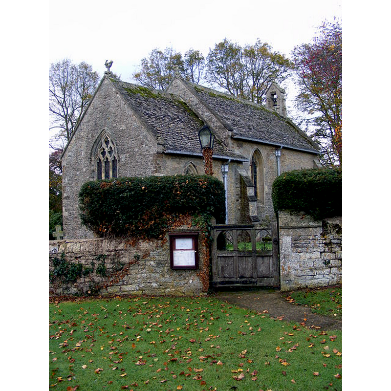
Image copyright © Gordon Griffiths, 2009
CC-BY-SA-2.0
Results: 1 records
view of church exterior - northeast view
Copyright Statement: Image copyright © Gordon Griffiths, 2009
Image Source: digital photograph taken 22 October 2009 by Gordon Griffiths [www.geograph.org.uk/photo/1583175] [accessed 12 December 2016]
Copyright Instructions: CC-BY-SA-2.0
INFORMATION
Font ID: 14310HAR
Object Type: Baptismal Font1
Font Century and Period/Style: 14th century, Decorated
Church / Chapel Name: Parish Church of St. Mary
Font Location in Church: [cf. FontNotes]
Church Patron Saint(s): St. Mary the Virgin
Church Notes: 13thC church almost entirely re-built 19thC
Church Address: Hethe Road, Hardwick, Oxfordshire OX27 8SS
Site Location: Oxfordshire, South East, England, United Kingdom
Directions to Site: Located off (E) the B4100 and A43, NE of Stke Lyne, SW of Cottisford, 8 km N of Bicester
Ecclesiastic Region: Diocese of Oxford
Historical Region: Hundred of Kirtlington [in Domesday] -- Hundred of Ploughley
Additional Comments: disappeared font?
Font Notes:
Click to view
There is an entry for this Hardwick [variant spelling] in the Domesday survey [http://opendomesday.org/place/SP5729/hardwick/] [accessed 12 December 2016], but it mentions neither cleric nor church in it. The Victoria County History (Oxford, vol. 6, 1959) notes: "A grant was made of Hardwick tithes in the late 11th century (see below), but as Hardwick was a chapelry of Stoke Lyne in the mid-12th century, the grant is not certain evidence for the existence of a church other than that of Stoke Lyne. Hardwick chapel is first mentioned in the mid-12th century, when it was granted with Stoke Lyne by Walter Giffard to Notley Abbey. [...] This grant does not seem to have taken effect, and by 1249 or 1250 when the lord of the manor, William d'Aundeley, presented, Hardwick was a separate church. [...] A late 12th- or early 13th-century doorway forms the main (south) entrance to the church and an ancient stoup, discovered built into some masonry, has been placed inside it." The VCH further notes that a new font was installed in the 1878-1879 re-building of the church, a "font (from Fringford church)". Sherwood & Pevsner (1974) inform that this was a small Decorated church "almost entirely rebuilt in 1878". [NB: we have no information on the font of the original church here].
COORDINATES
UTM: 30U 626317 5758375
Latitude & Longitude (Decimal): 51.9617, -1.1615
Latitude & Longitude (DMS): 51° 57′ 42.12″ N, 1° 9′ 41.4″ W
REFERENCES
- Victoria County History [online], University of London, 1993-. URL: https://www.british-history.ac.uk.
- Pevsner, Nikolaus, Oxfordshire, Harmondsworth: Penguin Books, 1974, p. 632